RE PNAT 03 Chozones Route La Loma
10,5 Km circular route through the "chozones sabineros".

Chozones La Loma
Dirección
Start and finish in La Loma
GPS
40.880076676456, -2.2781731199298
Circular 10.5 km Unevenness - m | Duration 4 h | Route On foot - Bike
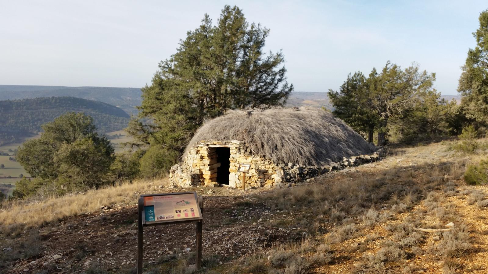
Ethnographic route 3: The Chozones Route La Loma
The route of the huts located in the area around the town of La Loma is a journey marked pedestrian walkway for hikers with a duration of 3-4 hoursThe starting and finishing point is the village of La Loma.
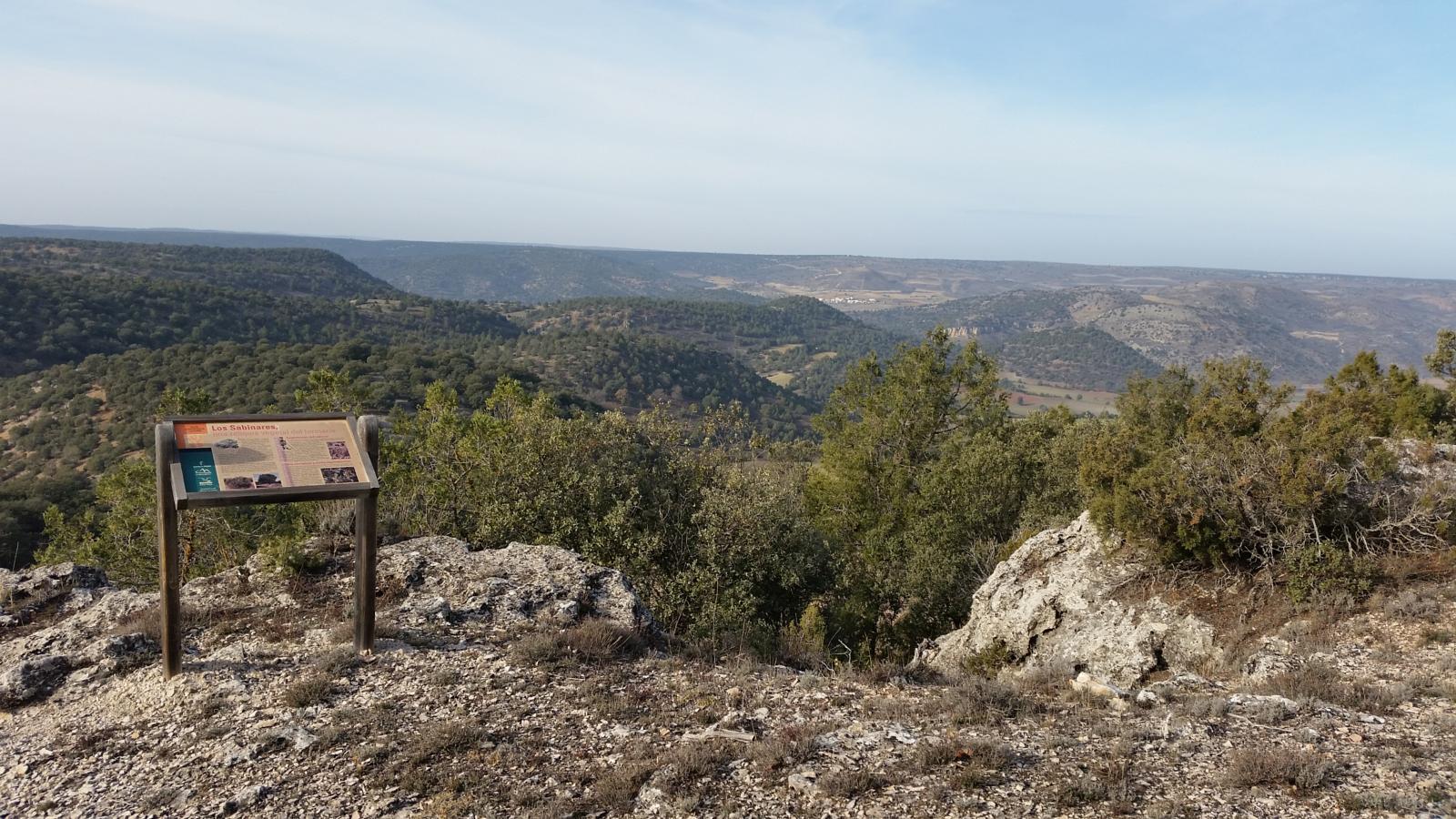
Continuing along abandoned roads, the higher altitudes of the hills of the Alto de la Cruz, la Medianilla or Rivagordathat surrounds and separates La Loma from the parched valley of the river Ablanquejo. For several kilometres the route leads safely into an open forest of juniper and kermes oak, where the walker can get to know personally some of the huts and caves that the territory preserves and to extend the gaze on the horizon, beyond the local confines, from several of its viewpoints natural.
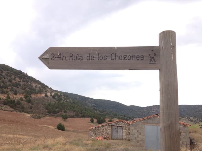
Signposting and Start of the Route
To get to the start of the path, we must go to the village of La Loma, the starting and return point. The path runs through the surroundings of the village, it is not difficult to reach the huts, but we recommend that you download the track The route is described here, although the path is easily recognisable. Please note that there is no water along the route, so we advise you to be well equipped, especially if it is summer.
Finally, the route is designed to be done on foot, so we do not recommend it for cyclists or any other vehicle.

