RG PNAT 1 Barranco de la Virgen de la Hoz
Essential route through these enclaves of the manor

Dirección
Start from any of the villages
GPS
40.843016164626, -1.9768049381462
Only Ida 56 Km | Unevenness - 400m | Duration - h | Route Car - Bike
General Route 1: Virgen de la Hoz Ravine
The route of the Barranco de la Virgen de la Hoz, currently classified as a Tourist Route 1 within the network of official footpaths of the Upper Tagus, offers an extensive route through some of the most outstanding corners of the Natural Park.
It has a circular route that can be done either by bicycle or by car, except for the section that goes to the Ermita de Montesinos, which is recommended to be done both on foot and by bicycle, in order to enjoy the beautiful landscape that surrounds us and to avoid unnecessary disturbances in this beautiful enclave.
The total distance is 37 kilometresHowever, if we access its branches, we will have to increase the itinerary by a few kilometres. If we go to the hermitage we will add 10 kilometres to the round trip, and if we want to descend to the St. Peter's Bridgethen we will add 9 kilometres back and forth, making a total of 56 kilometres if we do the whole route. Most of the time we travel by road, so travelling between branches is quite comfortable.
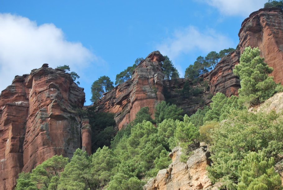
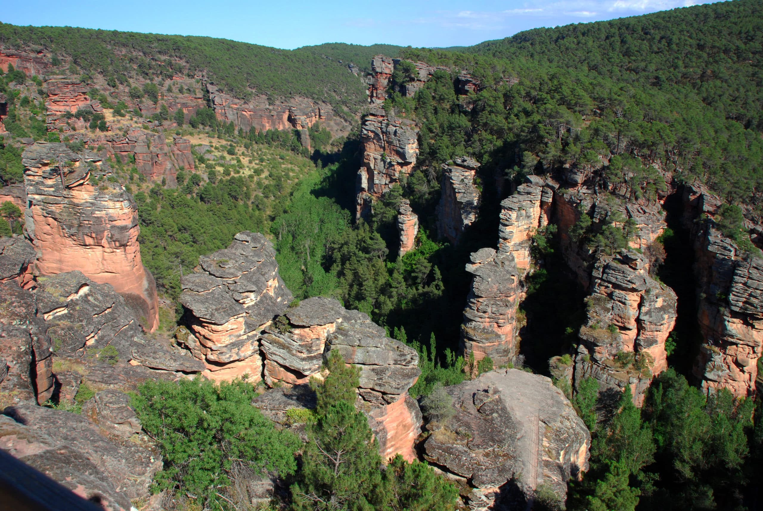
We can see canyons carved in ochre and red sandstone, such as those of El Gallo and El Arandilla, and in limestone, such as El Tajo. Both types of canyons have described an orography worthy of admiration, highly appreciated by the number of species of living beings that find refuge on their ledges and cliffs. In addition, we can enjoy beautiful riverside forests, where we can find various species of willows, poplars or hazel trees The canyons and gorges are one of the most diverse habitats, and their slopes are covered with gall oaks, oaks, pines and laricio pines.
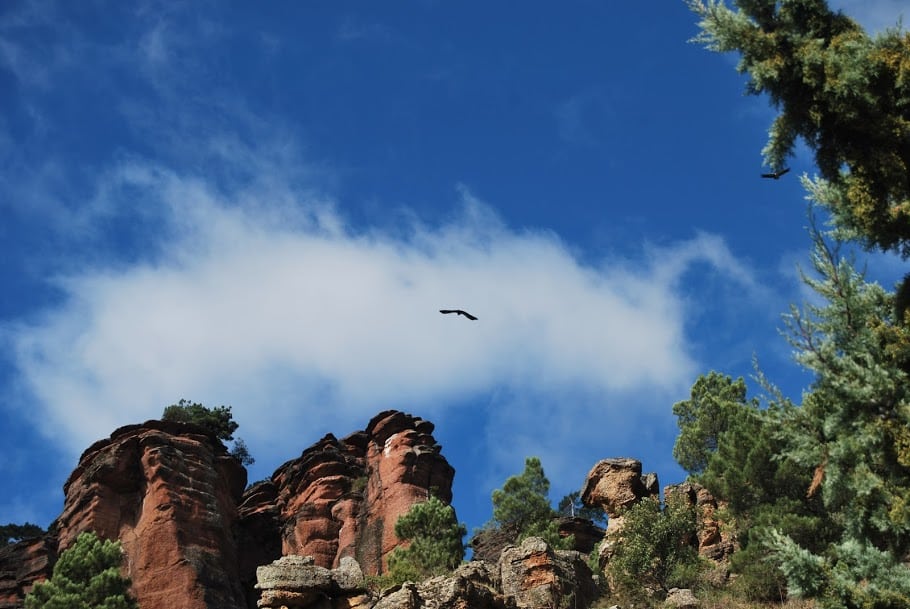
If we talk about the fauna present in this route of the Barranco de la Virgen de la Hoz, it is the birds, in particular the birds of prey, which are the most easily observable. From forest birds of prey, rupicolous, or those of watercourses such as, dippers and wagtailsThis is one of the most comfortable routes for birdwatchers or birdwatchers. birdwatchingThis is a great opportunity to get to know many of the different birds that reign in the Alto Tajo with our own vehicle.
During our tour we will find different fountains such as the Escabeche Fountain in the vicinity of the San Pedro Bridge (seasonal), Torete, Corduente and the Sanctuary of the Virgen de la Hoz, although it is always advisable to be well equipped in case the season has been very dry. We will also see that all along the route there are several recreational areas where you can stop to enjoy a rest or to contemplate some of the beautiful landscapes that this route offers.
<< How to get there?
To start the tour, we must park our vehicle in the car park of the Dehesa de Corduente Interpretation Centrewhere you will find the sign for the start of the Barranco de la Virgen de la Hoz route. Also, if you wish, and it is open, you can visit the centre to learn a little more about the landscapes that we will see on our route.
Signposting and Start of the Route
As for the signposting of this route, it has a information panel at the beginning of the route where we can see its general characteristics, the path is marked with painted markers of blue colourHowever, due to the long driving distances, there is no easy way to find your way around, so we recommend that you download the trackwith which you can decide whether you want to do the tour in full or without branches, always with the certainty of being on the right track.

