Sierra de Caldereros
Spectacular mountain range for raptor spotting

Sierra de Caldereros
Dirección
Sierra de Caldereros
GPS
40.8580556, -1.7494444
Sierra de Caldereros
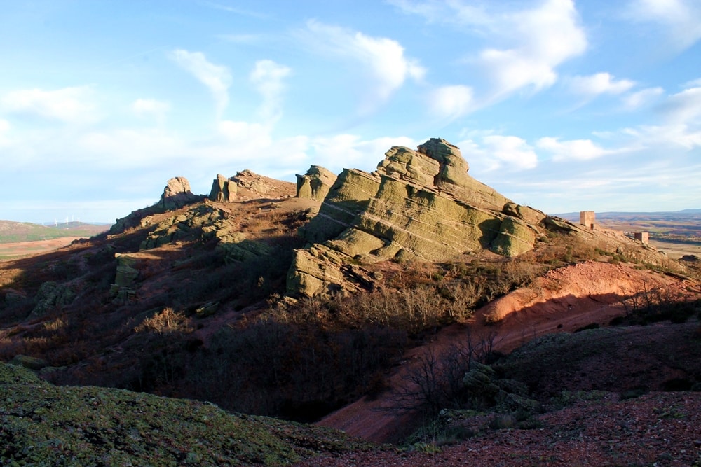
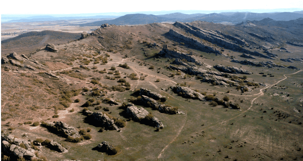
The Sierra de Caldereros, with an area of 2,368 ha, is one of the westernmost mountain ranges of the Iberian System, located in the northeast of the province of Guadalajara, forming a rugged relief with a northwest-southeast orientation from Molina de Aragón to Hombrados, elevated over the high moorlands of Señorío de Molina.
Although its hills reach a low prominence not exceeding 200 metres, it should be noted that it has higher heights, such as the highest point of the same, located in the so-called Lituerto Peakreaching 1.509 metres altitude.
La Sierra is made up of sandstones and conglomerates of an intense reddish colour. They correspond to sediments deposited at the bottom of rivers and alluvial fans from the Triassic, 245 million years ago. The compaction of enormous thicknesses of these sediments gave rise to the resistant rocks that we see today, which, together with their colours and the vegetation that surrounds them, form a landscape of great beauty. This formation is called BuntsandsteinThe German name, meaning brightly coloured sandstones, was assigned by the researchers who first studied them.
The monoclinal arrangement of these levels gives rise to a sloping relief configuration on its northern slope. The result of the unequal resistance to erosion is the training of a discontinuous escarpment that gives rise to isolated buildingswith the presence of morphologies such as chimneys, ridges and hollows.
The grandeur of the ruiniform reliefs and the escarpments in sandstone and conglomerates, provide a great relevance and unique characteristics in the whole region.

The dominant vegetation formation is the pine forests of resin pine (Pinus pinaster) accompanied by a varied undergrowth; it can be found dense thicketsserial communities of oak and holm oak grovesThe vegetation is also found in incipient oak groves that develop under the canopy of the pine forests. With regard to the potential vegetation, we can distinguish three vegetation series and a geoseries.
These rebollares are an important uniqueness, as they are the most easterly of Castilla La ManchaIn the northernmost parts of the Sierra there is a floral cortege of more northeastern territories, which find in these forests their most northeastern refuges and are habitats of special protection. In the easternmost areas of the Sierra there are mixed pastures and where the soil is deeper and cooler, they are dominated by gall oaks with scattered holm oaks and oaks.
On the escarpments appear siliceous rock communitieswhich occupy the sandstone and conglomerate crags of the shady and humid enclaves; in these communities ferns dominate.
It is also worth mentioning as a relict species, and as a species that has settled in the crags, several specimens of holly (Ilex aquifolium), a Euro-Siberian species that is quite rare to see in this environment.
In terms of fauna, it is worth mentioning the presence of rock birds which have their territory here and which nest here as golden eagle, Egyptian vulture and griffon vulture. Birds forestry as booted eagle, buzzard and goshawk. In addition, very close by, in the surroundings of the Sierra, between grassland and crops you can observe birds such as kestrels, cranes and bustards.
Nor should we forget that the species listed as being of "special interest" is the choughwhich has a considerable representation throughout the Sierra.
In short, the Sierra de Caldereros is an ideal habitat for a significant number of birds, making it one of the best places for sightings in the entire Iberian System.
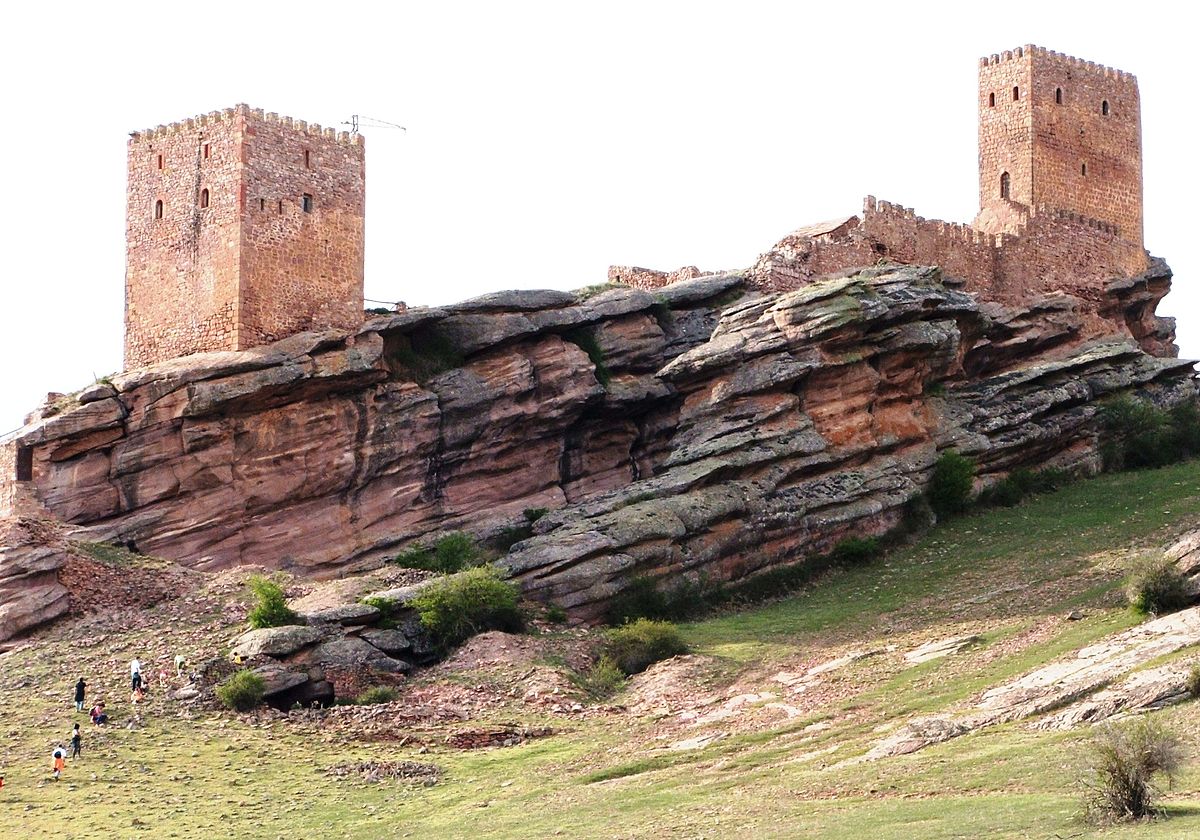
Here we must also emphasise the strength of the Zafra Castleraised on a watchtower
This rocky outcrop was already in the possession of the Celtiberians and was built by the Arabs during their domination. Later, due to its privileged location, it became a strategic building for the defence of the area.

PROTECTION
- Declared a Natural Monument in December 2005 (Decree 187/2005, of 5 December),with
an area of 2,368 ha.
- Included in the Natura 2000 Network, forming part of the Site of Community Importance (SCI) "Sierra de Caldereros".
- Proposed to form part of a UNESCO GEOPark, next to the Alto Tajo Natural Park and other parts of the Molina de Aragón.


