SL PNAT 8 Ruta de las Encinas (Pinilla de Molina)
Short circular route of 6.5 km through pleasant scenery.

Dirección
Start and finish in Pinilla de Molina
GPS
40.679267869832, -1.8807824873856
Circular 6.5 km Unevenness 64 m | Duration 2,5 h | Route On foot - Bike
Local trail 8: Ruta de las Encinas (Holm oak route)
This holm oak route starts from the village of Pinilla de MolinaWe start at the fountain at the entrance to the village where we can leave the vehicle without any problems. Cross the road and continue ascending along the forest track that coincides with the GR-160 (Camino del Cid), when we reach the top we will enter the mixed forest.
The total distance is 6.44 kilometres in length and circularhas carried out in counterclockwise. The unevenness of the route, it would be about 200 metresHowever, it is important to take into account the continuous climb up a forest track, which can be hard on very hot days, and the stretch of the descent to the road, which gives it a moderate character, so it is necessary to pay special attention, especially in this last stretch, as it can be very difficult to get to the road. there is no signposting until you get to the bottom..
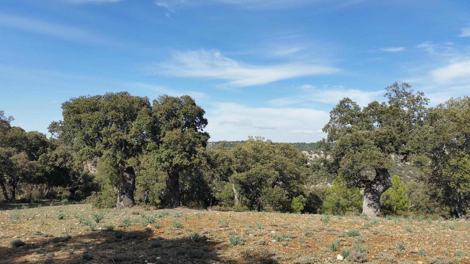
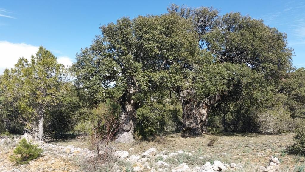
Along the route we will cross different landscapes, we start on an open forest track, between crop fields, and once at the top, we will enter a mixed forest that shares the same forest. pines, junipers and holm oaksOf the latter, we will find a redoubt worthy of being contemplated that has some of the most important centenary specimensYou must take special care not to damage them in any way. Amongst this forest we will find typical livestock constructions once used by the shepherds of the area, generally as calving stations for their livestock.
Faunistically speaking, we can find hares and partridges, and perhaps some roe deer or foxes that have the mountains of Pinilla de Molina as a home. This trail is undoubtedly a good walk to contemplate and enjoy the rural environment of the area. Download the track of the route for safety.
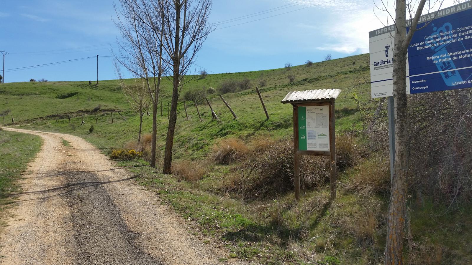
Signposting and Start of the Route
The PNAT 8, is a approved footpath It has an information panel at the beginning where you will find technical and morphological characteristics of the route and it is also guided by white and green markings along the route, except for the detour that goes down to the road, as the path and all signposting disappears until you reach the road again, where the posts return, so you will have to be careful on this section.
Another recommendation for this route of the holm oaks is to bring your own water, so make sure you are well provided with it as there are no fountains along the route.
 5")
 6")