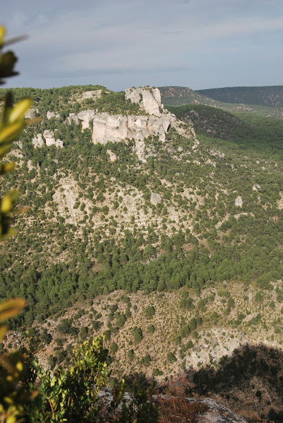
Viewpoint of Las Molatillas
Views of the junction of the Gallo and Tagus rivers

Dirección
Viewpoint of Las Molatillas
GPS
40.793184617606, -2.1505193598261
Viewpoint of Las Molatillas
Las Molatillas cannot be considered a real viewpoint, as it is not equipped as such, but from here the panoramic views in any direction are worth admiring. It is also an unfrequented spot.
On the right is the hill known as the Alpetea Castle with the confluence of the rivers Tajo y Gallo at his feet in the San Pedro´s Bridge and on the left you can see the tuffaceous edifice of St. Peter's Bridge and the intermittent waterfall of The Escaleruela. You can also see the Tajo or Zaorejas lookout pointbut from a completely different point of view.
Along the forest track that you have to follow to reach this beautiful spot, there are a succession of ledges from which you can contemplate the different views of the Gallo river ravine, particularly from the Hontanar refuge.
<< How to get there?
From Cuevas Labradas, take the forest track accessible to all types of vehicles that leaves the village to the right and continue straight on without turning off. You pass next to the Hontanar refuge and after approximately 1.5 km you will come to a turning on the right, through which you will reach the different views and our viewpoint at Las Molatillas.
This path connected with route 3 of the Park Natural "Los Miradores del Tajo" (Tagus Viewpoints)It is signposted with orange markers, but in the last update this viewpoint was removed from the official route, so it would be advisable to check the state of the paths and tracks.


