Black Cenote Gully
Spectacular and unknown despite where it is.

Black Cenote Gully
Dirección
Black Cenote Gully
GPS
40.778608600362, -2.156103970015
Black Cenote Gully
In the municipality of Zaorejasone of the most solitary and wildest ravines, the Barranco del Black CyanThis is responsible for the formation of one of the most impressive and well-known waterfalls in the Alto Tajo Natural Park.
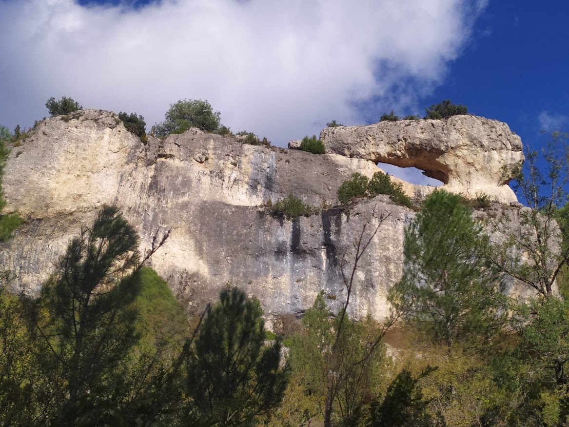
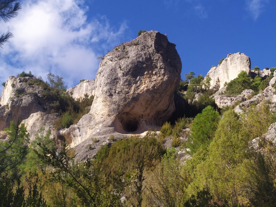
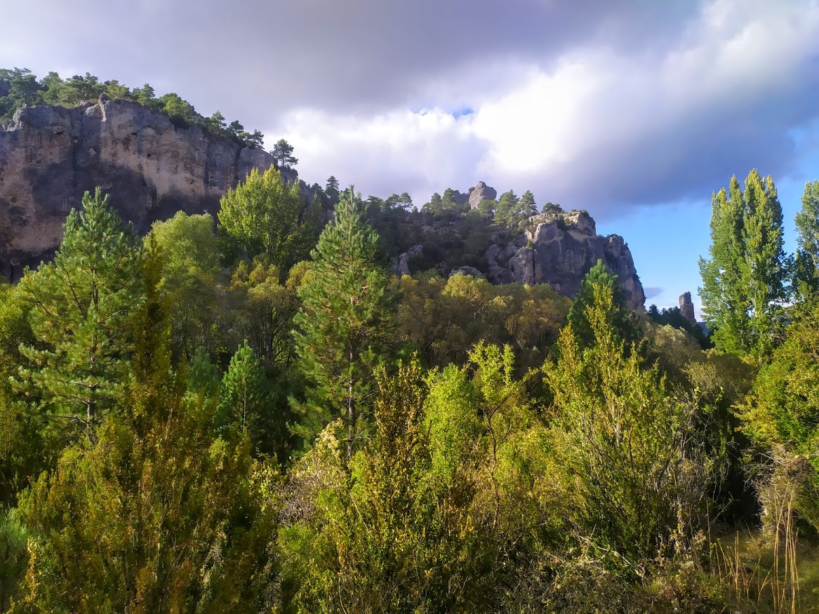
This ravine is formed by limestone, which, with the passage of time and erosion, has modelled itself, resulting in a landscape rounded shapes, with hollows, loose turrets, bridges between rocks and towers, very typical of this area of Guadalajara y Basinwhich, if larger in size, would qualify as "...".enchanted cities".
Travelling through the interior of the Ciño Negro, we find ourselves immersed in a plateau surrounded by high rock walls, which are full of life from the numerous species rock-dwelling birds that find in these cliffs and hollows the perfect place to nest.
We will see that the Ciño Negro is crossed by a stream, which flows dry unless we walk through this marvellous enclave just after a big storm or in very rainy springs after very cold winters where the snow has been abundant. This does not mean that the rest of the year it is dry, its flow continues to flow, but under our feet.
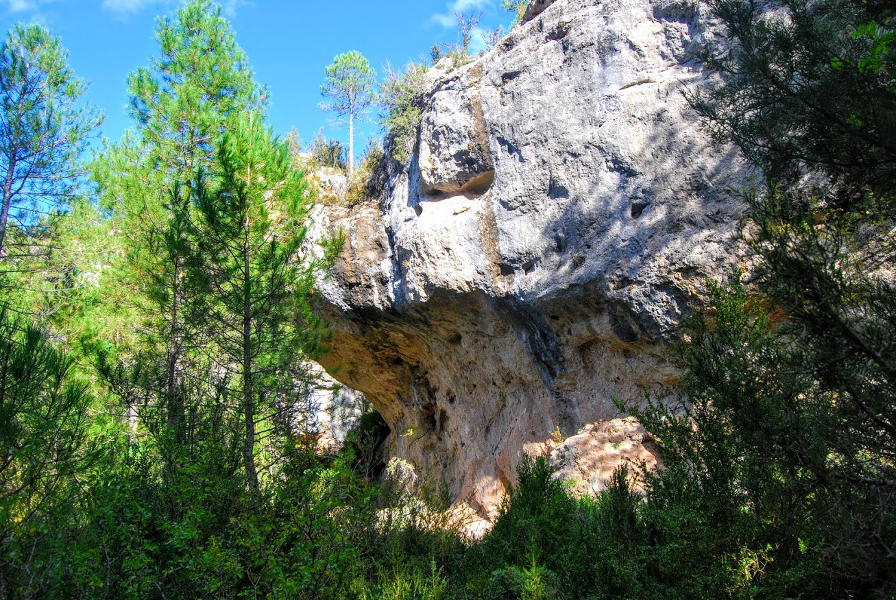
We are at the top of the travertine buildingWe could imagine it as a Gruyèr cheese, full of tunnels and cavities through which water seeps underground. But this water, after a zone of old orchardsThe new water, which is a small, small turquoise lagoon which is usually flooded all year round.
This lagoon is the one that feeds the well known Escaleruela waterfallWhen the tuffaceous edifice fills up, the water flows out at this point, overflows and carries the water to the edge of the cliff above the Tagus. It is here that the underground water, full of limestone materials, deposits these materials before rushing down, each time forming new rocks that slowly make this beautiful waterfall grow.
A walk through this peaceful ravine is essential if we want to understand a little better how this waterfall was formed, although it is also an unforgettable experience in the middle of the wild nature.
The exuberant vegetation that grows uncontrollably here, the abundance of animals and birds both forest and rocky and the beautiful views that the Ciño Negro gives us give it the necessary relevance to know it on its own, and for this there is the possibility of making a small route by comfortable tracks that has a distance of 8 kilometres round trip.
Going up the access to the Viewpoint of Zaorejas, Once at the top, there is a signposted turn-off which indicates access to stops 6 and 7 on the Georuta 4. Here we can leave our vehicle at the side of the road and start to descend along the path to the right, which in just over 40 minutes will have us walking across the Barranco del Ciño Negro ravine to look out just above the Escaleruela waterfall.

