Campillo Waterfall

Campillo Waterfall
Dirección
Campillo Waterfall
GPS
40.796268328855, -2.1664029870954
Campillo Waterfall
The Cascada del Campillo is a beautiful permanent fall of the waters of the Arroyo del Campillo towards the Tagus River. To better understand the formation of this curious waterfall and the building where it is located, we must better understand what karstification involves and the land on which it is located.
The karstification is a chemical process that produces reactions on the calcareous rock in contact with water and whose final result is travertine or tuff. In them it is often possible to observe remains of the leaves, mosses or trunks on which the calcium carbonate responsible for their formation precipitated.
Erosion on such substrates is much more capricious than pure water friction and can result in curious formations such as caves, holes, chasms or ravinesThe ground subsidence of the soil completes the process. The course of a river over this type of rock often generates important gorges and gorges that offer spectacular landscapes. On other occasions, aided by the erosion produced by wind and ice, they draw beautiful natural sculptures.
When the watercourse encounters significant slopes it can undermine the rock, resulting in waterfalls, as occurs in the Campillo waterfall. The stream that rushes through it, with a high lime content, is the protagonist in the formation of the building antaceous of Campillothe second largest in Europe
<< How to get there?
This waterfall is currently a little hidden, as it pours its waters into the riverbed of the Tagus, once past the width of the Bridge of San Pedro and when it has already begun to channel again. The easiest way to visit it is by taking the stage 6 of the GR 113If you don't want to do a linear trail, we recommend getting as close as possible to the Casas del Campillo with our vehicle, along a road that is taken between kilometres 62 and 63 of the CM-2015. We will go parallel to a stream along a very narrow concrete track until we reach the first building where we will leave the vehicle.
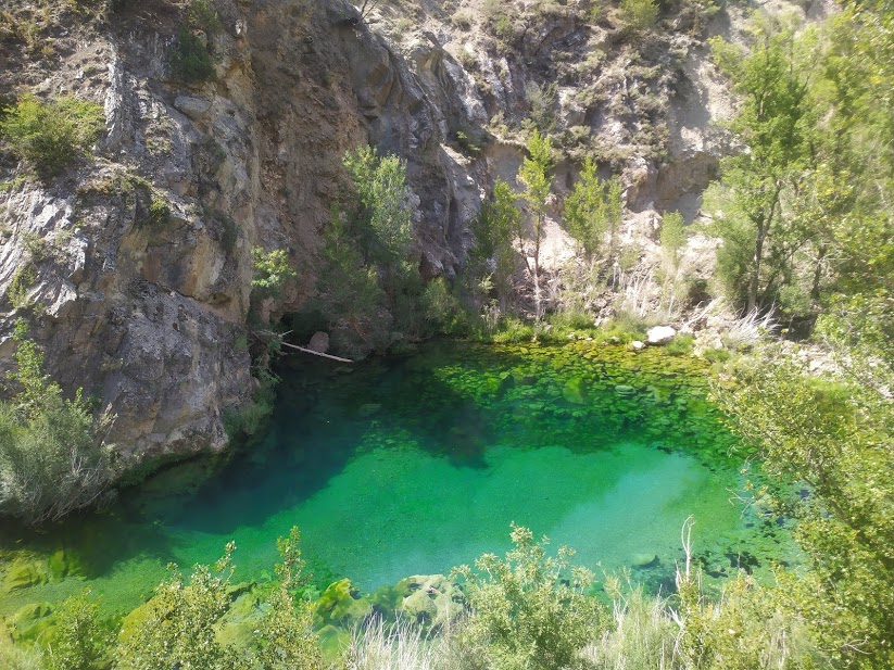
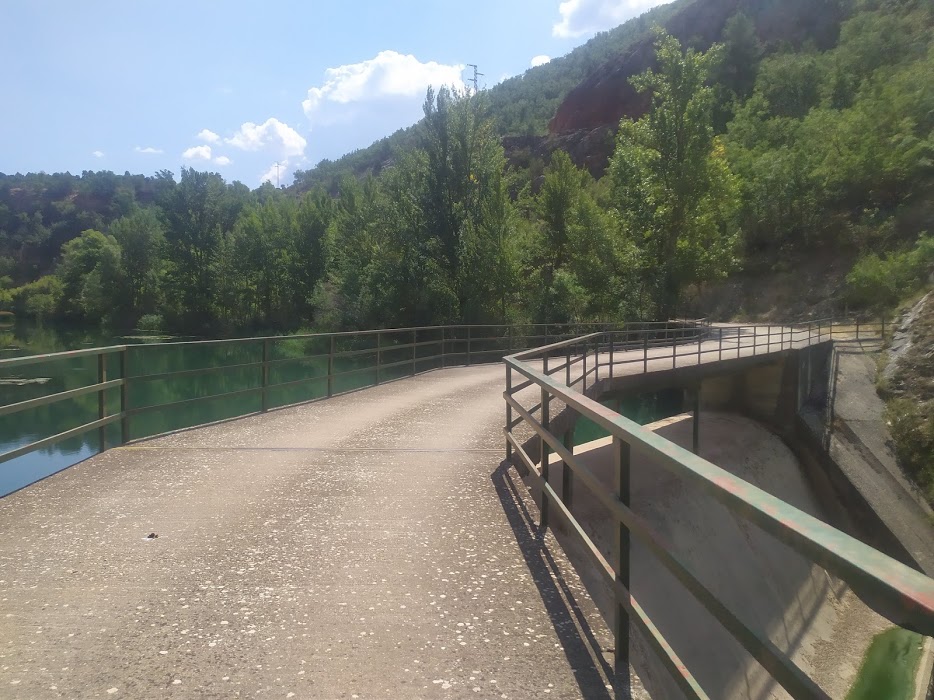
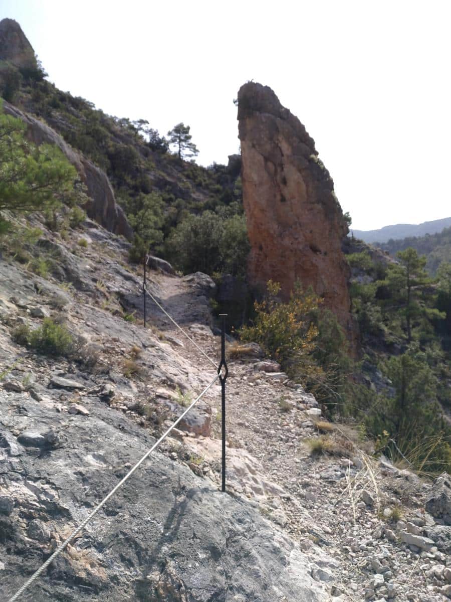
From here we take a small path that leads us to the back of the campillo building, and then suddenly we descend to a dam We will cross the river Tajo by means of a footbridge. On one side is the dammed river, on the other a small, sparkling pool of crystal-clear water. After crossing the bridge over the Tagus, a signpost warns us of the danger of the path on this stretch. The path narrows and climbs up a rocky slope, leaving the river on the right at first. Little by little the path gains height and moves away from the riverbed.
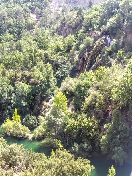
Once you reach a good height, the views of the river and the waterfall are spectacular, especially from some of the natural viewpoints overlooking the ravine. We stand right in front of the waterfall, watching its pure waters cascading down, nowadays in a totally opposite way to the way it did when it led to the formation of the tuffaceous building that houses it.
Another option for a visit is to leave by car from the San Pedro´s Bridgewith direction to Villar de Cobetaand at a bend in the road, we will see an esplanade with a sign of the GR-113Here we will leave the car and walk following the GR signs, until we reach the same point as the previous option, just in front of the Campillo Waterfall.

