GR-113 Tagus Nature Trail
8 stages of the natural path of the Tagus in the Upper Tagus

Tagus Nature Trail
Dirección
Home in Villar de Cobo
GPS
40.395375793427, -1.6727489006847
GR-113
Tagus Nature Trail we call on the more than 1000 kilometres that follow the path of the longest river in the Iberian Peninsula. It rises in the Montes Universales, in the heart of the Sierra de Albarracín, to gradually cross the peninsula to the Portuguese border at Cedillo, crossing endless landscapes, along with much of the history and culture of the entire interior of Iberia, crossing from east to west the provinces of Teruel, Guadalajara, Madrid, Toledo and Cáceres.
This Nature Trail has been approved as a long-distance footpath (GR-113) by the Spanish Mountain Sports Federation (FEDME).
The section of GR-113 in the Alto Tajo covers a little more than 200 km that can be done in 8 days on foot or 3 days by bike, although we can always adapt the route to our capabilities.
The Camino departs from Albarracínnear the source of the TagusThe route runs along the upper stretch of the river, with its fast, clean waters, through mountain landscapes, dominated by escarpments and rocky cliffs of juniper and pine forests; and the valley bottoms, with large laricio pine forests, riverside forests, farmland and olive groves. These areas, protected within the Upper Tagus Natural Park, are a refuge for birds of prey, such as the golden eagle, Bonelli's eagle, Egyptian vulture and griffon vulture.
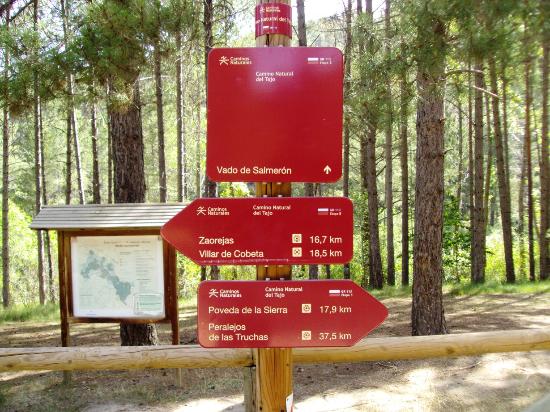
The GR-113 enters the Alto Tajo Natural Park by the Three Provinces boundary marker on the Monte de Sierra Molinawithin the Municipality of Czech. It runs through the villages of Peralejos de las Truchas, Poveda de la Sierra, Peñalén, Zaorejas, Villar de Cobeta, ArmallonesOter, Oter, leaving the Natural Park for Carrascosa de Tajo.
This is the best signposted long-distance footpath in the whole area as, in addition to the route, there are heritage, fauna and flora signs, and it coincides practically all along its route through the Upper Tagus with the GR-10 (From Valencia to Lisbon or Senderos de la Miel) and from the Puente de San Pedro to Peralejos with the GR-66 Camino de la Hermandad.
In the following link you can download on book with all the necessary explanations for a complete knowledge of the GR-113 Camino Natural del Tajo, so we will not go into too much detail here. You can also visit the website of the Ministry of Agriculture with all the information, maps, tracks, etc.
Stages of the GR-113 Camino Natural del Tajo, which run through the Upper Tagus Natural Park:
- Stage 2: Villar del Cobo-San Lorenzo Hermitage (38.6 km)
- Stage 3: San Lorenzo Chapel-Peralejos de las Truchas (23.1 km)
- Stage 4: Peralejos de las Truchas-Poveda de la Sierra (30 km)
- Stage 5: Poveda de la Sierra-Zaorejas (33.5 km)
- Stage 6: Zaorejas-Villar de Cobeta (16.3 km)
- Stage 7: Villar de Cobeta-Huertapelayo (18.7 km)
- Stage 8: Huertapelayo-Valtablado del Río (23.6 km)
- Stage 9: Valtablado del Río-Trillo (28.9 km)


