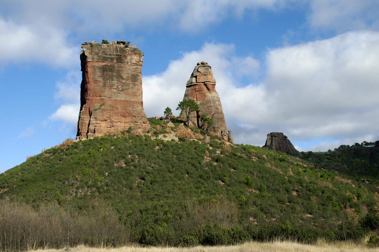
Georuta 2: Valle de los Milagros (Valley of Miracles)
Rocks, vegetation and landscape

The Miracles
Dirección
Home in Riba de Saelices
GPS
40.911841386024, -2.2966816567037
Ida 12 Km | 12 Km | 12 Km | 12 Km | 12 Km | 12 Km | 12 Km | 12 Km | 12 Km Unevenness 50 m | Duration 4 h | Route –
Georuta 2: Valle de los Milagros (Valley of Miracles)
We will start the Georuta 2 departing from the town of Riba de Saeliceswe will find ourselves with a route of 12 kmThis can be done on foot, by bicycle or motor vehicle, with the exception of the stretch that goes to from stop 2 to stop 7, which can only be done on footIt takes just over an hour to get there and back. There is also the possibility of visiting the cave, for which a visit must be arranged in advance via the website. http://www.ribadesaelices.es/cuevadeloscasares.html
This route, which runs mainly along the Valle de Los Milagroswill show you the keys to a better understanding of the role of geology in the landscape of this sector of the Natural Park. The relief, the vegetation and even the uses that man has given to the territory are conditioned by geological aspects to a greater or lesser extent, as you will discover at each stop. Come along this route and you will see how close the relationship between geology, vegetation and landscape is.
We will also find several enclaves of great historical and artistic value such as the Cave of the CasaresThe cave, in which we find representations of Palaeolithic rock art of great importance in the central area of the Iberian Peninsula; the 10th century Hispano-Muslim settlement located on the slope of the cave, and the Salinas de San Juanin Saelices de la Salcurrently in the process of restoration.
Signposting and Start of the Route
<< Stop 1: In the highest part of Riba de Saelices, by the Moorish towerIn a privileged viewpoint over the valley, you will find the starting panel. We will appreciate a spectacular view of the river Linares and its valley, where we can see rocks of different ages ranging from Paleozoic slate, the oldest in the area, to the Tertiary and Quaternary clays, gravels and sands, the most modern.
<< Stop 2: We leave the village and take the track that leads towards the Cave of the Casares and the Valle de Los Milagros. Although the track is in good condition, if you are in a car, drive with caution. In two kilometres you will reach a recreational area located next to the river, where there are several panels. From here you can walk five minutes to the Cueva de los Casares, where you can visit the ruins of an ancient Hispano-Muslim settlement from the 10th century. And also, by prior arrangement, you can visit the Palaeolithic cave paintings inside the cave.
<< Stop 3: Cross the river at the ford and walk into the Valle de Los Milagros. The stretch between this stop and 7 coincides with the route to visit the Natural Park marked with pink markers. Two hundred metres from the chain that prevents motorised access to the valley you will find a plaque on a block on the right-hand side of the path.
<< Stop 4: A few metres further on, but this time on the left side of the path, there is another plaque. From this point on, there are many changes: the physiognomy of the canyon slope changes, the vegetation varies and even the colour of the soil is different. All these changes are due to the variation in the type of rock. On the left, ochre-coloured limestones and dolomites, which give rise to soils on which the juniper, gorse and hawthorn grow, and on the right, red sandstones which give rise to siliceous soils on which the maritime pine, marojo oak and steppe rockrose grow.
<< Stop 5: We continue along the bottom of the valley between spectacular sandstone cliffs. In 15 minutes you reach a point where the track forks. We take the one on the right and in front of us we will find a plaque explaining the differences in the resistance to erosion of the different types of rock that we will find here.
<< Stop 6: We continue walking for ten minutes. The valley widens considerably and you reach an esplanade where you can make out the props of Los Milagros and where there is a panel where we can learn a little more about these curious geological formations.
<< Stop 7: Continue walking for five minutes until the valley turns sharply to the right. Here a signpost indicates that we must climb a small mound at the base of the struts to find a panel. In total, it will take us no more than 5 minutes from the previous stop. Here we will see how the landscape changes again thanks to the different types of rocks.
<< Stop 8: We walk back to the car and head towards Saelices de la Sal. As soon as we cross the village we will find (next to the road) the salinaswhere you will find a panel and where the route ends. Take the opportunity to visit the salt pans, which are in the process of being restored. They are one of the five salt pans that we will find in the Upper Taj Natural ParkoThey are a good example of how man has been able to take advantage of the natural resources of the area.


