Route 3: Cobeta - Barranco del Arandilla Gorge
Man and geological resources

Route 3: Cobeta - Barranco del Arandilla Gorge
Dirección
Cobeta
GPS
40.865106651782, -2.1406917130276
Ida 13 Km | Unevenness - m | Duration 4 h | Route –
Route 3: Cobeta - Barranco del Arandilla Gorge
The Georuta 3, The trip lasts 3 hours if you do it by car, 4 hours if you do it by bike, and 13 kilometres in the case of full implementation on foot, Some sections can be done by bike, but in many others you will be forced to leave your bike parked.
In the event of having to walk the sections, these will not exceed one hour in duration between the outward and return journeys. Depending on the state of the track linking the two routes, it may take Cobeta with La Olmeda de CobetaThe first section of the route may need to be done on foot. Stops 1 and 5 require short walks. Stop 2 requires a 20-minute round trip and stop 3 requires almost an hour more round trip. Stops 7, 8 and 9 are linked with a pleasant stroll along the Barrando del Arandilla.
This route shows the sustainable use that the inhabitants of the area have made of the geological resources existing in the area. Upper Taj Natural Parko. By extracting raw materials, they obtained what they needed to build houses, make tools and obtain energy. But they also took advantage of the particularities of the terrain to choose the location of fortresses, watchtowers or even places for spiritual retreat.
Come along georoute 3 and discover the close relationship between geological heritage and cultural heritage. We will also get to know two very different environmental and landscape units: the juniper juniper grove and the "rodenal". As for the fauna, the small passerine birds in the juniper grove, the forest birds of prey in the "rodenal" and the rock birds in the "Barranco del Arandilla" stand out.
Signposting and Start of the Route
<< Stop 1: From the people of Cobeta a road leads off to the Castle Keep. In five minutes of ascent, enjoying magnificent views of the surroundings of the village, you will reach the tower where the starting panel is located. Here we can admire the landscape shaped by erosion over time and the adaptation that man has had to this type of environment.
<< Stop 2: We leave Cobeta along the track that heads towards the Hermitage of San Antonio. Two hundred metres from the exit of the village, on the slope of the road, there is an outcrop plate. We recommend that you walk there, as there is not much parking space.
Here we find the two types of gypsum that appear in the Upper Tagus, on the one hand red gypsum and on the other fibrous, colourless and white gypsum, which have the same chemical composition but their internal organisation changes, giving rise to very different physical aspects.
<< Stop 3: Continuing along the track, you will reach the Ermita de San Antonio hermitage. After about 400 metres you will find a plaque on the slope of the track. This walk from the village of Cobeta will take us a little over an hour and a half to get there and back. The path winds along the right-hand side of the valley and cuts through the Keuper gypsum and clay formation and some Quaternary deposits of foothills and alluvial deposits. If we look at the slopes of the path, where the gypsum and clays outcrop, we can find two very significant mineral species in the Upper Tagus, the aragonites and the Compostela hyacinths.
<< Stop 4: We return to Cobeta and leave with our vehicle in the direction of Molina de Aragón. Three hundred metres from the Cobeta exit there is a lay-by on the left, where there is a panel showing how man has taken advantage of the geological resources of the area to solve basic issues for his life, such as the construction of lime kilns or millstones.
<< Stop 5: A few metres further up the slope, next to the tile kiln, there is an outcrop plate.
<< Stop 6: Continue along the road to Molina. After passing a pass, the descent begins until you reach a bridge over the river Arandilla, where you take the track that goes off to the left and where there is a car park. Although it is possible to continue with the vehicle up to the vicinity of the Montesinos HermitageWe recommend you park it here to reach the Hermitage by taking a pleasant walk along the Barranco del Arandilla ravine. Just over the bridge, a couple of hundred metres further on, you will find a plaque.
<< Stop 7: We continue walking towards the Hermitage until we arrive, in 10 minutes, at the recreational areaThere is a panel where we can find more information about the processes that took place in the formation of this beautiful valley.
<< Stop 8: At the height of the Ermita we find a log bridge that crosses the river Arandilla, which leads us to the foot of some escarpments where there is an outcrop plate in the place where a waterfall used to fall.
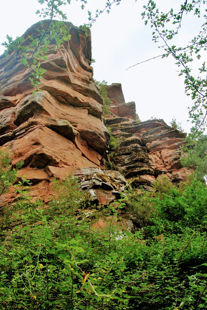
<< Stop 9: We return to the hermitage and continue walking for ten minutes, going up the course of the river along the path that enters the valley. After crossing a concrete bridge you will see an old mill, where there is an outcrop plaque. We recommend that you continue along the path for a few more minutes to reach a meadow at the foot of the sandstone escarpments, where our route ends. Looking up at the rocky escarpments, we can watch carefully for griffon vultures, which find the perfect home in these hollows.


