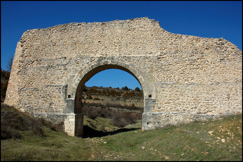
Zaorejas Roman Aqueduct
Roman aqueduct near Zaorejas

Roman aqueduct of Zaorejas
Dirección
Zaorejas Roman Aqueduct
GPS
40.7546133, -2.2021908
Zaorejas Roman Aqueduct
The aqueduct of Zaroejasalso known locally as "the roman bridge is located just over a kilometre south of the town centre.
To visit it, the descent to the ravine of the Fuentelengua stream is spectacular in itself, and once down it is incredible, a solitary place of quiet beauty, with a marked path that follows the course of the ravine and allows us to circulate through it comfortably, arriving at a small recreational areawhere the Fuente de los Chonos (Fountain of the Chonos) is located.
Roman domination was brief in this territory, but in spite of this, some vestiges can be found in the Natural Park, such as villas, roads and this curious and unknown Roman aqueduct, the only one known in the province of Guadalajara.. According to its architectural characteristics, it has been dated to the 2nd century AD during the High Roman Empire. Various theories claim that this hydraulic work was used to supply water to the Roman villa of Caraelocated in the present-day town of Zaorejas.
A large part of its construction material has gradually disappeared to be used in other constructions, such as enclosures or terracing of the surrounding embankments. Originally, it bridged the difference in level formed by the ravine of the Fuentelengua stream and took advantage of the waters of the Barbarija area, located at a distance of about 1260 metres altitude.
It is difficult to define its limits outside the visible remains of the aqueduct, as the layout on the slopes is not appreciable, it can only be guessed at, especially in the eastern part, where the remaining remains are located closer to the hillside. The best preserved part in the central part where an impressive archway let the scarce water flowing through the ravine through, preventing it from being dammed. The arch is carefully finished with well-finished ashlars.
<< How to get there?
To reach the location of the Roman aqueduct of Zaorejas we must head south of the town. Once at the height of the last row of houses, we must look for the track that descends the ravine and from there continue along the path, which is signposted, until we reach this amazing construction.
Finding the start of the path can be confusing, the simplest way to do this is to climb up to the threshing floor behind the Interpretation Centre, Once here, we must turn our back to the bullring and walk alongside the corrals on the edge until we reach the end of the threshing floor, where we will find a street that descends and turns to the left, this will be our path.


