Route from Canales del Ducado to La Hoz del río Ablanquejo
11 km circular through the Ablanquejo gorges

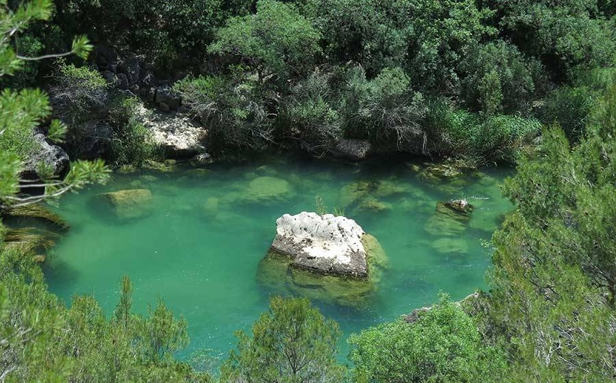
Hoz del Río Ablanquejo
Dirección
Home in Canales del Ducado
GPS
40.809736648786, -2.3591162242118
Circular 11 Km | Unevenness 337 m | Duration 4 h | Route On foot
Route from Canales del Ducado to La Hoz del río Ablanquejo
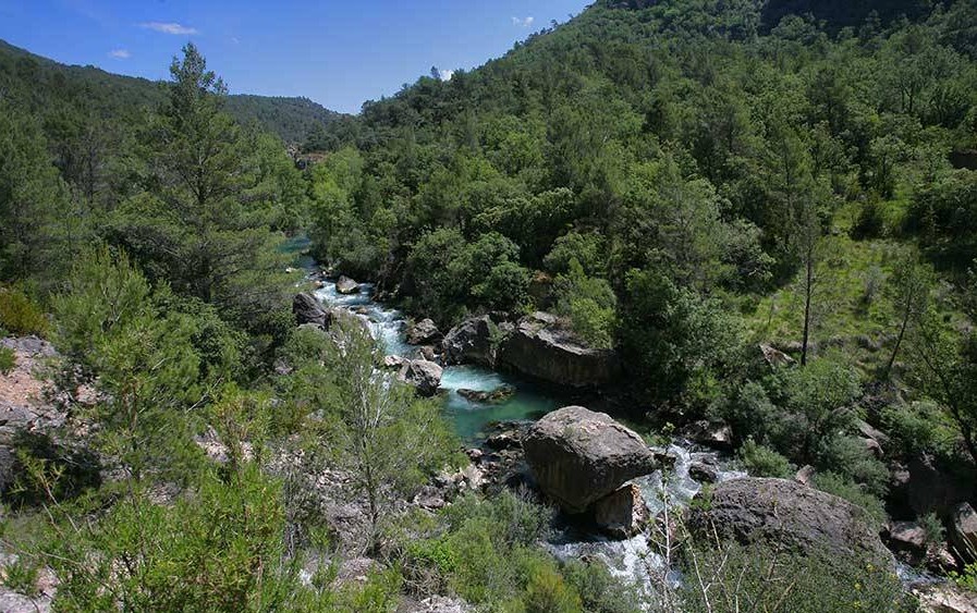
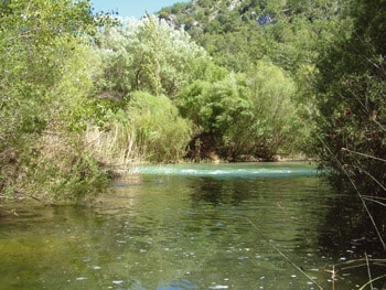
The route from Duchy Channels to the Sickle of the river Ablanquejo is one of the most beautiful and wildest paths in the whole Natural Park, although it must be said that in this area of the Upper Tagus, everything is beautiful and wild, in many cases impregnable, nature here makes it clear who is in charge.
We will walk for about 11 kilometres on narrow, sometimes exposed trails, the gradient we face is of 337 metresThis is not much, but in terrain like this there are stretches that are quite difficult, so we recommend that you take it easy and enjoy the privileged environment in which we find ourselves. We will do a route circular and it will take no more than 4 hours making a multitude of stops to enjoy and take pictures.
We start our tour in the small town of Duchy ChannelsIf we leave our vehicle in the fountain square, we must continue along the street that comes out at the end and which gradually turns to the right, until, once the ground has been turned into earth, we leave all traces of human constructions behind us.
We walk along the high plateau with hardly any gradient for 3 kilometres and it is then that we start our first relegation until we come across the Salinas de la Inesperada, now very close to the course of the river Tajo. Once at the building that used to be the saltworks warehouse, now in ruins, we turn to our left, turning our back on the area occupied by the Hundido de Armallonesand we head towards the Tagus river gorge itself, where we flows into the river Ablanquejo.
After walking parallel to the river for a couple of kilometres, we reach the point where we will have to go up and then down the ravine that forms the river Ablanquejo prior to its joints. This is a small climb of less than 500 metres, which on hot days seems like 5 kilometres. But in reality we soon reach the top and see the first view of this spectacular and wild river.
Once we have made the descent to the river bank, we will try to walk parallel to the river while enjoying the natural wonder that is kept here, so close and yet so far away from everything.
After 2 kilometres of walking along the river, it is time to tackle the final climb that will take us back to the village of origin. Here we have to do the ascent to the ravine of El CeñoAt this point we will have finished our ascent and all we have to do is take the straight track that will take us back to Canales del Ducado in a short time. After 1 kilometre of ascent, we reach an old sheep-farrowing building. At this point we will have finished our ascent and all that remains is to take the straight track that will soon take us back to Canales del Ducado.
Signposting and Start of the Route
This route is not signposted and the section that passes through the area of the Ablanquejo river ravine can be very wild and we may have more than one misunderstanding. To guide us as well as possible we recommend downloading the track of this tour right up here.

