Route from Huertapelayo to the Tagüenza Bridge
Spectacular route to and from the Taguenza Bridge
Tagüenza Bridge
Dirección
Huertapelayo
GPS
40.782940591975, -2.2780477700392
Only Ida 7 Km | Unevenness 340 m | Duration 2 h | Route On foot
Route from Huertapelayo to the Tagüenza Bridge
The route of Huertapelayo to Tagüenza Bridge is one of the routes in the Alto Tajo that you cannot miss if you visit it. It is a route of character moderateThe following must be done round trip the same road and in total we traveled about 9 kilometres, This is clear as soon as you enter the beautiful Huertapelayo .
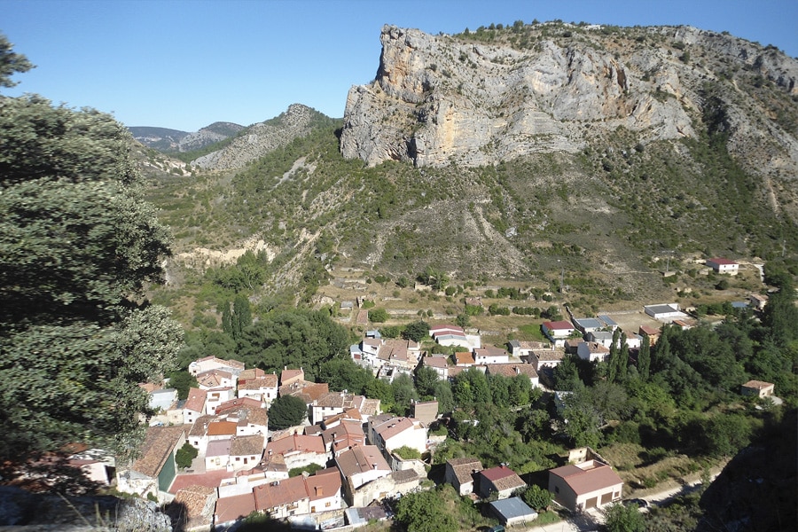
To start this trail, we must go to its Church of Santa Maria Magdalenajust behind it starts a path that takes us to the AsomadillasThe rock over which we are given a spectacular view of the Piedra de la Calera, a large limestone ridge that flanks the village and about which there are several versions of its name.
From here, we continue along our track, ignoring the detours on the right until we come to a wider path that immediately takes us up above the road. El Picayo, and at the foot of which the Huertapelayo cemetery was established. From the top, the views are incredibleIt's a place where you deserve to see the sun rise every day because you couldn't be in a more beautiful place.
We continue along this wide dirt road, and approximately one kilometre into our journey, we will come out of it. on the right hand side a detour marked with the markings of the GR-113-GR-10, along a path that gradually descends until it reaches a natural viewpoint from where a long walk begins. zig-zag descentThe route is very open, with loose stones, where extreme caution is necessary.
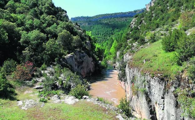
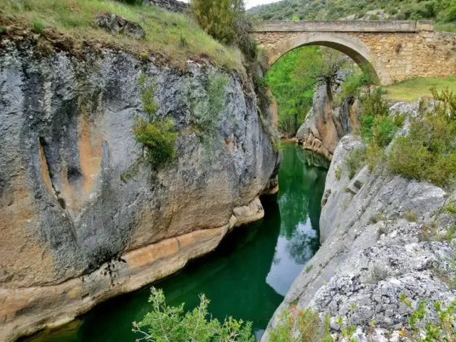
This last section drops towards the river, and it is just as we finish our descent that we see the figure of the Tagüenza BridgeA single-arch bridge built in the 19th century, partially blown up during the Civil War and repaired in the mid-20th century. It does not stand out for being a construction of extreme beauty or antiquity, however the setting in which it is built, between large rocks that flank the Tagus River, gives it a strong scenic attraction.
It is also one of those places steeped in history throughout its existence. In the past, it was an obligatory passageway for the cattlemen who transported timber along the river and, in addition, next to the bridge you can see the footings or indentations of provisional constructions that were built to facilitate driving.
Just when we reach the bridge, the first part of our route will be over, and we will return along the same path we came from, although if we wish and if possible, just on the other side of the bridge, there is a path that goes towards Huertahernando, which can join these two towns that are so close and yet so far from each other, due to the rugged terrain.
Signposting and Start of the Route
The access to the beginning of the route from Huertapelayo to the Tagüenza Bridge is not signposted in any way, the route follows quite noticeable paths and tracks and is not easy to get lost. truck The route map, which you can download below for your safety.

