Location: Huertapelayo
Huertapelayo (colloquially Pelayo) is located on the north side of the Tagus river, in the central part of the western part of the Upper Tagus Natural Park, in a picturesque hollow between two high crags, called del Thread and Chainwhich give permanent shade to the village.
The south comprises the descent of the moorland of Zaorejas towards ravines and the plain, but not before creating an ecosystem of pine forests extending westwards towards the north on its border with Armallones.
Its middle section is dominated by meadows and hills of rain-fed crops, while its northernmost part is characterised by the evident presence of rocky areas that extend from El Portillo northwards to the Tagus River, creating imposing canyons.
One of the places Huertapelayo is most famous for is the Tagüenza BridgeIt is one of the most famous passes in these lands.

The Tagüenza Bridge in one of the hidden places of the Tagus, curious and full of ingenuous beauty.
Ver más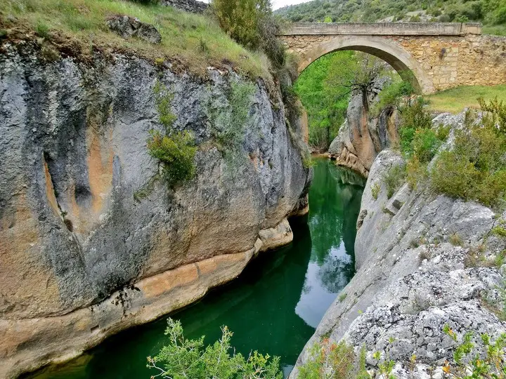
The route from Huertapelayo to the Tagüenza Bridge is one of the routes in the Alto Tajo that you cannot miss if you visit it.
Ver más
El Chorrero is the most famous waterfall in Pelayo right next to the tunnel opened in the middle of the massive rock to enter the village.
Ver más
The Huertapelayo route will allow us to enjoy one of the least humanised landscapes in the entire Upper Tagus Natural Park.
Ver más