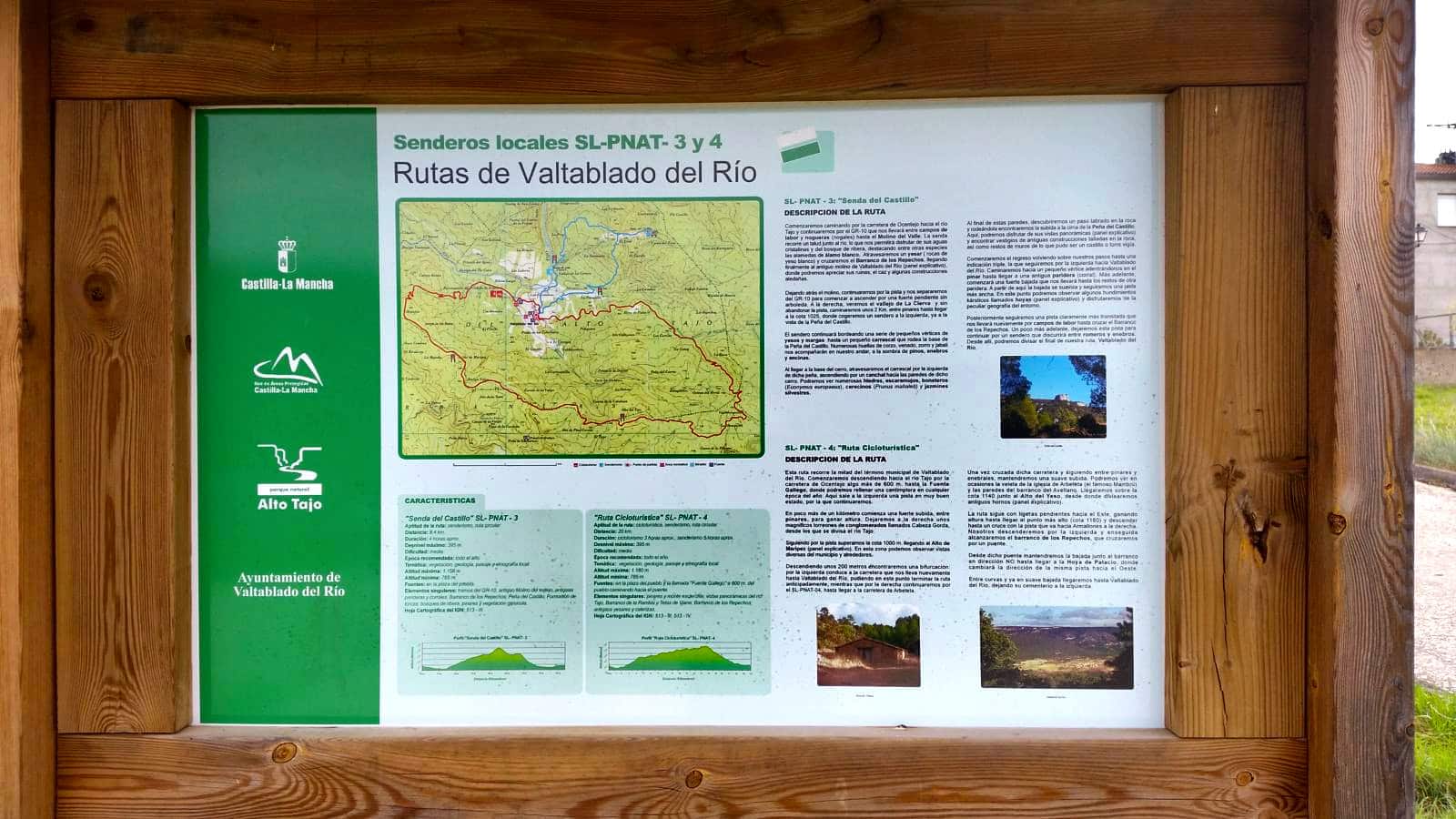
SL PNAT 3 Senda del Castillo (Valtablado del Río)
Route through Valtablado del río and its forests

Dirección
Start and finish in Valtablado
GPS
40.715273284079, -2.4018878988022
Circular 8,4 Km | 8,4 Km | 8,4 Km | 8,4 Km | 8,4 Km | 8,4 Km Unevenness 435 m | Duration 3 h | Route On foot - Bike
Local Trail 3: Senda del Castillo
This route, which starts in the village of Valtablado del Ríohas a length of 8.4 kilometresis circular and presents a moderate slopeespecially the descent down the log skidderbetween kilometre 5.6 and 6.1. It is also worth mentioning the Peña del Castillo where there is no clear access path, which makes it a bit more complicated and we will have to take the track of the path to ensure that we can go around it without any problems.
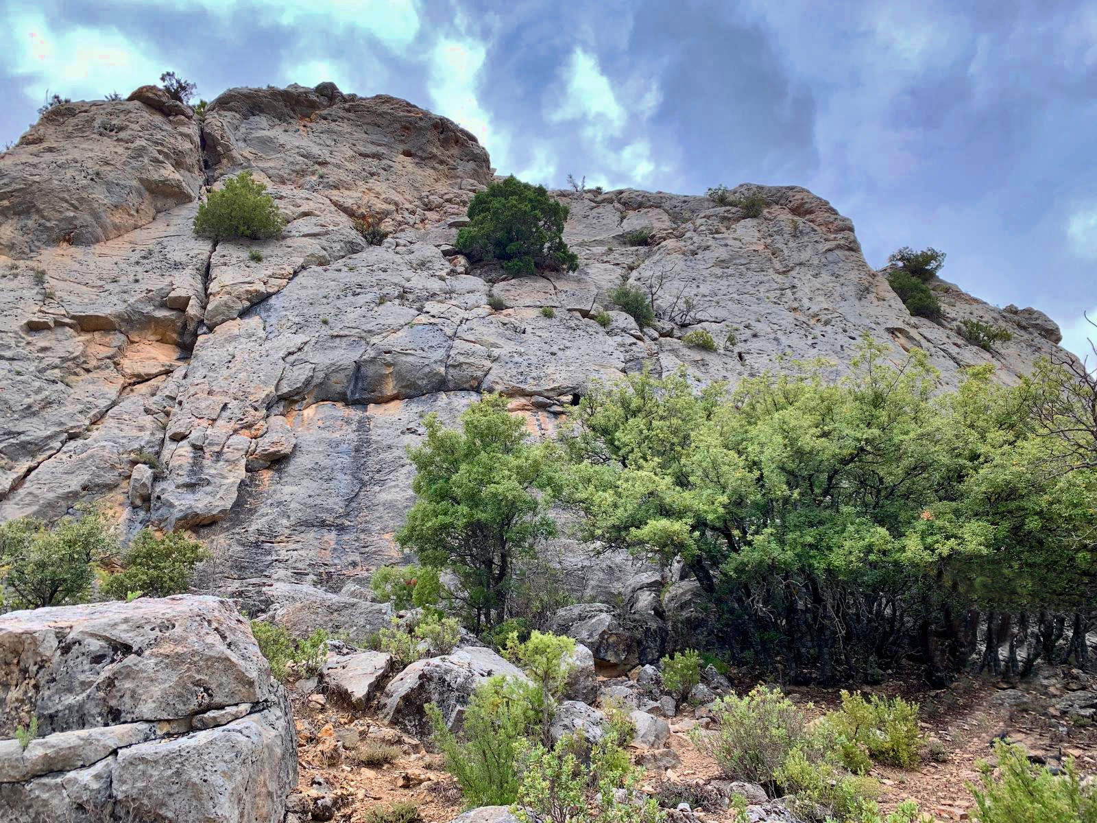
It is advisable to be patient as we will have to ascend through a canchal The path is made of stones and stairs carved into the rock itself, which are not without danger, so it is necessary to walk slowly and without haste. It is essential to wear comfortable shoes and water on this route, as we will not have water all the way, but we will be able to recharge our batteries at the village fountainbefore starting the route.
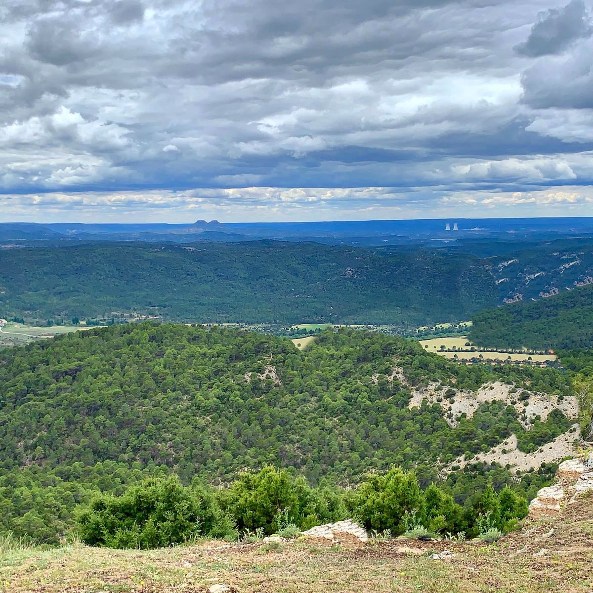
Almost the entire route of the castle path is through a dense pine forest, except for the final stretch, close to the village, where there are plenty of fields.
Signposting and Start of the Route
The Castle path is signposted with a information panel at the beginning of the route, on the outskirts of the town of Valtablado del Ríoand its route is beaconing with coloured markings white and green. In the first section, we can follow the signs of the GR-10to the Valley MillThe route continues along the white and green waymarks. The Peña del Castillo area is not well signposted and the path is barely perceptible, so it is advisable to take the track of the route so that there are no unforeseen events.
<< We start at the information panel located on the outskirts of Valtablado del Río, from there we must continue 100 metres along the road until we come to an arrow that leads us to a path shared with the GR.10. We follow the signs between farms and walnut groves until we reach the river where we can observe numerous specimens of Poplar White on their pavements.
<< We continue along a gypsum slope until we cross the river over a footbridge on the Ravine of Los Repechos. Once at the river, we will continue along a wider and more comfortable path until we get to the Valley MillHere we leave the track and the GR.10 to climb a steep slope that also leads away from the river.
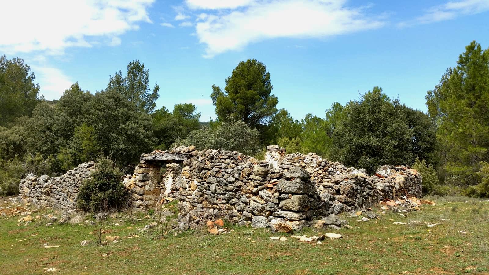
<< As we gain altitude we can see the remains of an ancient farrowing. After reaching the 1025 metres altitude, we have already observed the Peña del Castillo. We continue in search of them along a small path on the left where we can see that junipers and junipers are replacing the pines and where we can see countless remains and tracks of roe deer, deer and wild boar. Shortly after, we will come to some signs that guide us to the Castillo path or back to Valtablado del río. gypsum and marlstones where the holm oaks and some foot of Montpelier maple make an appearance.
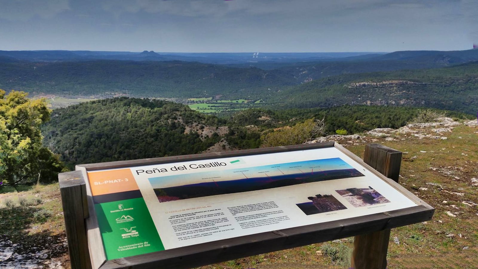
<< We arrive at the base of the crag, which we must go around to the left and go to by a cliff originated by an old collapse of the buildings on the hill. Here the floristic landscape is admirable in springThe surrounding area is populated by ivy, ivy, rose hips, boneteras, ash trees and wild jasmine. Once you reach the stairs carved into the rockWe only have to continue to the summit of the Peña, where we will see the castle, an ancient watchtower of Arab origin of which parts of the outer wall and the remains of a cistern and several buildings are still preserved.
Its location makes it a natural viewpoint that allows us to see the whole valley and where, looking at the sky, we can see the flight of the griffon vulture.
<< To return we must retrace our steps back to the crossroads where we find the two red signs and here we will take the path on the left that leads us between junipers and juniper trees to a viewpointHere we will make a stop on the way to continue enjoying the views of the valley. From here we will continue along an old wooden trawl which descends steeply into the valley. The vegetation changes again and scattered stands of hundred-year-old junipers appear.
<< About 500 metres further on the slope decreases and we will cross some karstic sinkholes called hoyas (torcas), which an information panel will help us to find out about. Continuing forward we will cross again the Ravine of Los Repechos1 kilometre further on, the descent ends as we enter the agricultural surroundings of the village. last part of the road along a path among junipers which will allow us to see the end of our castle path.
Finally, this route is part of the official footpaths of the Upper Tagus, occupying the number 2.
 8")
 9")