SL PNAT 4 Cicloturismo (Valtablado del Río)
Cycle route for bicycles that can be done on foot
Cycle touring (Valtablado del Río)
Dirección
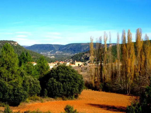
Start and finish in Valtablado del Río
GPS
40.715273284079, -2.4018878988022
Circular 20.7 km Unevenness 472 m | Duration 2 h | Route Bike
Local Trail 4: Cycle touring (Valtablado del Río)
This route starts in the village of Valtablado del Ríofrom the information panel that we will find in the GU-929 roadside. It is a cycle touring route from 20.75 kilometres (3h duration) although we can make it on foot no problem (5h) as it is circular and the roads are in good condition. It is one of the few official routes in the High Tajo which are marked and designed for cycling.
The The slope is considerable It is advisable to take it easy on the climb, especially if you have children with you, as some of the slopes can be very difficult for them. We should be aware that at 6.2 and 8.2 kilometres of having started the route, there is an escape route that brings us back to the village where we start from in case we do not want to or cannot continue ascending.
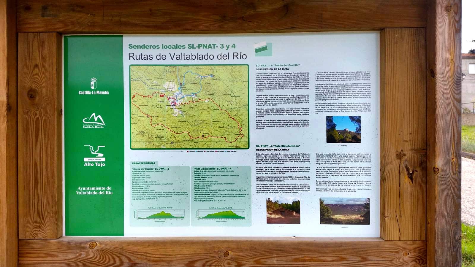
Signposting and Start of the Route
This route departs from the town centre of Valtablado del Río and goes to one of its points of interest, the Peña del Castillo. We look for an information panel on the same, and from there we take the road to Ocentejodown towards the Tajo. After 100 metres we will find the turn-off, with an arrow indicating it. From here on, the path is marked with green and white markers, with indicators at the crossroads, and described with panels at the points of interest.
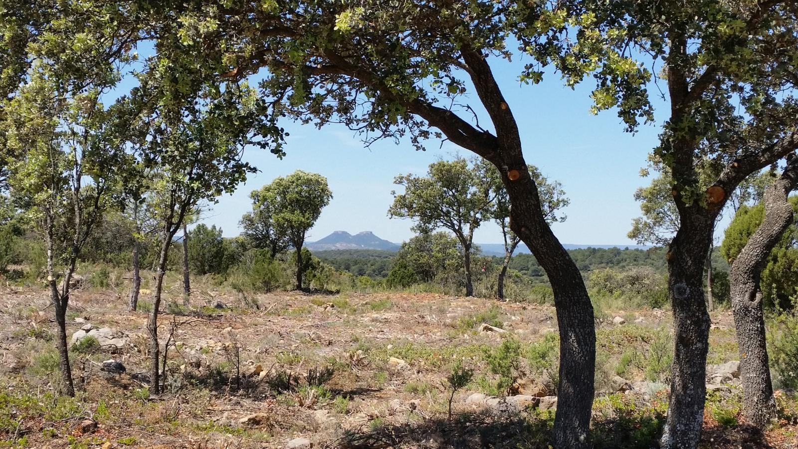
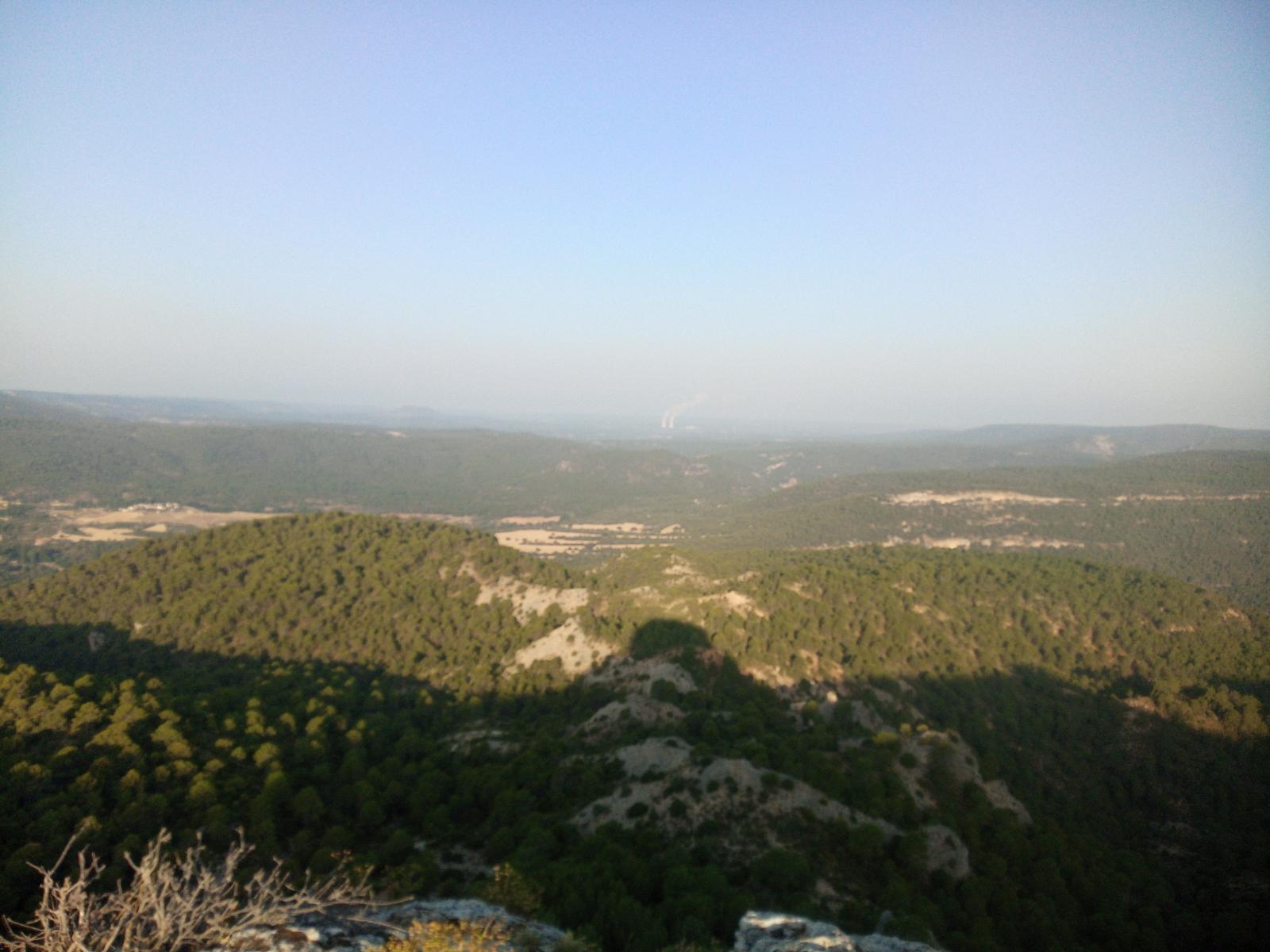
This route runs through half of the municipality of Valtablado del Río through a high area between pine forests alternating with stands of holm oaks accompanied by junipers and junipers. 600 metres to start our path on the road ahead, we come across the only place to get water along the route, the Fuente GallegoFrom here we take the path that goes off to the left of this and soon begins to ascend between bends to gain height quickly, entering the pine forest.
Along the way, we will see different constructions once used and nowadays as witnesses of the activity of the area, such as ovens for the achievement of gypsum from the mineral, such as the one we will see at Alto del Yeso, or some farrowing crates for the shelter of livestock.
One of the advantages of this trail is that shortly after reaching an altitude of 1,000 m, on the Alto de Maripez (about 6.4 kilometres), and about 8 kilometres after we have started our tour, we will have two escape routesboth signpostedBoth will take us back to the village from where we started if we do not wish to complete the full circular route.
After some 17 kilometres and after passing Alto del Yeso and an old well that is now operational thanks to the construction of a more modern water trough, we reach the start of the descent to the Ravine of Los RepechosThe gully becomes more rugged. Once in the ravine, we cross a small bridge to continue on through the scrubland and arrive at the spot known as the Hoya de Palacioa settlement with two farrowing troughs A clear example of the original constructions, as one of them is still in perfect condition. From here, the pine forest is replaced by fields of crops and walnut trees while we observe the Peña del Castillo on the right.
Finally, a gentle winding descent brings us back to Valtablado, leaving its cemetery on the left.
 5")
 6")