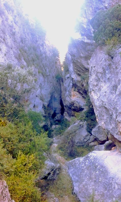
Hoz de Oter Ravine
Canyon formed by the Arroyo de la Dehesa stream

Hoz de Oter Ravine
Dirección
Oter
GPS
40.7377212, -2.4550652
Hoz de Oter Ravine
The ravine of the Oter Sickleis a canyon formed by the Arroyo de la Dehesa stream from where it passes through the town of Oter until it flows into the Tagus River.
To say "barranco de la hoz" in a land crossed by dozens of canyons, gorges, cliffs, gorges and ravines is to give few clues, to be honest. From Sigüenza Beteta Molina and Peralejos Beteta PeñalbaAt least half a dozen ravines of the sickle open their tormented gashes in the worn-out province of Alcarria. Fortunately they all have a surname: Virgen de la hoz, de la hoz de Oceratejo, del río Dulce, del Ablanquejo, de Oter...
One of the most remarkable parts of the Barranco de la Hoz de Oter ravine is a narrow passage which is called by different names such as El Barrancazo, Estrecho del Orao, Estrecho Lorao, or Lorado StraitAt its narrowest point, you can touch both vertical walls with your hands at the same time. You have to pass under a large rock that fell and got stuck about 2 metres from the bottom. The rock is attached to one of the walls in a pebble of barely an inch.
It has a couple of difficult crossing points and it is not a good idea to do it if it has rained recently or if it is very wet (the rocks are very slippery), otherwise, it is a great adventure through one of the most spectacular canyons in the whole of Spain. Alto Tajo.
<< How to get there?
To get to know this spectacular ravine, we have to head towards Oter, park in the town, and start our route crossing the village until we come across the Arroyo de la Dehesa, along which we will follow a parallel path until we come across the Arroyo de la Hoz de Oter (generally a dry riverbed), which we have to follow in the direction of the river Tajo.

