Georuta 10: Sierra de Caldederos-Castle of Zafra
A walk through history

Georuta 10: Sierra de Caldederos-Castle of Zafra
Dirección
Georuta 10: Sierra de Caldederos-Castle of Zafra
GPS
40.883487825951, -1.6844778398618
Ida 22 Km | Unevenness - m | Duration 4 h | Route –
Georuta 10: Sierra de Caldederos-Castle of Zafra
The Georuta 10, has its beginnings in the village of Campillo de Dueñaswhere we find the home panel. It consists of two branchesone of them heads south in the direction of the Zafra Castleand has a length of 7 kilometresIt can be done by car or bicycle. It can be done by car or bicycle, although from the car park to the foot of the castle, it is a comfortable walk. The other branch goes towards the Laguna HondaThe length of the track, which is accessible for vehicles, is 4 kilometres one way. The entire route would take an estimated 4 to 5 hours, depending on the means of transport chosen.
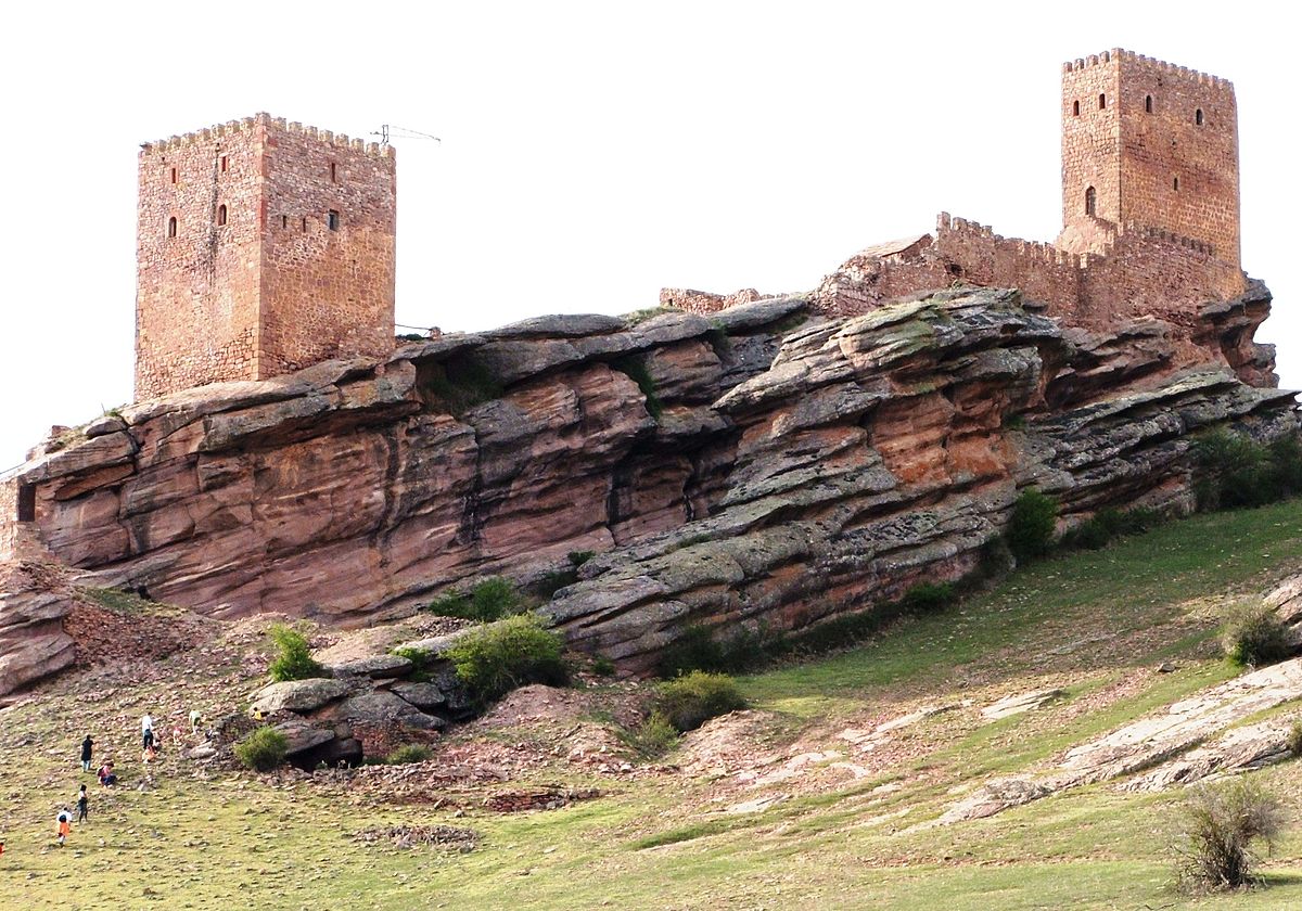
This route goes deep into the Sierra de Caldereros and its surroundings. During our walk we will be able to observe the capricious shapes that the landscape has modelled. We will be surprised along the way by the tormos, fairy chimneys, fungiform rocks and ridges, which serve as a refuge for the great variety of fauna that populates this mountain range. On one of these monoliths we find the Zafra CastleOne of the best examples of a rocky castle. The walls of Zafra, of Muslim origin, stand on a rocky watchtower, which Celtiberians and Romans already valued as a strategic point. The route also climbs up to a viewpoint which, on clear days, allows us to catch a glimpse of the silhouette of the Moncayo, the Gallocanta Lagoon or the Mesa Valley..
Signposting and Start of the Route
The signposting that we find is the usual in these Geo routes, always guided by green signs and complemented with explanatory panels of the surroundings along the route. It should be noted that Geo-Routes 10 and 11 are very recently created, so we do not have much more information, so we recommend, if you want to do them with total security, to obtain the necessary information in the Museum of Molina de Aragón.
