Taravilla Lagoon
Tobaceous lagoon next to the Poveda waterfall

Taravilla Lagoon
Dirección
Taravilla
GPS
40.665598029486, -1.9528582940056
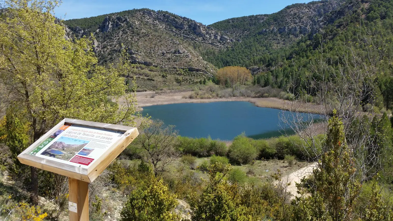
Taravilla Lagoon
This beautiful lagoon is located in the locality of Taravillawas formed by the growth of a tufa barrier that dams the water. Although a stream provides flow, most of its supply comes from groundwater, i.e. from springs close to the lagoon itself or even located within the lagoon.
The apparently inexplicable changes in the flow of the Taravilla lagoon, which have fed legends since time immemorial, are due to the fact that the underground water supply does not respond immediately to rainfall. Thus, it takes some time from the time it rains and the water infiltrates the subsoil until it emerges in the lagoon, which makes it difficult to relate the rains to the increase in its flow.
The lagoon is dammed by a tuff barrier 175 metres long and about 75 metres wide. With a height of 30 metres, it acts as a natural dam, preventing the stream from discharging its flow directly into the Tagus. Only in times of heavy rain does the lagoon overflow over its dam, forming a beautiful waterfall.
Thanks to the fact that the tuffs and the organic remains contained in them can be dated by complex isotopic techniques such as Carbon 14, it is possible to know that the barrier formed around 11,000 years agobut also that although it is currently inactive, except at one end and during the rainy season, just 200 years ago the barrier formed an incredible moss-covered waterfall, similar to the nearby Poveda waterfallbut much larger and of natural origin.
It also hides a large number of interesting curiosities. The sediments that accumulate at the bottom of the lagoon have recorded with great precision the environmental and climatic changes of the last two thousand years. These silts and clays contain mineral particles, pollen grains and tiny fossils of organisms that lived in the waters of the lagoon, which, like the black box of an aeroplane, reflect the evolution of the area quite accurately. Even if the sediments at the bottom of the Taravilla lagoon are well preserved, it is possible to estimate the amount of annual rainfall for the last 400 years.
Finally, another peculiarity of this lagoon is that if it were empty, you would be able to distinguish very abrupt edges and a surprisingly flat bottom. This is due to the fact that the depression that the lagoon occupies was generated as a result of the dissolution of the calcareous rocks that form its
environment. Thus, possibly, a cave was first created, the roof of which collapsed, giving rise to a basin that was filled by water.
The lagoon is located in the Tagus River Canyon halfway up the hillside on the right bank, protected from the north wind and with good sunshine, it enjoys favourable climatic conditions that have favoured the development of an extremely rich ecosystem in its surroundings.
To access it, we must take the road that comes out next to the huerta del forestal recreational area from TaravillaFrom here we will ascend little by little to finally reach the depression where the lagoon is located after having travelled about 5 kilometres. From Peralejos de las TruchasFrom here we take the track that leaves next to the martinete bridge, which gradually enters the canyon following the course of the river Tajo. From here we are about 10 kilometres from the Taravilla Lagoon.

