RG PNAT 2 El valle de los Milagros (Valley of Miracles)
One of the must-sees of the Upper Tagus

Valley of Miracles
Dirección
Home in Cueva de los Casares
GPS
40.939636, -2.2922272
Only Ida 10.5 km Unevenness 142 m | Duration 4 h | Route On foot - Bike
RG PNAT 02: The Valley of Miracles
This route can be suitable for hiking if it takes place between the Cueva de los casares and Cueva de la hoz, in this case the length is 12 Km round trip. There is also a variant of MTB from 28,5 Km passing through the town of Ablanque, This version of the route has a circular character. It is currently the number 4 in the Alto Tajo network of official hiking routes.
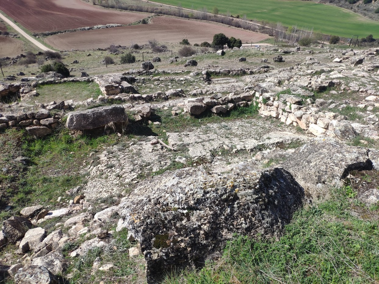
At the beginning of the route is the Cave of the Casares with important Palaeolithic engravings and which can be visited by appointment through its official website.
Our hiking route will have an elevation gain of 100 metres and it will take about 3.5 hours round trip, is a very fresh and comfortable route, especially in the many sections where we have to cross the river Linares.
In the case of the 28.5 km cycling routewe will have a difference in altitude of 260 metres and it will take about 5 hours The whole route, which has to go in the direction of the road, has to be done in the following directions Cave of the Casares, Riba de Saelices, Softening.... due to the steep slopes near the Valley of Miracles.
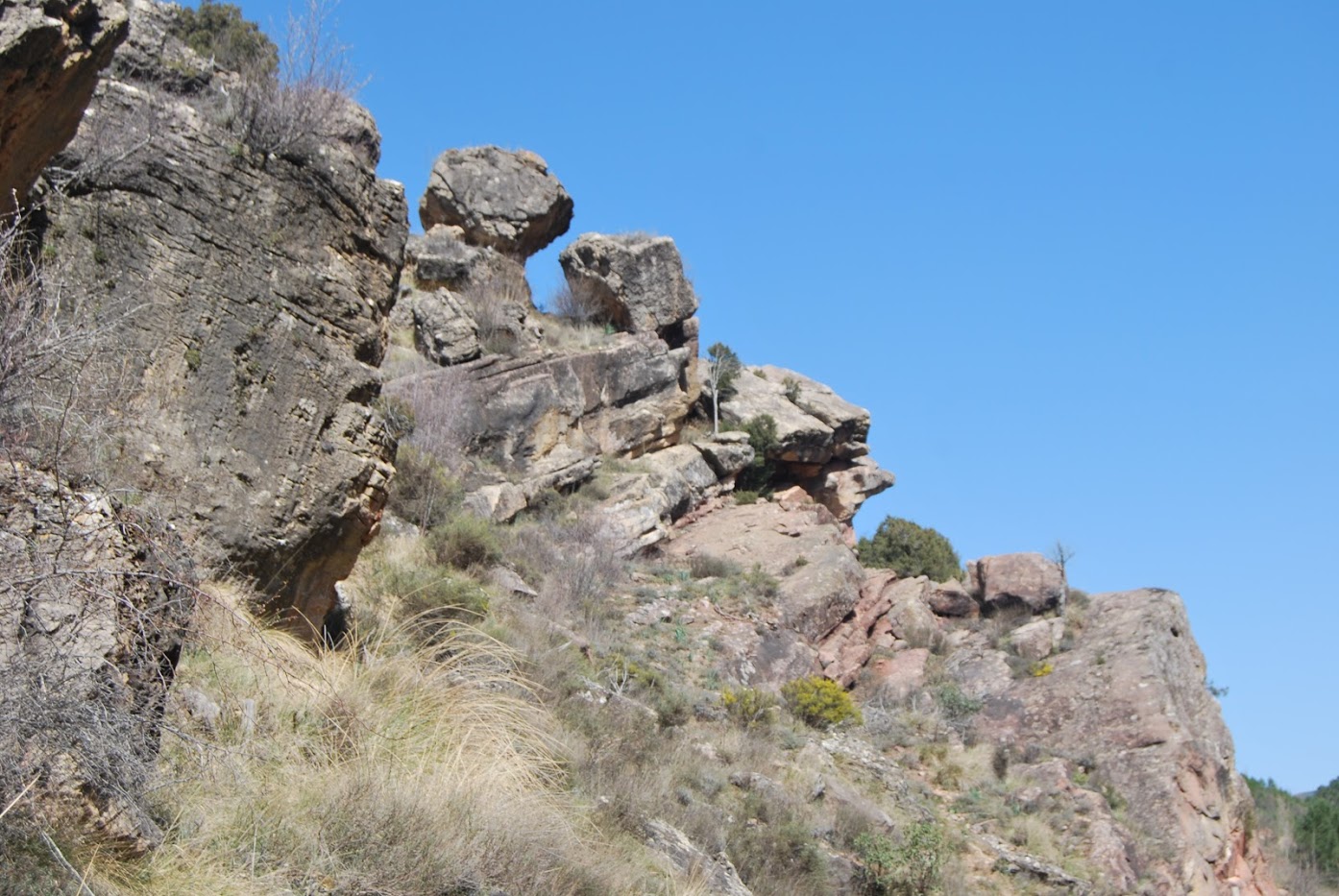
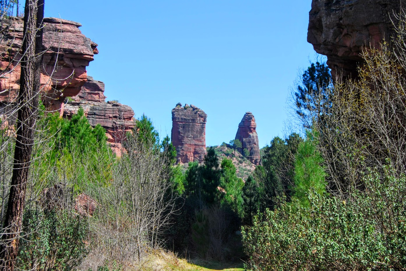
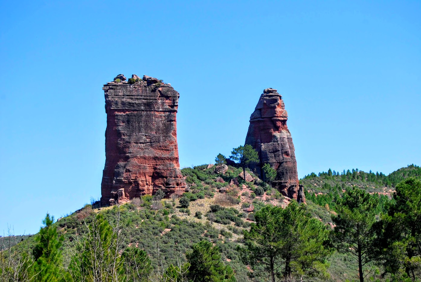
This route takes us on a comfortable walk following the course of the river Linares to the base of the two sandstone pinnacles that give this route its name. We will also discover a completely excavated valley in which we can easily appreciate the different types of rock that have gradually formed the valuable geological past of this area.
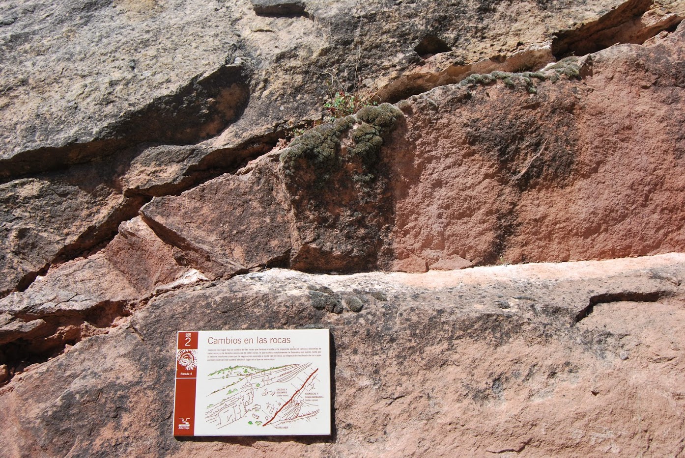
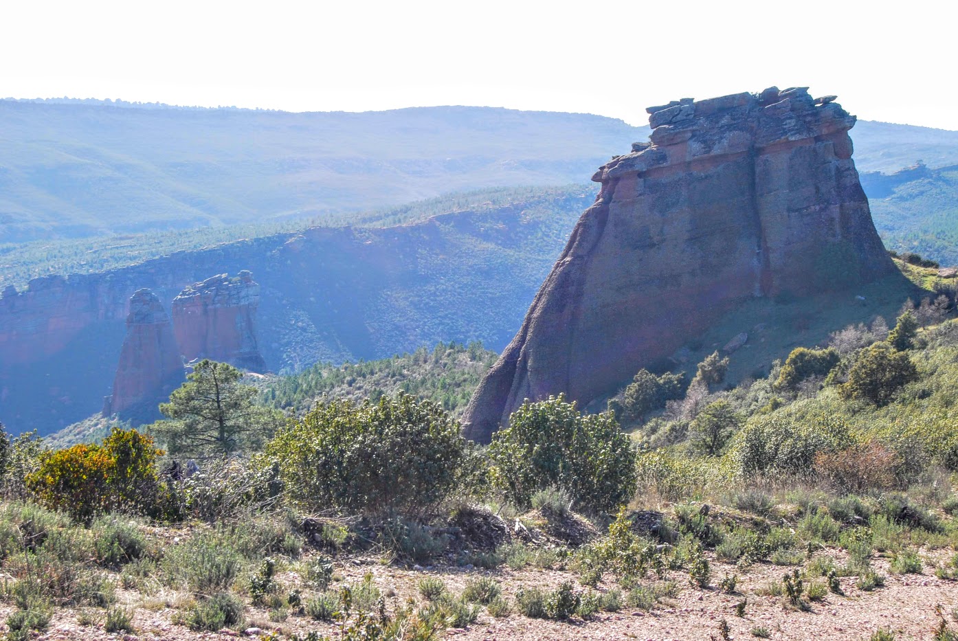
The geology of the Valle de los Milagros stands out, first we can appreciate the limestone materials, of whiter and browner tones, which are the product of sedimentation in the ancient seas that occupied the whole of this territory. Then, the red sandstones and conglomerates, product of the bottoms of large and abundant rivers that are now extinct, and finally, the evident change of colour to dark and black tones belonging to the more than striking slates.
Another of the attractions that make this one of the trails that we liked the most is the ease with which you can observe all kinds of birds, mainly birds of prey and forest birds of prey.
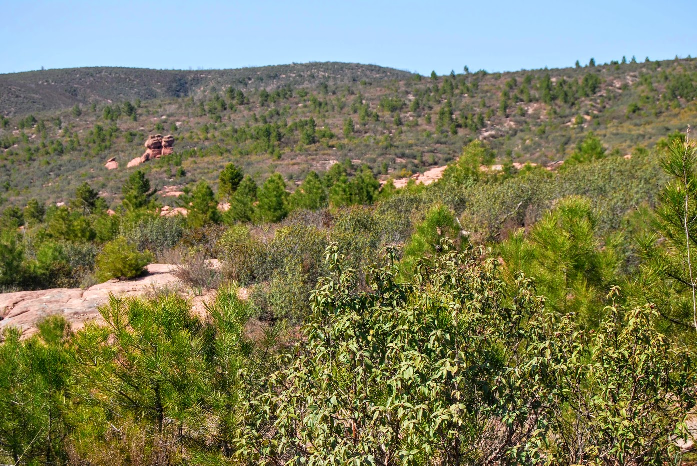
We walk through an impressive forest mass (still under development, as we are in the area affected by the 2005 fire), which is currently occupied by numerous species of birds such as the common treecreeper, the cuckoo, the woodpecker, the robin, the jay... . Among the forest birds of prey that use these forests to breed are the short-toed eagle (Circaetus gallicus) and the booted eagle.
<< How to get there?
To do the route on foot, we must go with our vehicle to the recreational area at the foot of the Casares Cavewhere you will find the starting panel, which takes you into the Milagos ValleyIf, on the other hand, we want to make the journey in bicyclethe direction of travel it will be the other way aroundFrom the Cueva de los Casares, direction Riba de Saelices.
Lastly, remember to carry enough water for the whole route, as there are no fountains or water points anywhere along the route.
Signposting and Start of the Route
This route has a information panel at the start of the route and the path to follow is marked with colour pinkThe current status and the long distance make them not easy to follow, so we recommend downloading the track of the route to make it smoothly.
We left the recreational area which is located at the foot of the Cave of the Casares and of the village of the same name, which we visited before starting our route. We are going to enter following the path that comes out on our right as soon as we cross the small bridge of the Linares River. Right next to it you will see the explanatory panel.
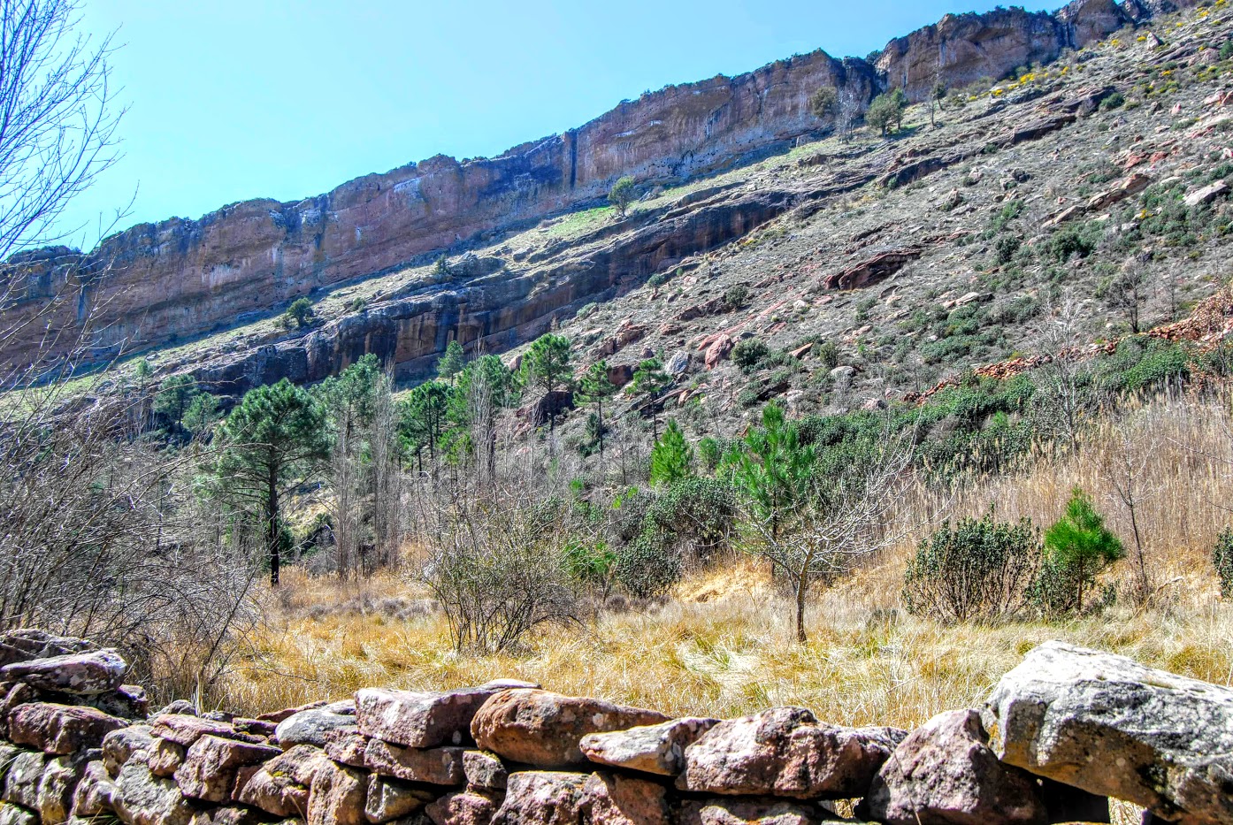
We will follow the path always upstream, fording it on several occasions over small stone bridges that help us to cross, although for those less accustomed to these activities we recommend carrying poles to have a third or fourth point of support to help us in this task. The valley, which is narrow at the beginning, gradually becomes wider as we advance. The path is mostly wide and shady, except for the initial stretch, which should be avoided at peak times of the day, and allows us to reach the structures in a comfortable and quick way. The MiraclesThese are curious geological formations, which, as we have already mentioned, are the result of erosion.

We walk always in the direction of these reddish towers and gradually ascend to the base of the two nearest towers, the Miracle Strut (The widest and squarest) and Peña Eslabrada (The most pointed).
After a short rest at its base and taking refuge in its shade, we begin our return and the descent until we reach the recreational area from which we started, following the same route we described on the way up. With the view of the returning hiker, we can make out on the top of the hill to our left the Cave and the Casares Settlement with its watchtower of Muslim origin visible from a great distance.
If we have not visited the cave and the watchtower before, we can climb to the top, from where we have a beautiful view of the valley of the river Linares and the Valle de los Milagros. From the top of this watchtower, we can also enjoy the view of the Casares settlement, appreciating its size and distribution much better.
In short, a very interesting hiking route in a spectacular setting, full of history, both geological and of our human evolution, and now, in its favour, it allows us to contemplate the good and rapid regeneration of this wonderful forest, which in a short time, although too soon for us, will regain all its splendour.

