Castillosfríos Route (Orea)
Circular of moderate hardness to the Castillosfríos de Orea

Dirección
Start and finish in Orea
GPS
40.558356903347, -1.7271051728651
Circular 11.6 km Unevenness 368 m | Duration 3 h | Route On foot
Cold Castles Route
The route of Cold castles is one of the jewels of Oreathe highest village in the province of Guadalajara (1499 metres), with the permission of the now depopulated Villanueva de las Tres Fuentes of which 1520 metres altitude gave it this title in other times with more life in these lands.
The proposed route is circular with a length of 11.6 kilometresa difference in level of 368 metres and a duration of around 4 hours, which is why we give it a character of moderateWe will do practically all the slope at once and in a continuous way.
The information on this trail has been taken from the Mancomunidad de la Sierrato which Orea belongs, and its description is as follows:
Go to the outskirts of the village, go up the street that comes out next to the Casa Cuartel, where a path leads to a bridge over the Arroyo Frio. It goes to the right, towards the valley.
On the left hand side are fields covered with rockroses, gorse and the occasional creeping juniper. On the right hand side you can see the Cerrillo de la Dehesa. In a few moments you reach a valley on the left. At the bottom you can see what must be a small stream coming from the Alto de Castillos Fríos area.
A few metres away, a path is takenThe path goes up towards the Castles and you walk until you reach a meadow at the bottom of which you can see the rocky towers. They are two rocky masses that rise up, separated by a meadow. Looking back, you can make out the mountain range of the Sierra de Albarracín, with the peaks of La Peña de la Gallina and the San Cristobal Hilland in the background the valley where Orea is located.
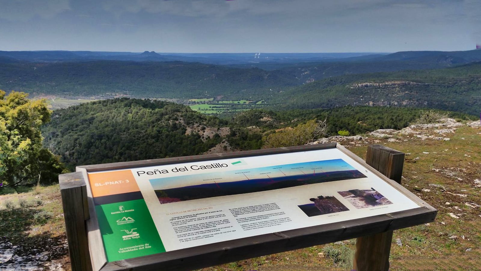
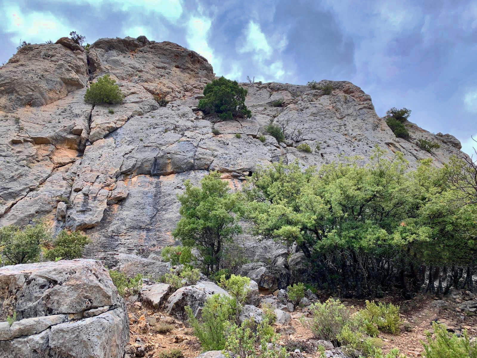
El Alto de Cold Castlesis not a summit, it is a succession of rock masses alternating meadows, lined up one after the other, to end at the highest, which could be called the summit. Between the first two masses of rocks, two hills can be distinguished, one with what appears to be a watchtower and the other is the Puntal de Juan Rana, where the route will take you.
Go around the dense rocky area and take a track that starts to climb. You reach a pine forest until you reach a cairn. Take a path that leads to a point from where you can see the treeless summit of Puntal de Juan Rana. To reach it you have to go down a little and then climb up again through the pines and some rockroses. What you can see now is the area of the Sierra del Tremedal.
The ravine is deep, dotted with rocks and covered with pine trees. To the right, at the bottom, there is a track, the Cañada Real de Merinas. You have to head that way. To do so, go down the slope. On the opposite side there is a well-marked path, which leads to a grassy plain. Take the track that climbs up the hill.
You enter a pine forest where the track splits in two. Once again you start to climb up the branch to the right, and climb up the slope until the pine forest ends, where you can see the smooth summit of Las Neveras.
Cross the plain at the summit and follow the track towards the pine forest, which you enter by taking the fork to the right. Descend down the slope that leads to the Collado de la Nava, from where you can see the valley. Turn right again and enter the ravine that forms the First Streamwhich we follow. Almost at the end, the Arroyo Frío jumps over the stones. Cross the bridge and you are back at the starting point.
Signposting and Start of the Route
Neither the access nor the route of this route of Castillosfríos have any signposting, if it is true that we see some marks along the way but it is not feasible to orientate ourselves with them, so we recommend that you download the track This is the right place not to get lost at any time, as it is a route with a multitude of detours and mountain crossings where it is easy to get lost.
 5")
 6")