Valley of Miracles
A geological journey through time

Valley of Miracles
Dirección
Valley of Miracles
GPS
40.94457143717, -2.2863198540381
Valley of Miracles
This valley was carved out of the limestone, sandstone and slate rocks by the Linares Riveris also a journey into the geological past. Starting with the limestone outcrops resulting from marine sedimentation, we continue through the red sandstone outcrops, originated from the fossilisation of the beds of enormous ancient rivers, where we find the spectacular pinnacles, the result of differential erosion and, finally, we come to the slates originated by the metamorphism of very ancient sedimentary rocks.
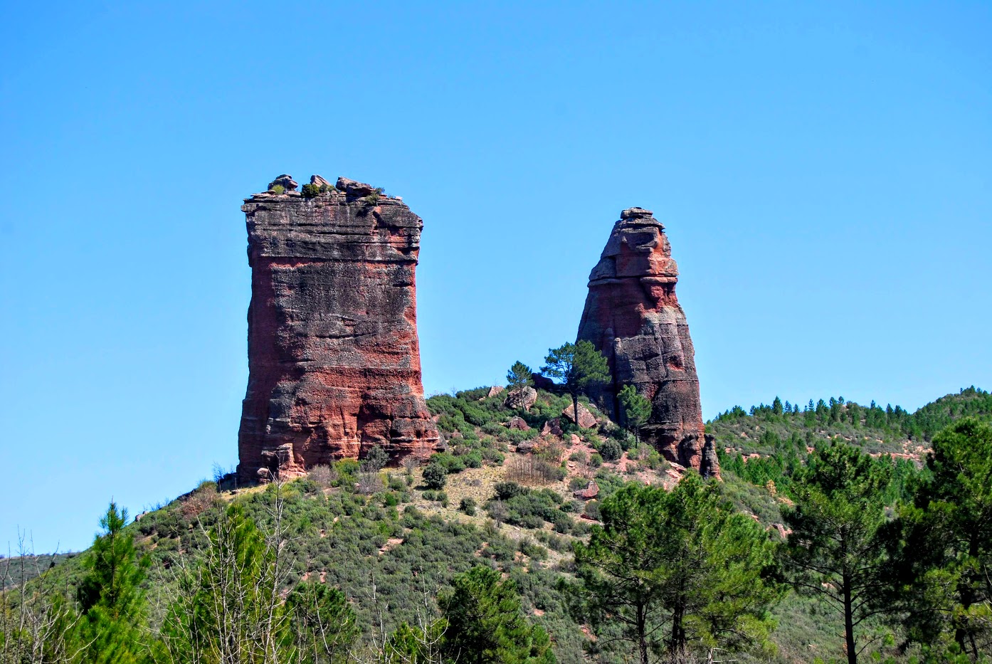
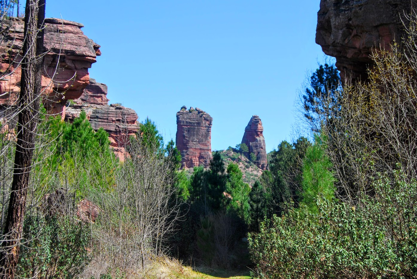
The impressive monoliths that give the valley its name stand out, now a symbol of recovery from the great fire that devastated this enclave in 2005.
Los Milagros form spectacular rock towers that seem to watch over the bottom of the Linares river valley. The reddish rocks that form these large towers are sandstones and conglomerates from the Lower Triassic (Mesozoic) more than 250 million years ago.
They are located on a plain or esplanade that has been crossed by the river Linares just at the foot of the two large rocks called El Puntal del Milagro (the almost cylindrical shape), and Peña Eslabrada (his friend with a more pyramidal or more pointed shape). In the distance, over the mountain and much higher up is the Puntal del Canto Blanco.
These rocks do not have a homogeneous resistance to erosion, but in some places, the quartz grains and cobbles are more strongly cemented, making them more resistant. In addition, these rocks have planes of weakness, due to the stresses received by the rock mass during its geological history. Through these planes, water, ice and roots penetrate easily, eroding the rock.
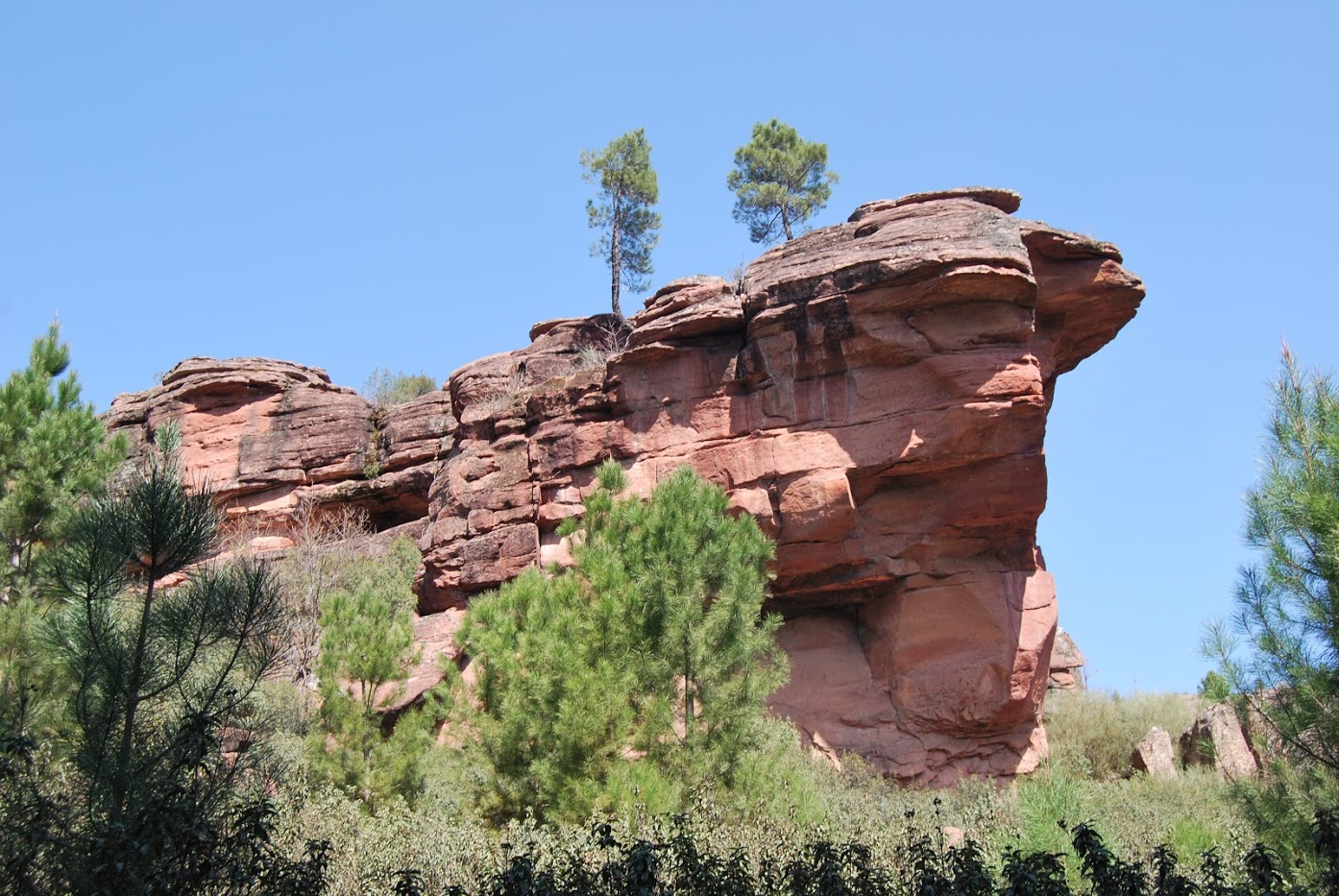

Over time, the cracks become wider and wider until they manage to separate entire blocks of rock, as in the case of the Los Milagros towers, giving rise to whimsical stone shapes. These towers have given their name to this valley known as the Valley of Miracles, which nowadays is sparsely wooded.
This is due to the fact that just a few metres away, on the recreational area of the Cueva de Los Casares, The tragic fire of 2005, which claimed the lives of 11 workers at a roadblock and devastated more than 13,000 hectares of pine, gall oak, sessile oak and yew forests, among others, originated.
One of the problems affecting the regeneration of this area is erosion, caused by the deforestation of the slopes, where you can see structures built with plant remains, called faginas or albarradas, to minimise erosion and favour the regeneration of the forest. Despite this, a visit to this peculiar spot is highly recommended, spectacular for its "miracles" and a symbol of regeneration and overcoming the fire from which it is gradually recovering.
To get to know it in depth, we recommend that you take the official route or the georuta which explains a little more about the curiosities of this valley and its formations.
<< How to get there?
We can get to know the Valle de los Milagros from the towns of Santa María del Espino y Riba de Saélices. From the first one we must look for the square and the church which is in the upper part, towards the east. This is where the path begins. We leave the cemetery on the left and continue along the upper part, descending gently.
From Riba de Salices we can approach with our vehicle to the area located at the foot of the Cave of the Casaresand from here to start the comeback of the Linares River on foot, This route is part of the network of official footpaths in the Alto Tajo Natural Park.

