Puntal del Pancho viewpoint
Views of the Tagus and the Castle of Garabatea

Puntal del Pancho
Dirección
Puntal del Pancho viewpoint
GPS
40.742173677918, -2.08446871159
Puntal del Pancho
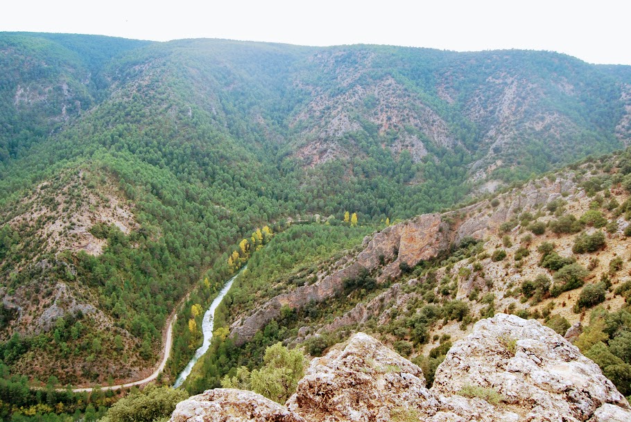
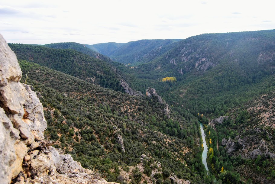
The spot called Puntal del Pancho is not equipped as a viewpoint, as it has no protection, but its location and exposure to the canyon of the Tagus River is in itself a window through which every visitor deserves to look out. From here we can contemplate the immensity of the valley perforated by the river with its turquoise blue waters, the height of its walls and the depth of its ravines, as well as the limestone crag located at the bottom of the valley, called "Garabatea CastleNext to it we will see a beautiful meander. From here on countless occasions we find griffon vultures delighting the observer with their flight.
The best way to get to this place is by taking the route RGPNAT 03 The Tagus viewpoints which departs from the town of Taravilla and goes through several viewpoints on this same limestone rock, but if we are in the village of Lebranconwe can take the track that starts straight ahead from the Elms of SolitudeWe will continue in the direction of the Alto de la Mela and the Tajo ravine until we see the orange signpost corresponding to the route, which will lead us to a path on our right that leads to the viewpoint.

