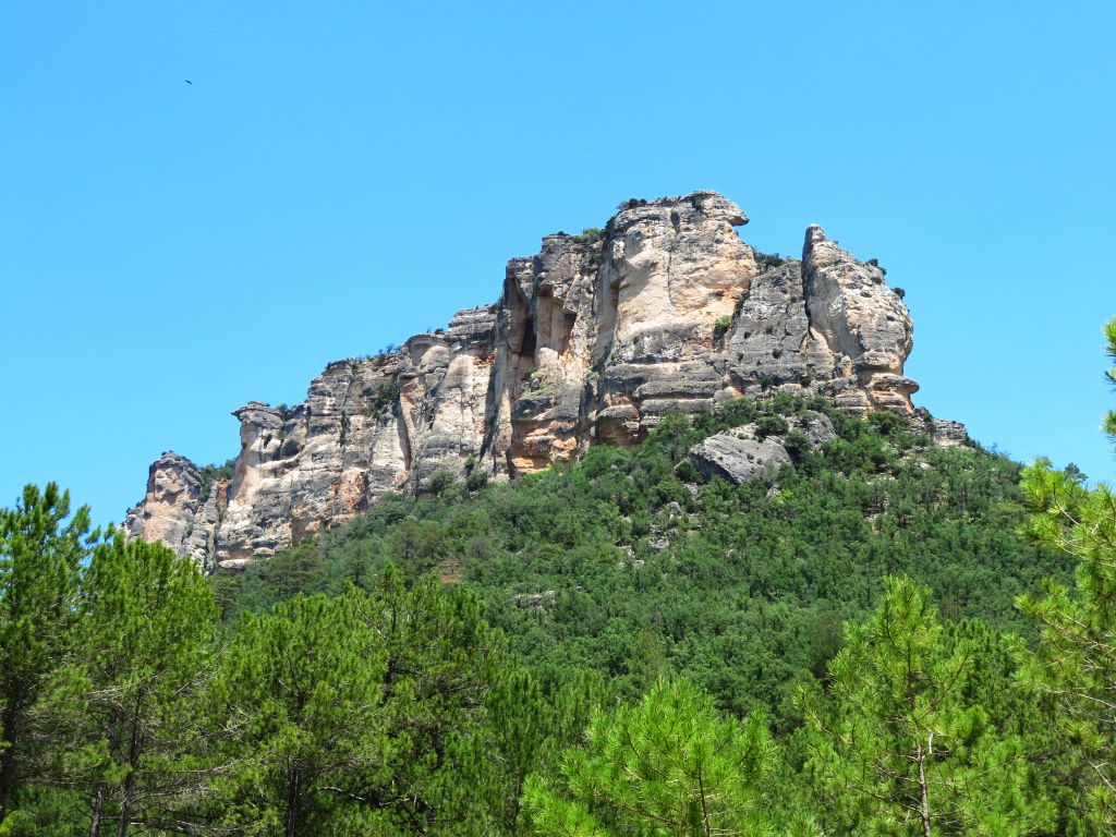
Muela del Conde
Imposing rock face with beautiful rocky escarpments

Muela del Conde escarpments
Dirección
Muela del Conde
GPS
40.662916826245, -1.9897061138288
Muela del Conde
The Muela del Conde, with its 1,454 metres, is one of the most vigorous and spectacular reliefs in the Upper Tagus Natural Park. It is located on the right bank of the Tagus river, in the area around the Taravilla Lagoon and the waterfall of the Poveda waterfallThe mountains, two of the most popular sites in this extraordinary natural area, are rarely visited.
<< Environment
We can easily observe it from the road that connects the towns of Taravilla y Poveda de la SierraThe viewpoint is located on one of the banks of the river, where you can easily park your car. Its solitary and peaceful summit is a refuge for mountain goats, griffon vultures and all kinds of rocky birds, apart from the hustle and bustle of the bathing areas set up next to the river during the summer months.
The cliffs on its western side have several climbing routes, which are subject to the regulation of sporting activities on the Natural Park, which expressly allows climbing in the Agujas de la Muela del Conde "outside the nesting period for birds of prey between 1 January and 15 August". In view of its special geological and cultural values.
In addition, we are located in a very popular spot, being able to link the visit to the Muela del Conde with the Muela del Conde. Taravilla Lagoon or the Poveda waterfall.
<< Curiosities
The "muela del Conde" is named after Count Julián, who, on the occasion of the invasion of Spain by the Arabs, the last of the Visigothic hierarchs, took refuge in these surroundings, in a place that the locals still call "the castle of Don Julián" or the "muela del Conde", situated on a high and almost inaccessible promontory where the river Cabrillas flows into the Tagus.
The fact is that some ruins can still be seen in this enclave, apparently of a Celtiberian castro, later used as a medieval watchtower, with a narrow entrance and the remains of weapons and other military equipment. It is still said that the Count's wife, Doña Frandida or Farandina, was there, and that a daughter of both of them, called Florinda, threw a large quantity of treasures to the bottom of the Taravilla lagoon so that the Moorish invaders would not take advantage of them.
There are also several figures carved into the rock, petroglyphsThe inscriptions are of a more contemporary nature.
<< Recommendations
The muela del conde guarantees a wild adventure excursion. There are no signposts to guide us. If you want to get to know it, follow this brief explanation.
To find the path that leads to the summit, we recommend that you drive your vehicle to the Taravilla Lagoon and, once parked, start your ascent along the dirt track on the left until you reach the Collado Somero. Once here, you should head for the meadow towards the edge of the pine forest, following the paths that have been marked out by the wildlife that inhabits this mountain.
Continuing our ascent between pines and some rocky escarpment we will find a worn zig-zag path that guides us on the final stretch of the ascent along the rocky escarpment where a milestone marks the strategic path.
The extensive plateau of the summit of the Muela del Conde lacks orientation points, so to find its highest point, we must go around the plateau in a counter-clockwise direction, as close as possible to its external north-western edge, occasionally looking northwards, where we can see the view of Cabeza Machorra at 1426 metres, until we come to a small fence of crumbling stones that indicates the highest point of the Muela del Conde.
The descent will follow the same route used on the way up, carefully and enjoying the surroundings, and in about two hours we will be back by the lagoon.


