La Hoz Ravine
One of the jewels of the park and a must-see.

Dirección
Suction cup
GPS
40.829413217154, -1.9994774491774
La Hoz Ravine
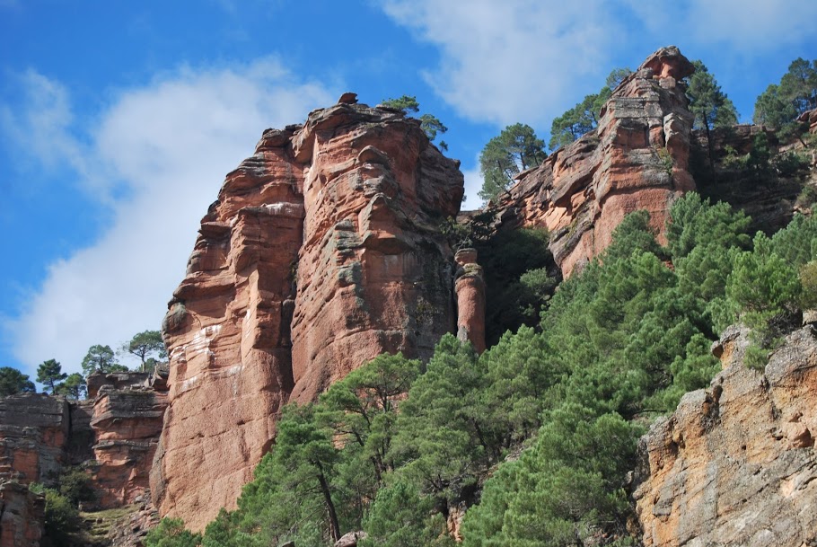
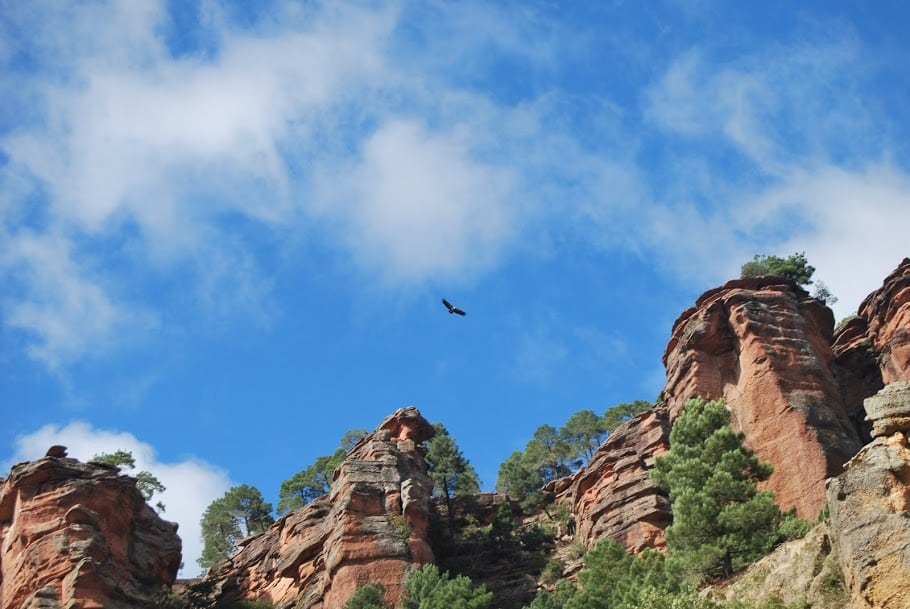
The Barranco de la Hoz is undoubtedly one of the most emblematic landscapes of the Alto Tajo Natural Park. It is a canyon delimited by reddish cliffs with a drop of several hundred metres and is one of the most important tourist attractions in the province. On the sandstone and conglomerate walls erosion has carved out whimsical shapes among which some of the most outstanding ones are torms such as The Spindle. The curious morphologies, together with the wide botanical variety, complete a chromatic diversity that evolves throughout the seasons, offering a natural environment of great beauty.
When you come to visit the Virgen de la Hoz For the first time you are amazed when you reach the entrance to the gorge and see the reddish rock formations. As you drive further along the road and follow the course of the Gallo river The water has carved its way through the formidable rocks, making its way through the abrupt nature of the landscape.
Contemplating the "Spindle". a thin, pointed rock, we approached the hermitage of the VirginOn arrival, we are once again surprised by the "DistaffThe "huge rock that rises in front of the Sanctuary and above all, we are struck by the enclave of the Casa de la Hoz The rock is located in the same rock under a large formation of sandstone and conglomerate rocks that tell us about the millenary past of this land. We enter the square and raise our eyes to a stone that looks dangerous because it is more visible than the others and which the locals call the "...".Cover".
In its spectacular cliffs we find stratigraphic outcrops of exceptional quality that serve to reconstruct the climate and conditions of the Earth around 250 million years. For this reason, this place is one of the Spanish Geosites, i.e. those places in Spain with a geological interest of worldwide relevance. In addition, these escarpments are a refuge for birds of prey that can easily be spotted flying over the area.
On the other hand, its approximately east-west orientation favours different microclimatic conditions on its two banks, which, together with the abundance of water, increases the number of species that find their habitat on its steep slopes. Some, such as the Delphinium fissum, represent one of the last populations of a relict botanical species in serious danger of extinction.
<< What to do?
In the surroundings of the ravine there are several possibilities to discover all these corners. Route 1 of the Natural Park runs through the Barranco de la Hoz ravine and connects with the San Pedro´s Bridge and the Montesinos Hermitage over a distance of 37 kilometres. The georuta 5connects us with Cuevas Labradas where we can see its spectacular folds. And the picnic areas along the banks of the river Gallo invite us to simply stroll in peace and quiet or rest in the cool shadows.
<< How to get there?
It is perfectly signposted, as it is one of the jewels of the park and is located on the road that connects the towns of Corduente y ToreteIt is impossible to get lost. You can park in several car parks along the road, each with its own parking area. area and the sanctuary, have one.

