Arandilla Ravine Route
An incredible walk along the Arandilla ravine

Arandilla ravine route
Dirección
Start at Carretera de Cobeta
GPS
40.866507745275, -2.113759894399
Round trip 6 Km | Unevenness 120 m | Duration 2 h | Route On foot - Bike
Arandilla Ravine Route
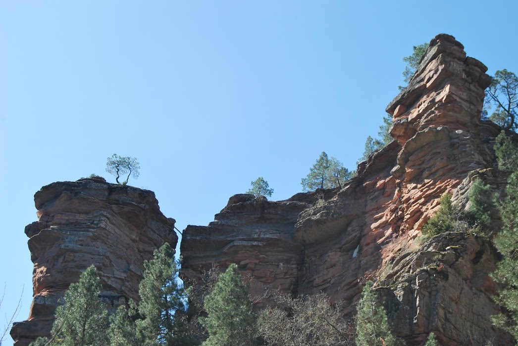
The route of the Arandilla ravine is one of the most picturesque routes in the Molina-Alto Tajo Natural Park and Geopark. The Arandilla river, in its middle section, has carved a spectacular picture, forming a beautiful canyon in sandstones and red conglomerates from the Triassic that has nothing to envy to its first cousin, the great Barranco de la Hoz. The variety of shapes sculpted by the effect of the water in the canyon and the spectacular nature of its walls give this beautiful place a special touch.
This is a nice and flat 6-kilometre walk parallel to the river bank. The path starts next to the road, at the beginning of the path, just before the bridge, where there is space for one or two vehicles. Once parked, we only have to go up the Arandilla riverbed on its right bank.
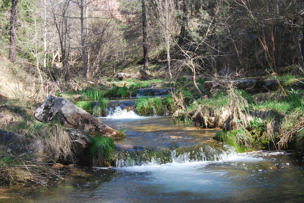
We will see a nice and clean river full of life in which it is bathing prohibited, that irrigates rich lands that many neighbours have been using for their vegetable gardens since ancient times, a fact that becomes clear when you see the number of shelters and lairages The shepherds' huts located on the sunny side of the ravine, which used to provide shelter for the livestock that moved through this area.
We also share a path with the Georuta 3which departs from CobetaThe route is a great opportunity to follow the stops along the way and find out a little more about the curiosities and how this marvel was created.
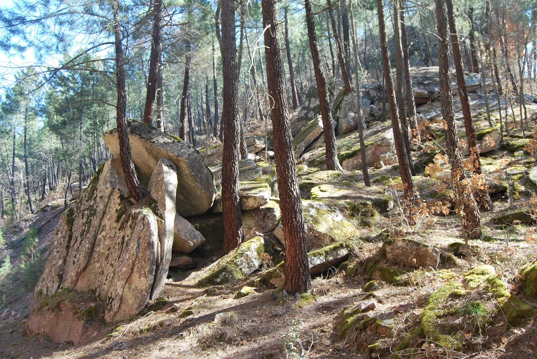
We will see a chaos of blocksWe will witness the abrupt changes that the terrain has undergone, and we will also contemplate the curious hanging river valleywhich is in front of the hermitage. This type of valley is characterised by the fact that it flows into the main valley many metres above it, giving rise to an escarpment or even a waterfall. They are a reflection of the former level of the river, which progressively became more and more boxed in, leaving its tributaries hanging over the main riverbed.
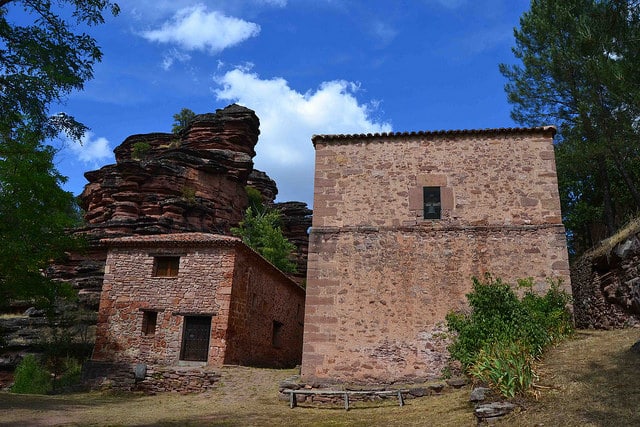
After about 2 kilometres of walking we will reach the road to the hermitage of the Virgin of Montesinos, It is here where, if we wish, we can cross the river over a wooden log bridge and continue between the canyon walls and the river itself until we reach another bridge, but not before contemplating the track of a old signposted waterfall Once here we can continue a few more metres and visit the last stop on the georoute, which is the old building of the millThe site is a perfect example of man's ancient uses of natural resources.


This mill harnessed the energy of the water flow to transform it into mechanical energy. The mill's operating mechanism was very simple. By means of a small dam upstream, part of the river flow was stored and channelled through a channel, in many cases carved in the rock, to a pool or bucket. This channel had very little slope, less than that of the river, as the aim was to create a waterfall. When the sluice gate at the bottom of the pool was opened, the water came out at great speed, moving the mill's blades.
At first, the mill was a flour mill, but later a dynamo was installed to produce electricity for the villages in the area. Torremocha and Arangoncillo and the village of Arandilla. The presence of mills in the river courses of the region is a common occurrence, in fact, this could be the origin of the name of the locality of Molina de Aragón. Practically every village had one or several mills in its municipal district, some of them in remote and difficult to access places, so the miller used to spend long periods of time in his mill, which he used as a residence.
Finally, it should be noted that this route of the Arandilla ravine is in one of the purest and most preserved places of the Molina-Alto Tajo Natural Park and Geopark and also represents an ideal place for the nesting of rupicolous raptors as the Egyptian vulturethe peregrine falcon or the griffon vulturewhich look out from their ledges. If you wish to do this route, remember that in places like this it is very important to keep the peace and respect the environment, making our presence almost imperceptible to the animals that make this beautiful Barranco del Arandilla their home.
Signposting and Start of the Route
The access to the beginning of the Arandilla ravine route is in the surroundings of the GU-951, at the point where it crosses the river Arandilla. If we access from CobetaBefore crossing the bridge on the left hand side there is a small area with room for two or three cars where we can leave our vehicle, from here the path is straight on parallel to the river, next to the right bank, we will find the dirt track just after crossing the bridge.

