SL PNAT 1 El Rodenal (Corduente)
9 km circular from the C.I. of Corduente to the Barranco de la Hoz.
El Rodenal Path
Dirección
Start and finish at the Corduente Interpretation Centre.
GPS
40.852107273182, -1.9983021453897
Circular 9 Km | 9 Km | 9 Km | 9 Km | 9 Km | 9 Km | 9 Km | 9 Km | 9 Km Unevenness 203 m | Duration 3 h | Route On foot
Local Trail 1: El Rodenal
This is a circular route of 8.5 kilometres between the Sanctuary of the Virgen de la Hozthe monument to the Foresterthe swimming pool of Corduente and the Dehesa de Corduente Interpretation Centre.
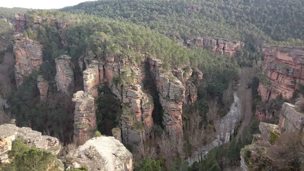
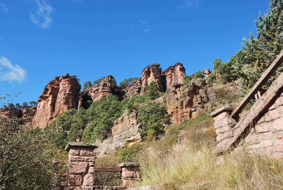
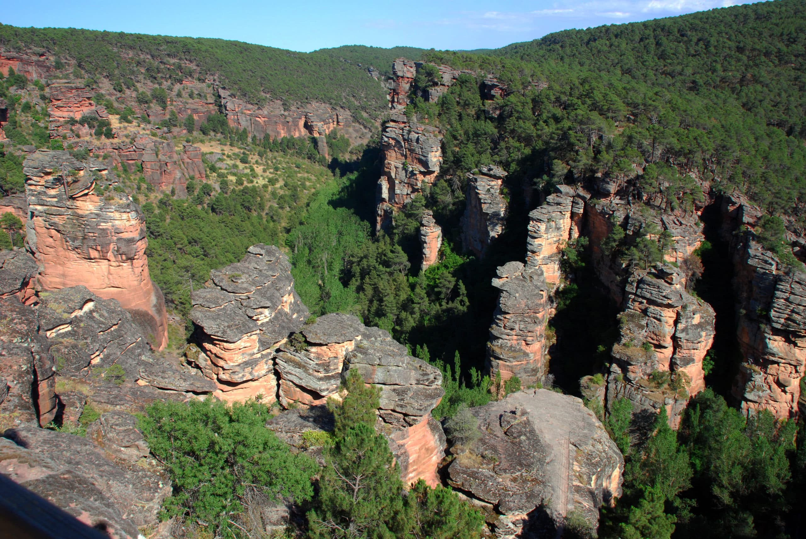
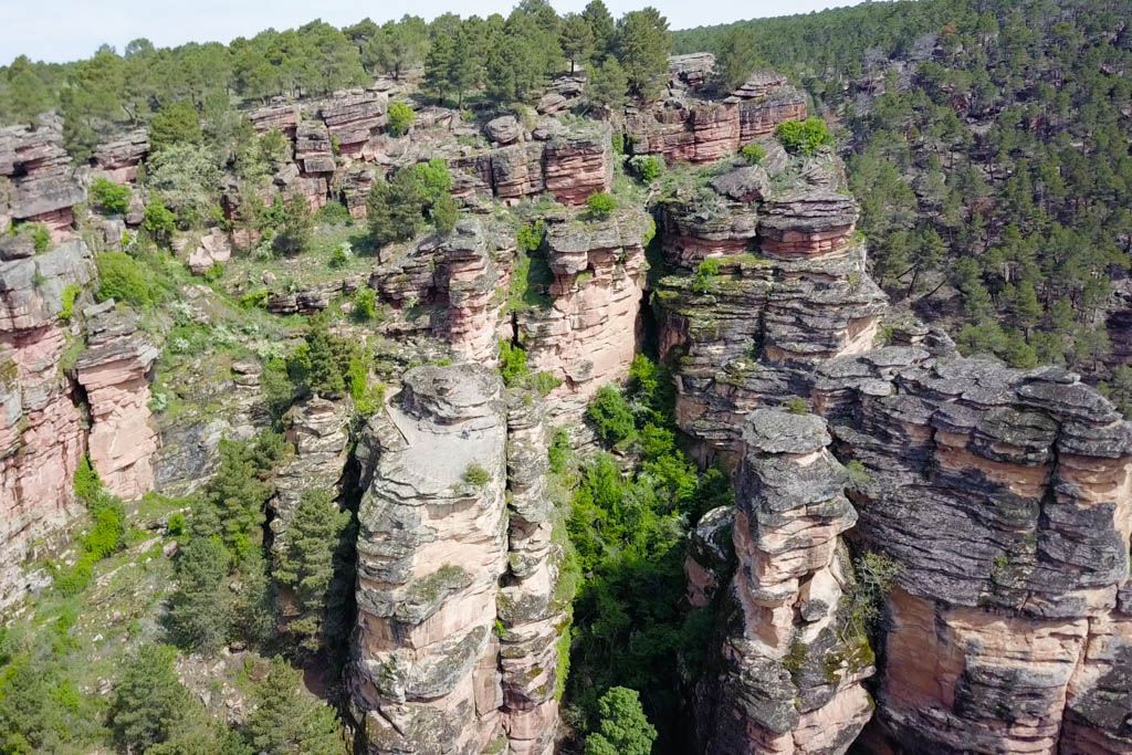
It leads us in a simple way to one of the essential places in your visit to the Alto Tajo, the well-known Barranco de la Virgen de la Hoz, a spectacular red canyon that always leaves us speechless when we visit it.
We also enjoy the company of the Gallo river, responsible for the modelling of this spectacular landscape where we find a great variety of elements with a high geomorphological value.
It is a path where you can enjoy plant formations, a great diversity of species of flora and fauna, and landscapes that have been little or nothing shaped by the hand of man, except for the examples of activities such as resin production that can be seen around these forests.
It can be started either in the car park of the La Dehesa de Corduente Interpretation Centre (recommended) or from the Virgin of the SickleIt is signposted by posts with painted arrows. It is advisable to walk in the direction of the signs, as there is a certain danger of getting lost if you walk in the opposite direction.
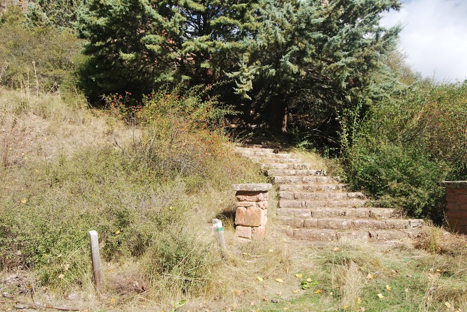
Children will have a good time, as it is a path for the whole family. Even so, it is not suitable for bicycles or wheelchairs because of the stretch that goes down from the viewpoints to the Sanctuary of the Virgen de la Hoz, as we practically descend a staircase carved into the sandstone rock that forms the ravine.
<< Signposting and Start of the Route
The route begins on the track next to the car park of the Interpretation Centre of the Dehesa de Corduente.
A 700 m We leave the track to the right and take a path that goes through the pine forest, the rodenal, mixed with oaks, oaks and steppe rockrose, going up the watercourse until we rejoin the track. There is an information panel on resin extraction.
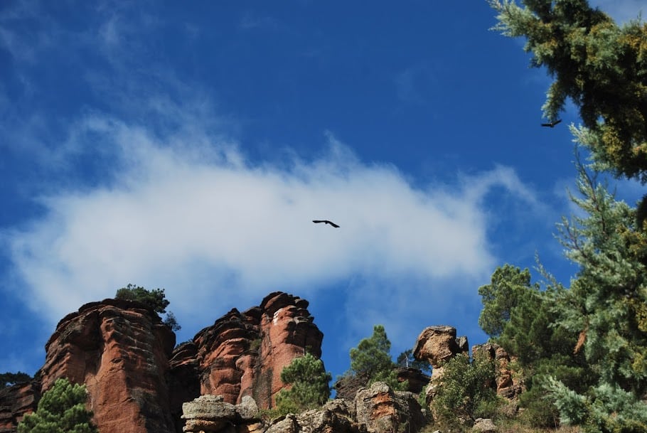
A 1 km Once back on the track and as we continue through the pine forest, we will pass crossroads and forks in the paths on both sides of it. One kilometre after returning to this track, you will pass the turn-off to the La Colmena campsite. If we are lucky, we will be able to observe the flight of some birds of prey such as the short-toed eagle or the goshawk or discover traces of small carnivores such as the fox or the marten or herbivores such as the deer and the roe deer.
A 3 km the track ends at the La Hoz viewpoint over the canyon that the Gallo river has opened in the reddish sandstone and conglomerates of the rodeno on its way through the Virgen de la Hoz. An information panel tells us about the natural characteristics of this unique spot. We descend along the narrow path that leads to the sanctuary, equipped with different plaques and interpretive points on geology.
A 3.5 kmWe leave the road next to the sanctuary of the Virgen de la Hoz in the Vega del Gallo and continue upstream along the asphalt for 1.5 km, seeing the gallery forest made up of sargas, poplars, ash trees and reeds.
A 5 kmWe arrived at Monument to the Forester and geological interpretation point. Above it we cross a grassy meadow for 150 m to connect with the old path that ascends towards the pine forest through bare, grainy terrain until it ends at a forest track.
A 5.5 kmAfter a slight descent we turn left and after leaving the pine forest and entering an agricultural area we leave a turning on the left.
A 6.7 km: We arrived at the swimming pool of CorduenteFrom here we take the track on the left, which in a little over a kilometre and a half will take us to the road.
A 8.4 km: We go out on the road to Corduente–Zaorejas after crossing the bed of a small stream. Only 300 m of asphalt separate us to return to the starting point at the interpretation centre.
This is one of the best known routes in the Natural Park and Geopark as it represents a perfect visit to one of the most iconic enclaves. A spectacular reddish canyon continuously bathed by the abundant waters of the turbulent Gallo river. If you haven't visited it yet, don't miss it in your backpack on your next visit.
In case you want to do this route without any problem, here is a link to the track to unload and enjoy a beautiful and peaceful day in the mountains, walking through one of the most amazing landscapes of the whole region. Finally, this route currently belongs to the official footpaths of the Alto Tajo, and is the only one of its kind in the region. number 8.
 8")
 9")