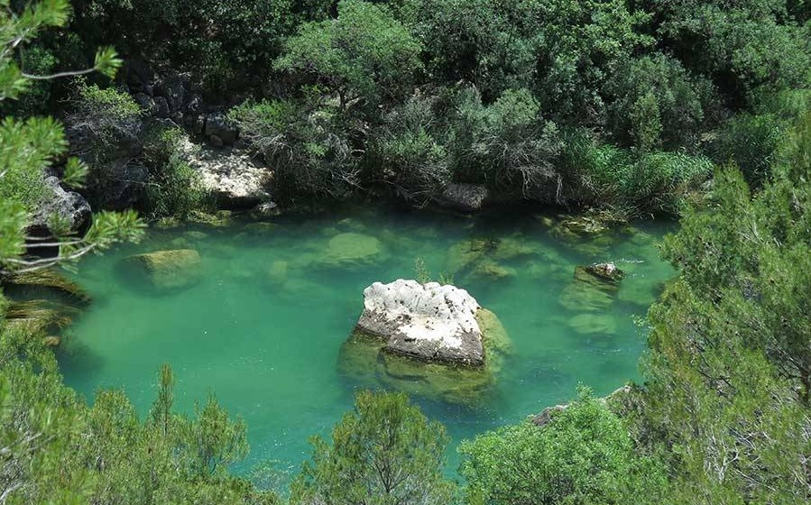
Georuta 1: Ocentejo-Hundido de Armallones
Inside the canyon

Georuta 1: Ocentejo-Hundido de Armallones
Dirección
Ocentejo
GPS
40.7727457, -2.3967913
Round trip 8 Km | Unevenness 200 m | Duration 3 h | Route On foot - MTB
Georuta 1: Ocentejo-Hundido de Armallones
Georuta 1, starts in the town of Ocentejonext to the information booth located on the road. It goes into the canyon of the Tagus River, in the area of the "Hundido de Armallones" (Armallones Sinking)one of the most spectacular sites in the park.
In this place we can see the constancy and the work carried out over the years by the Tagus River, in terms of the erosion of its landscapes.
Here we can see the result of deep canyons where numerous rupicolous birds currently live, among them the Bonelli's eagle, which is very protected and conserved in places of such importance as this one.
It has a length of 8 km between the outward and returnIt takes about 3 hours on foot, and by bicycle the time is reduced by half. Although if we want we can lengthen the path to the 13 kilometres (round trip) to visit the Salinas de la InesperadaThe path along which, in the rainy season, we can see the Eyes of the Carchemitetwo waterfalls gushing out of a cave.
This option will only be available from 15 June to 1 February as access is prohibited due to the nesting season for birds of prey.
The maximum difference in altitude is 100 metres, but the accumulated difference in altitude with the outward and return trip totals around 200 metres. It is not hard, but we must not forget to be well equipped and have enough water.
In addition, this area is of exceptional botanical value, as it is home to species of flora of distribution ibero-north african, eurosiberian y mediterraneaThe canyon of the Tagus as a place of passage of flora from the north, south and east, and its role as a refuge, due to the special microclimate it enjoys, for some species.
In terms of fauna, the most outstanding species are the rupicolous birds of prey such as the Bonelli's eagle, Egyptian vulture, griffon vulture or peregrine falcon, as well as forest birds of prey such as the goshawk or sparrowhawk, which find the ideal place to nest on these rocky walls.
Signposting and Start of the Route
<< Stop 1: The route starts in the village of Ocentejo. It is necessary to park here as the road up to the Hundido de Armallones, The entrance of motor vehicles is restricted. From the village we will take the track where we will find the sign for the start of this route, which is easy to see just behind the last houses in the village.
<< Stop 2: After walking about 500 metres along the dirt track, we see a plaque next to the path, located next to an old orchard, which explains a landscape dominated by the structure adopted by the rocks, visible on the mountain in front of us, the result of the union of a folding and subsequent erosion process.
<< Stop 3: We continue descending towards the river, until we come to the road that prevents cars from passing. You will see that if you have taken yours, it is not a good place to park, and you have done well leaving it in Ocentejo.
Once here, a sign invites us to look towards the rocky walls in front of us. We will be able to see a large fold formed during the Alpine orogenyIt was later split in two by the erosive forces of the Tagus River, which has been mainly responsible for the modelling of these landscapes.
<< Stop 4: We continue our way steadily downhill until we see a sign on the rocky wall to our left, here if we look up we will see that we are at the foot of a stone waterfall. A phenomenon that is very much present in the Upper Taj Natural ParkoThe most important features are water emergences and the formation of tuffs or travertines.
In this case the waterfall is a simple reflection of ancient streams. Nowadays we can only see the path along which they flowed, although it looks like it is still flowing, it is only a rock waterfall.
<< Stop 5: As we continue along the track we come to a small sign explaining why these huge blocks of rock are in the riverbed and scattered on the opposite slope. If you pay attention, with the help of the sign you can locate the exact place where they came from at the top of the canyon walls.
<< Stop 6: Looking for our last stop we continue along the track descending little by little until we reach the height of the river, if we continue advancing we will see that to our left there is a large rocky wall of large blocks marked with the last of the plaques of the route.
Here we will see the effects of folding produced during the Alpine orogeny, if we go back a few metres to gain perspective, we will see how the rocks, which were initially folded, ended up fracturing, giving rise to an "failed fold".
We can see that the path continues even though the route of georoute 1 ends here. It is possible to continue further and discover other of the most beautiful corners of this area such as the junctions with the river Ablanquejo, but you must remember that between the 1 February and 15 June, access is restricted and we will not be able to continue here even on foot.
