RG PNAT 4 La Muela
Route that crosses the muela of Utiel with a visit to the viewpoints of the Tagus.

The molar of Utiel
Dirección
Home in Huerta del Forestal or near Peralejos
GPS
40.618952553625, -1.9035631857752
Only Ida 24 Km | 24 Km | 24 Km | 24 Km | 24 Km | 24 Km | 24 Km | 24 Km | 24 Km Unevenness 500 m | Duration 4 h | Route On foot - Bike
General Route 4: La Muela
The route of the muela is a route that can be done both by car and on foot. bicycle as in off-road vehicles. Being linearhas a distance of 24 kmbut, in case we want to come back, making it, a route circularwe would travel 35 kmThe return trip is shorter as we do not have access to the viewpoints. The outward journey was completed in 6 hoursIf it is to be returned, in the event of a return, being of 11 kilometres The path to retrace, it would take us only a few minutes to walk them.
In addition, this path has now been incorporated as an official route of the Upper Tagus for cycling, which has been given the number 3.
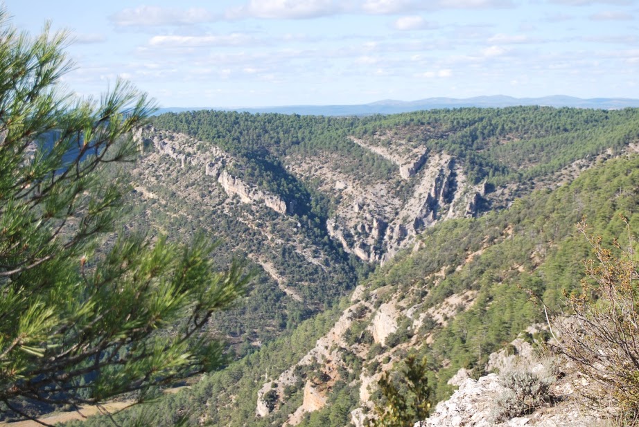
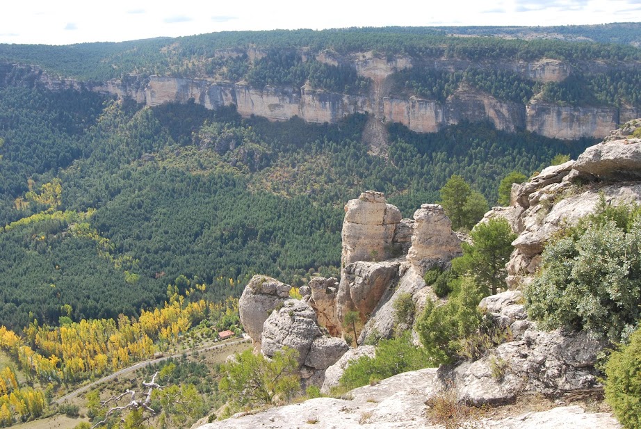
The trail runs through a dense forest on a limestone plateau, the Muela de Utiél, which runs between the villages of Taravilla and Peralejos de las Truchas. This is another of those solitary places where the silence, peace and tranquillity together with the impressive views of the canyon make our route an ideal plan.
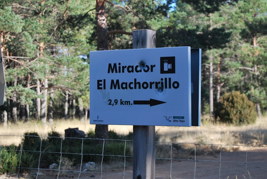
Shortly after the start of the trail, basically once we have climbed steeply and steadily up to the plateau, we will turn off, as indicated, to the first of the viewpoints, to the Machorrillo viewpointfrom where we will enjoy a beautiful panoramic view of the Tagus river canyonthe Muela del Conde and the Taravilla Lagoon, and can intuit the location of the Poveda waterfall.
In our opinion, this is one of the best and most beautiful viewpoints in the whole of the Alto Tajo, as it offers incredible views from an angle we are not used to.
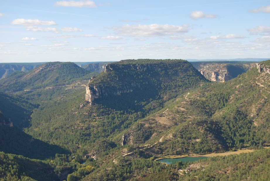
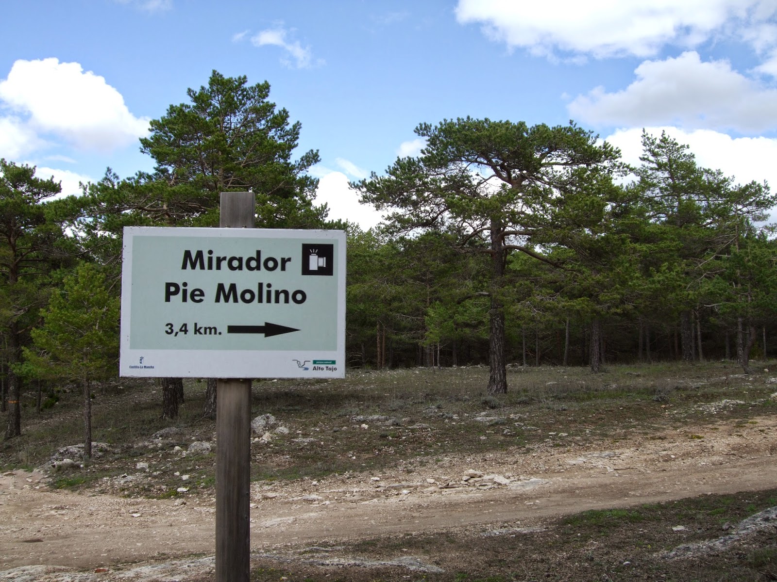
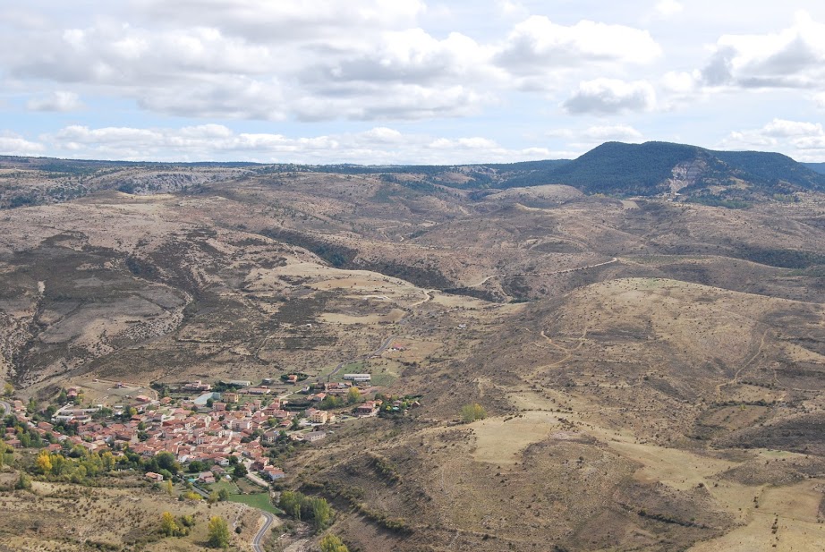
Once we have returned to the main track that leads us through this leafy mountain range, we reach the turn-off to the viewpoint of the Mill foot. From it, we enjoy beautiful views from the heights of the town of Peralejos de las Trucha, located next to the Tagus riverbed in one of the most visited places in the Upper Tagus. In addition, in the background stand out the spectacular Altos de la Campanaand to our right, on the other side of the river, the shady areas of Belvalle.
Another incentive of these bicycle tours is that we ride through areas where it is very easy to enjoy the sight of fallow deer or deer among other mammals, although we can also observe all kinds of small forest birds. great tit, coal tit, coal tit, blue tit or blue tit.
Moreover, we can assure you that from the viewpoints, at the right time of the day, you will enjoy the view of the flight of golden eagles, peregrine falcons, griffon vultures or Egyptian vultures. So we can say that this is an ideal route for the practice of birding or birdwatchingwhere birdwatchers will get that precious photo they are longing for.
Let's not forget that along this route there is nowhere to get waterThe route, even without great effort, can be difficult due to the exposure of the main track along which we walk, as there is no continuous shade during the peak hours of the day.
<< How to get there?
To access the route according to the official meaningwe must approach the Huerta del Forestal recreational area from TaravillaThe route is a linear route, which starts and ends very close to two towns, so it makes no difference which way you go. In any case, it is a linear route, whose beginning and end are very close to two towns, so it makes no difference which way you go.
In case you want to do the route in opposite directionstarting from Peralejoswe have to take the road that goes to Molina de Aragónand a few kilometres further on, you will come to an left turn of our road, signposted both by the grey markers corresponding to our path, and by the sign at the start of the trail. local trail 6 La muela, of Peralejos de las Truchas.
In our opinion, we recommend that the direction of the route be the same as indicated on the starting panel, as the path, in its initial part, climbs steeply up a path in very bad condition, and we will be more careful if we are going up and not going down. Once at the top of the muela, there are no more difficulties and we will walk along a path with its ups and downs, but always without unevenness as we will be in the highest and flattest part of the Muela de Utiél.
Signposting and Start of the Route
Like all routes of this type, it has a information panel located in the car park of the Huerta del Forestal Recreational AreaThe trail is marked with a brief description and the characteristics of the trail, which is also marked with markers. grey paint which are not very noticeable. In order to be able to follow the route without any problems, we recommend downloading the track a little further down, as there is no clear signposting, much less along the whole route, and it can be confused with other paths with which we share the route.

