Route from Ventosa to the Barranco de la Hoz ravine
An alternative way to visit the Barranco de la Hoz from Ventosa

Ventosa to Barranco de la Hoz
Dirección
Home in Ventosa
GPS
40.81987403516, -1.9640489379178
Round trip 9 Km | 9 Km | 9 Km | 9 Km | 9 Km | 9 Km | 9 Km | 9 Km | 9 Km Unevenness 275 m | Duration 2 h | Route On foot - Bike
Route from Ventosa to the Barranco de la Hoz ravine
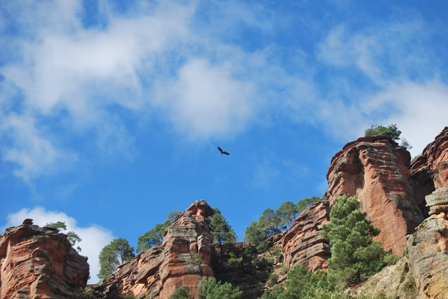
The route of Suction cup to the Barranco de la Hoz ravine is a surprising route, along which we will drive along tracks and paths to get closer to one of the wonders of the world. Natural Park and Geopark of Molina-Alto Tajo from a totally different point than usual. It is a route of 9.5 kilometres circularHowever, once at the top of the ravine, and always with care, we can walk around these impressive rocky forms as far as we like, as the ravine ends at the mouth of the Gallo river with the Tagus.
As for the route, we start from Suction cup down the road to its neighbour TerolejaOn leaving the town on the right hand side you will find the road you need to take. If you are travelling by car you can park in this area, or in the town itself, these roads are not very busy and the turn-off is very close by.
We continue ascending through a dense forest until we come to a crossroads, then we turn off to the left and begin to descend little by little, amidst abundant vegetation. We simply continue on our way, except for the detours we make to look out over the various formations, remembering that our safety comes first and we must take extreme precautions when walking along the edge of a ravine.
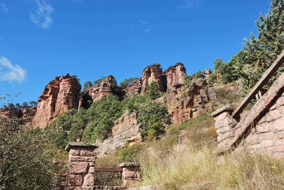
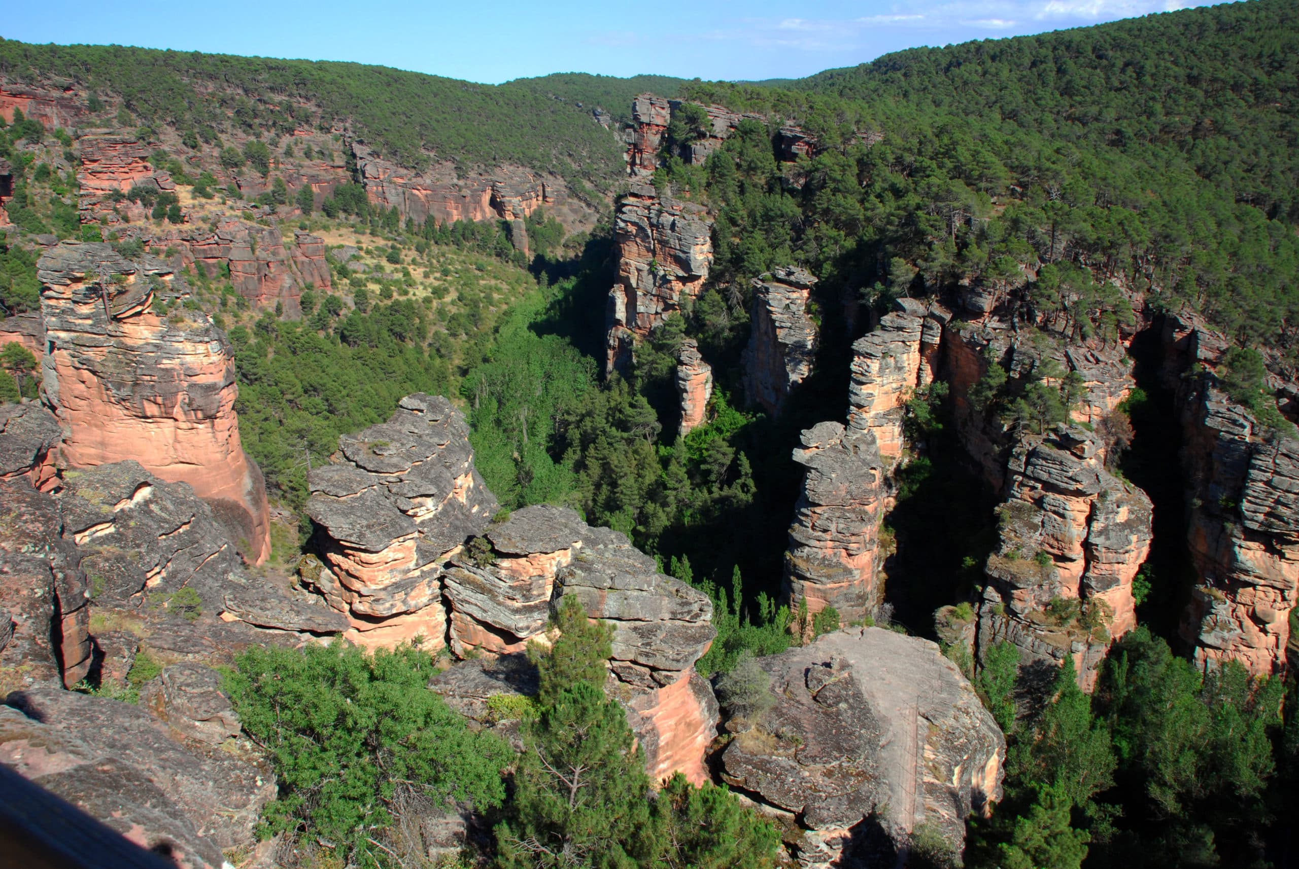
This route is not signposted or buoyed. Although in this particular case, there is no way to get lost. It is necessary to pay special attention to wear good footwear as there are sections where you literally have to jump between large rocks.
<< How to get there?
To access the route, as we have already said, you just have to go to the town of Ventosa and take the track that comes out next to the road that joins it with Teroleja, around kilometre 1 on the right hand side (if you are coming from Ventosa). From here we can start our route from Ventosa to the Barranco de la Hoz.
Signposting and Start of the Route
This route is not signposted or signposted. However, in this particular case, as it is a walk through a canyon that ends at the confluence of the rivers Tajo and Gallo and there is no detour of any kind, there is no way to get lost. Special attention must be paid to wearing good footwear as there are stretches where you literally have to jump over large rocks.

