Route along the Hoz Seca Joints
An incredible route not to be missed
Juntas del Hoz Seca Route
Dirección
Start a few km from Peralejos
GPS
40.541067787405, -1.8811047697444
Circular 8,6 Km | 8,6 Km | 8,6 Km | 8,6 Km | 8,6 Km | 8,6 Km Unevenness 270 m | Duration 3 h | Route On foot
Route along the Hoz Seca Joints
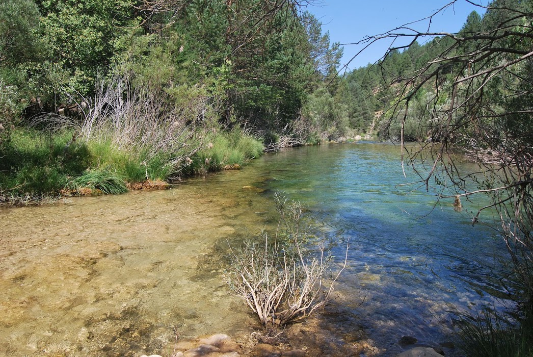
The Hoz Seca river is one of the main tributaries of the Tagus in its upper course. This route is a journey circular from 8.6 kilometresThe river runs along its final stretch, where we can delight in the observation of its cold turquoise waters. The route is beautiful, wild and uncrowded as it runs through an area far away from the towns in the park. The route is uncomplicated, although once you reach the river bank, there is no defined path and you have to look for a way through.
To find the starting point of the route you have to go as far as Peralejos de las Truchas and take a dirt track that leaves from the right side of the pelota court located in the upper part of the village. The track ascends, arrives at a crossroads where it forks and we will continue on the left turn (on the right we would arrive at the car park from where you can visit the Molino de Arriba waterfall).
We will see that we leave the municipal rubbish dump on our left and continue along the main track. From this point on, it is a matter of following the track for a few minutes. several kilometres direction towards the Ribagorda Chapelin the middle of a magnificent esplanade.
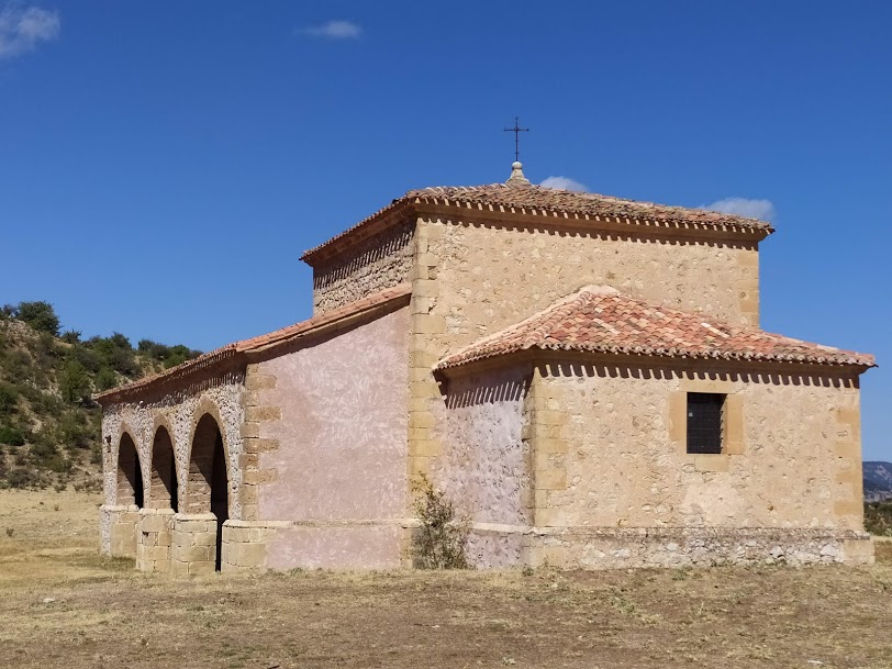
After an obligatory visit to the hermitage and its poplar treeIf you are not there, you will still have to walk a good distance, about 3 kilometres, to get to the start of the trail where we start to walk. We will recognise this point because on our right there is a path that does not look too bad (and then it is) that leads to an area of old livestock pens. We parked the vehicle in these corrals and began our route along the Hoz Seca joints.
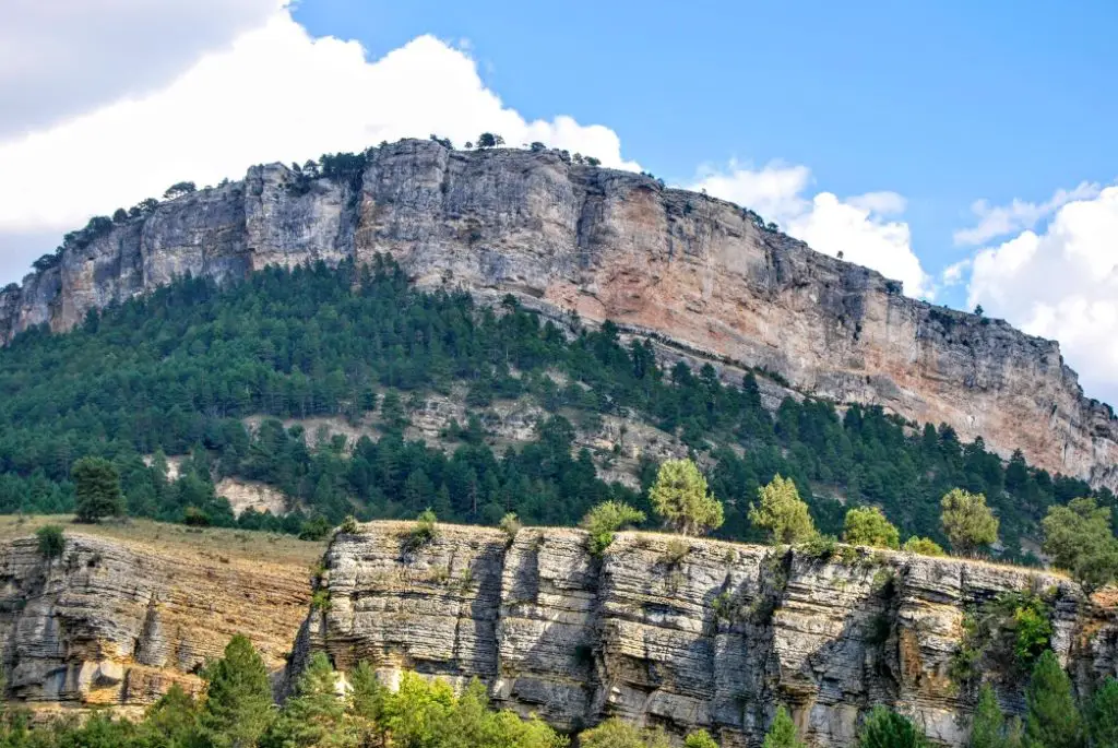
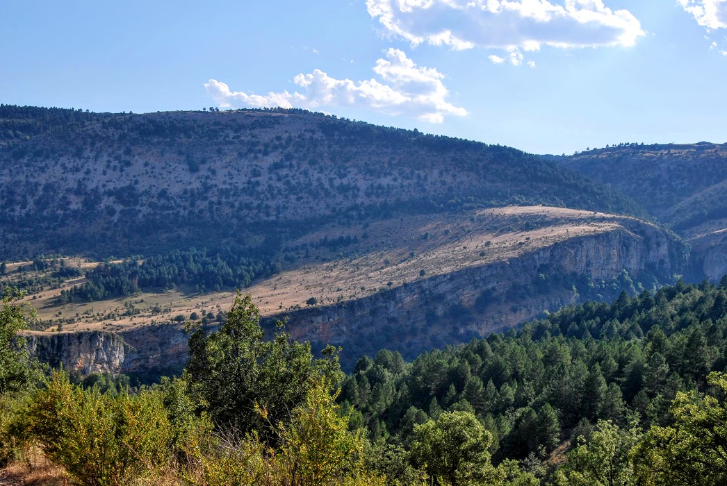
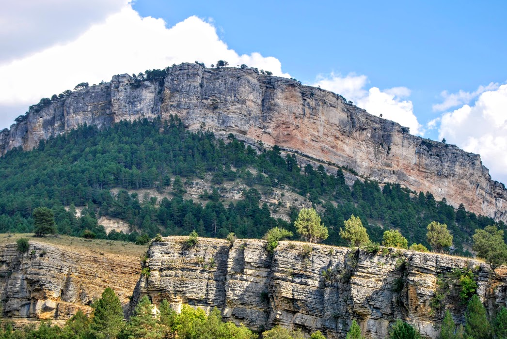
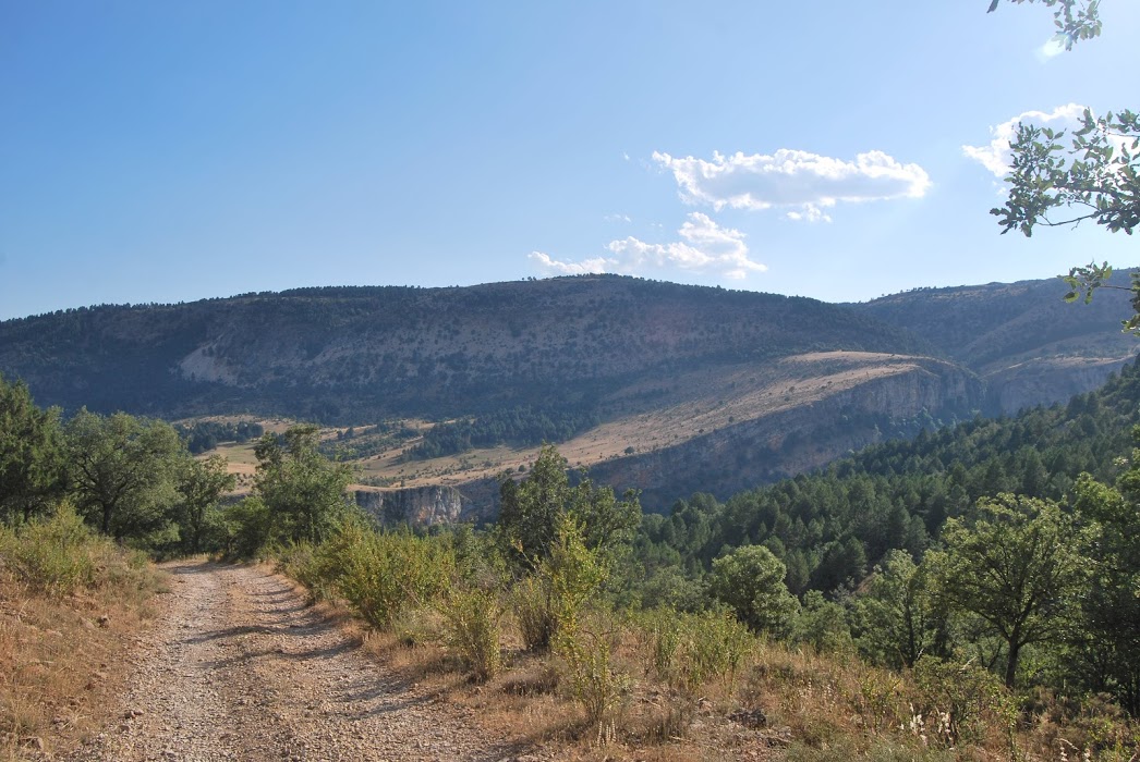
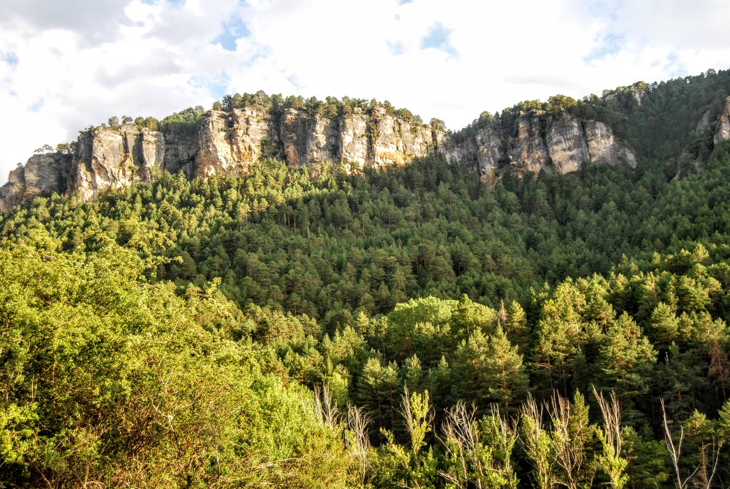
We start our walk down a path that gradually gets narrower and narrower as we enjoy the view of the mountains. canyons formed by the Tagus and the Hoz Dry from above. Just in front of us the Hoz Seca, to our right the vertical walls of the river Tajo, and behind them, Cuenca.
After about 2 kilometres we will reach the river, we will see a small esplanade from which two paths lead off, in our case we take the one on the left and continue until we reach the power station, if we take the one on the right we will have to ford the river and reach the power station from the opposite bank, we can then visit the curious confluence of this mighty river with the still meagre Tagus.
It is from here that the stretch gets more complicated The path is doubtful because there is no apparent track and we will have to look for the small paths dug out by roe deer and wild boar.
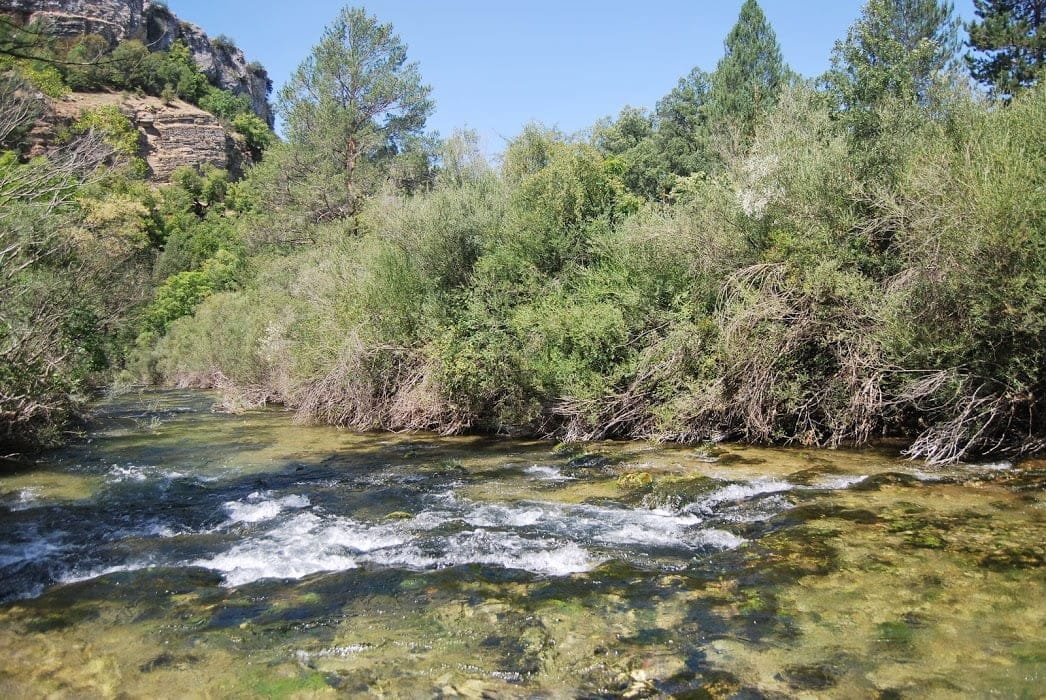
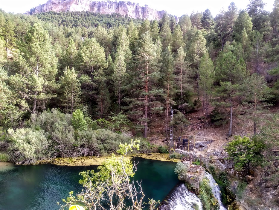
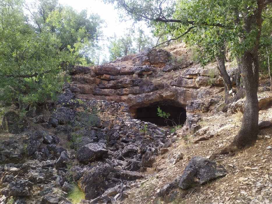
In any case, if we walk slowly and without haste, there are hardly any difficulties. We will always go parallel to the river, at no time should we lose sight of it on our right, so it is simply to continue as straight as possible until we reach the next stop, the impressive constructed waterfall for the hydroelectric power station and which today splits the waters of the Hoz Seca in two (although its demolition is imminent as a project to recover the original course of the river).
The water that is dammed upstream of the waterfall makes a great swimming pool where some dare to take a dip during the hot season, although simply observing its turquoise waters we can be surprised by the amount of life that this great river holds.
From this point onwards, a wild landscapethe river has washed away all kinds of logs and some stand straight in the same watercourse. In some places the water forms pools greenish tones, the riverside vegetation is abundant, very dense and we have good, cool shade. It's amazing, the truth is that landscapes this natural and not very humanised are difficult to find.
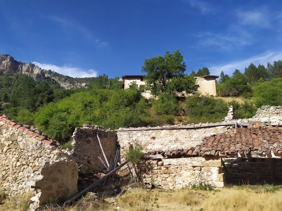
After about 3 kilometres along the river bank, we see the remains of an old building, an old building, the The Blacksmith's of the Morencos. The building is surprising for its size, in its day it must have been something important because it is very large, also throughout the tour and especially in the immediate vicinity there are metal remains everywhere, they are the slag of the iron smelting that was formerly carried out here.
Metal from many of the mountains that today make up the Upper Taj Natural ParkoIt was here that it was melted and from where it came out already prepared. It should also be said that the metal that came out of here was recognised and appreciated for its great strength and ductility.

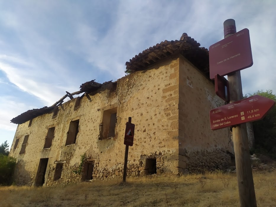
Right next to the Blacksmith's Shop, we find the signage which belongs to the GR-113If we continue along this path, from this point, we can already get to Peralejos de las Truchas if we no longer wish to continue; but if the spirit of adventure still lingers, we can continue parallel to the river for a further stretch until we reach an area where we will see a small wooden bridge which crosses the bed of the Hoz Seca, and a few metres further on there is a small ford where some people ford the river. It is here that the riverbed has been gaining ground, and little by little a marshy area is forming, a paradise for amphibians and other fauna that come here to drink.
This area is the perfect place to restThe way back will be along the track that we will take (without crossing the bridge), which will take us back to where we have the car. We will also share the way back with the signposting of the GR-113 which heads towards Peralejos de las Truchas, so there is no way to get lost, you just have to walk until you see the starting point.
The return journey will be approximately 3 kilometres long, we will drive along a track in good conditionThe heat in the summer can make it a little hard, as it there is no shadow at all We recommend that you plan your day well in order to avoid areas where the heat can play a trick on you.
However, this section, although exposed, offers breathtaking views and landscapes; we will be flanked by the Rason (1658 metres) to our right and the Altos de la Campana (1661 metres) on the opposite bank, two impressive limestone crags between which the griffon vultures give us incredible flights.
Little by little, without haste and allowing ourselves to be delighted by the landscape, we will be back at the start of our route, and we will have enjoyed an incredible day with the route along the Hoz Seca joints.
Signposting and Start of the Route
At no point on this route will we find any markings or signs, so we must download the track There are times when the path gets lost and it is a good idea to get some extra help. The only section of the route that is signposted is the one we will share on our return with the GR-113, which ends, in this stage, in Peralejos de las Truchas.

