Cycling along the banks of the Tagus in Peralejos
Cycling along the Tagus River in Peralejos de las Truchas

Cycling along the banks of the Tagus in Peralejos
Dirección
Home in Peralejos de las Truchas
GPS
40.593889, -1.9092851
Circular 7,4 Km | 7,4 Km | 7,4 Km | 7,4 Km | 7,4 Km | 7,4 Km Unevenness 145 m | Duration 2 h | Route On foot
Cycling along the banks of the Tagus in Peralejos
The route, which starts at Peralejos de las Truchas draws a circular It also passes through some very interesting bathing areas due to their low number of visitors, although in the summer months it is inevitable to find crowds of people in this area. The route is very simple, a journey of little more than 7 kilometres, with hardly any gradient which will take us parallel to the Tagus River.
We start from the urban centre of Peralejos de las Truchaswe walked to the pediment We turn right at the top of the village. Winding through the last urbanised streets, we leave the town along a path that gradually loses visibility.
This section of our trail is shared with the GR-113 in its stage 3, but the signalling is not always easily perceptible.
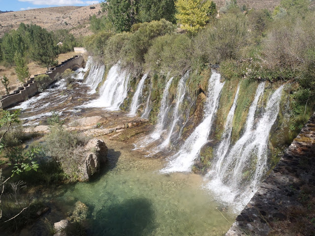
Once we have climbed up the hill and left the town centre, we gradually begin to walk up the hill. descent to the river. At the height of the riverbed, we will see a building belonging to the hydroelectric power plant and a parking area, it is here that we can visit the Molino de Arriba waterfallThe dam is now naturalised, but its time is numbered, as its demolition is planned to return the river to its original course.
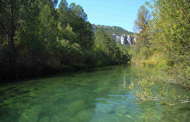
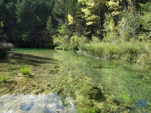
Here we walk in a northerly direction, always parallel to the river On the right bank, in hot weather, it is impossible not to take a dip in the cool, turquoise waters along this stretch. The path can get confusing here, but if you pay attention you will find the path to follow. We continue on our now undulating path until we reach the El Vado recreational areaA place where we can take another dip and enjoy a snack in the cool shade.
Once you have left the recreational area, the most fun part of the route begins, which is now going along the river This forces us to make funny jumps, walk over logs that act as improvised bridges or simply to get our boots wet. So, amidst laughter and the occasional involuntary dip, we arrive at the "La Aserradora" campsite, where we can find a very quiet bathing area. Here there are some icy pools and areas where the river gushes backwater. The bathing in this area is memorable and we decide to rest for a while in this beautiful place.
Leaving this idyllic spot, we set off on our way back to Peralejos de las Truchas following the GR-113 markings that have accompanied us on our route, now along the left-hand side of the road. It is a quiet road with a lot of pedestrians, so there is no problem in doing the last part of our journey walking along it.
We will pass in front of its small cemetery and shortly after we will arrive at the town centre of Peralejos, a small village that has everything, so do not hesitate to have a drink in its bar or book a meal in one of its several rural houses, which have a gastronomy closely linked to the truffle, one of those delicacies that grow in these lands.
Signposting and Start of the Route
The road shares signage with the GR-113as this route is part of the Stage 3, is a long distance path, which is not always well maintained, so it is not possible to follow a continuous signposting. In addition, several sections of the path are under bushes or very poorly defined and we will have to look for the way, so to avoid confusion or confusion we recommend that you download the track of this route just below.

