GR-10 Valencia to Lisbon
The oldest of all the GRs that cross the Upper Tagus.

gr-10
Dirección
Home near Orea
GPS
40.544912593045, -1.695483911214
GR-10
This long-distance route crosses the Iberian Peninsula along ancient roads and paths that have been used over the years. It starts in the city of Valencia and, after a few kilometres, it 1600 kilometres ends in Lisbon.
It crosses several autonomous communities, but it is the section that leaves Aragón and enters Castilla-La Mancha that interests us, because it is here that the adventure of the GR-10 through the Alto Tajo.
In total, during our journey through the Natural Park, we will walk for approximately 100 kilometres, divided into 6 stages, and some variants, in order to complete the route respecting the restrictions in place between February and June due to nesting raptors.
Furthermore, although it is a route that runs parallel to the Tagus River in sections where the canyon closes and makes the path complicated, there are possible alternatives to facilitate the way for those who decide to do this route by bicycle and not walking, although even so, on many occasions we will have to carry our bicycle to overcome the many obstacles that we will find.

Stages of the Gr-10 that pass through the Park
- Stage 1: Orihuela del Tremedal-Orea–Czech–Chequilla–Peralejos de las Truchas. 30 kilometres that allow us to contemplate, almost for the last time, an open and wide landscape, far from the gorges and canyons, which is the entrance to the course of the Tagus river.
- Stage 2: Peralejos de las TruchasHuerta del Forestal de Taravilla. A short 19-kilometre stage along the Tagus, on the stretch between Peralejos and the Taravilla Lagoon, From here we can continue onwards to the huerta del forestal, or we can go down the Poveda waterfallnot recommended for bicycles.
- Stage 4: Cabrillas river track (Taravilla)–San Pedro´s Bridge. 22 kilometres parallel to the rivers Cabrillas and Tajo, a beautiful and comfortable stage, a bit cold for winter.
- Stage 5: St. Peter's Bridge-Huertapelayo track. A tough stage of 22 kilometres and about 6 hours duration with steep slopes that you have to take it easy and enjoy the wonders of the road, such as the Campillo Waterfalllocated halfway uphill from the Rocha Dam.
- Stage 6: Huertapelayo-Valtablado del río. 22.6 kilometres of pure wonder. A full day's walk that takes us along one of the purest, wildest and most solitary stretches of the Tagus River, undoubtedly one of the best.
- Stage 7: Valtablado del río-Cifuentes. The last stage in the Alto Tajo, 30 kilometres that end in the neighbouring town of Cifuentes. This is a one-day stage in which the change of scenery is more than notable. We leave behind the gorges and canyons, the cool shady areas and begin to glimpse the undulations of the The Alcarria.
NOTE:
- Between 1 February and 15 Junethe tranche from Tagüenza Bridgeis restricted. From here we will have to cross the bridge, and continue on to Huertahernandoand then take the variant "hoces del Ablanquejo".which leads us to Duchy Channels (step 6)and from here, passing through Ocentejo without visiting the Hundido de Armallonesto Oter (step 7)We continue on to Cifuentes, leaving the Natural Park.
- These stages of the GR-10 and their duration are for guidance only. Each hiker should inform themselves and adapt their route and rests to the possibilities and physical condition they are in. There are areas where you will find several refuges, so these routes can be extended or shortened depending on the hiker.
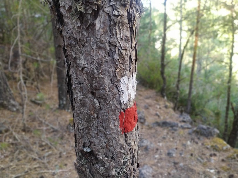
- On countless occasions we will see that our signage gets mixed up or confused with that of other long-distance trails (generally with the GR-113) which run parallel to the Tagus River. We must say that their routes are very similar, with differences at very few points where they separate to take different variants, but they practically run parallel with the same aim, to cross the whole course of the Tagus River from one end to the other.
- Finally, it is essential to plan this route well, as we will have practically no contact with civilisation for 3 or 4 days in a row, so we must know the route well and be equipped with sufficient provisions, as it will be very difficult to carry our backpacks in the Alto Tajo, unless we deviate from our route to get close to some of the villages.


