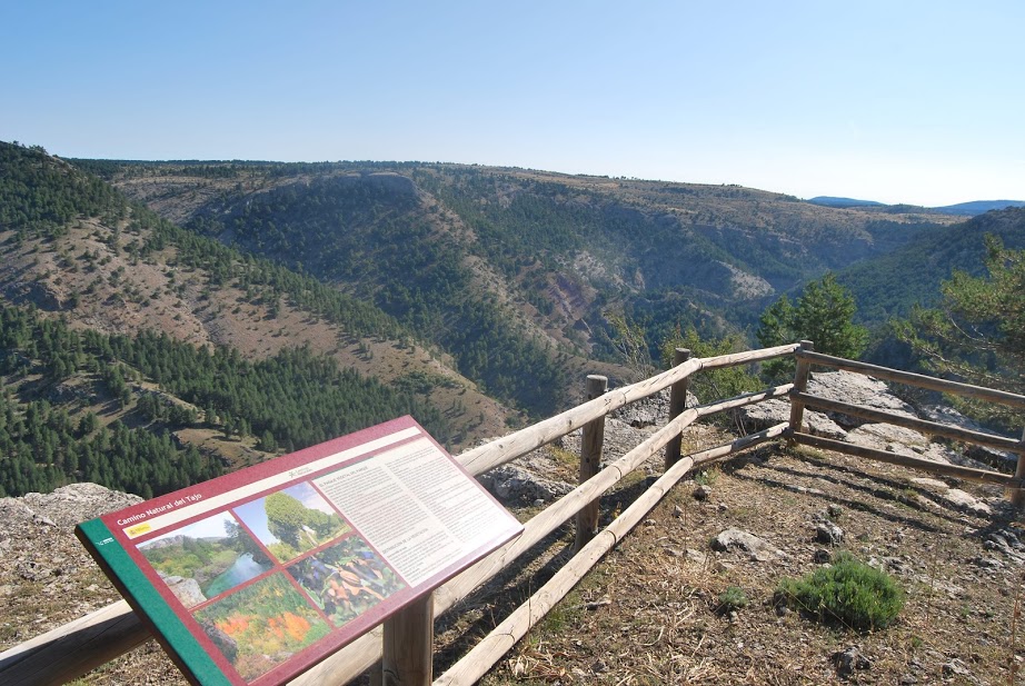
Viewpoint of the Cuesta del Acebar
Impressive but very difficult to reach

Cuesta del Acebar
Dirección
Viewpoint of the Cuesta del Acebar
GPS
40.523095381654, -1.8609979182155
Cuesta del Acebar
The viewpoint of the Cuesta del Acebar is one of those hidden places, which are not easy to reach because of the lack of humanisation of the place where they are located.
This viewpoint is located on the foothills of the Sierra de MolinaThe project is located on a rocky outcrop of the cliffs of the Alto del canyon carved by the Hoz Seca river (Oceseca). Here the landscape is breathtaking, the human trail almost disappears.
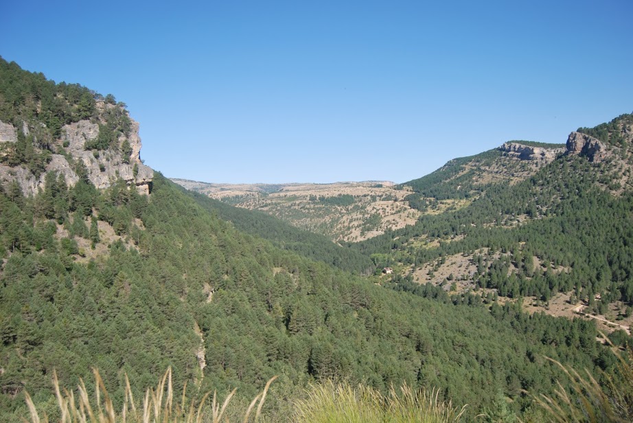
Looking out over this beautiful natural balcony, we can enjoy the final stretch of the Hoz Seca canyon just before it flows into the still meagre Tagus. We can see how the landscape changes and takes on different tones as we move away from or towards the water source. On the high plateaus that we can observe, we can see how the landscape changes from the typical paramera with extensive forests of sabinato species capable of withstanding life in the solana of the limestone canyon, such as the Scots pine.
The rocky walls that we contemplate before us also reveal the incessant work of the climatic processes that for eons have been carving and modifying this landscape. We can see the different layers of sediment that have been exposed by erosion under the lush forest that stretches out at our feet.
From the heights we can appreciate the remains of the ancient Blacksmith's shop of the Morencos which, in the form of a witness, gives us some information about the use that humans have made of the natural resources present in its mountains.
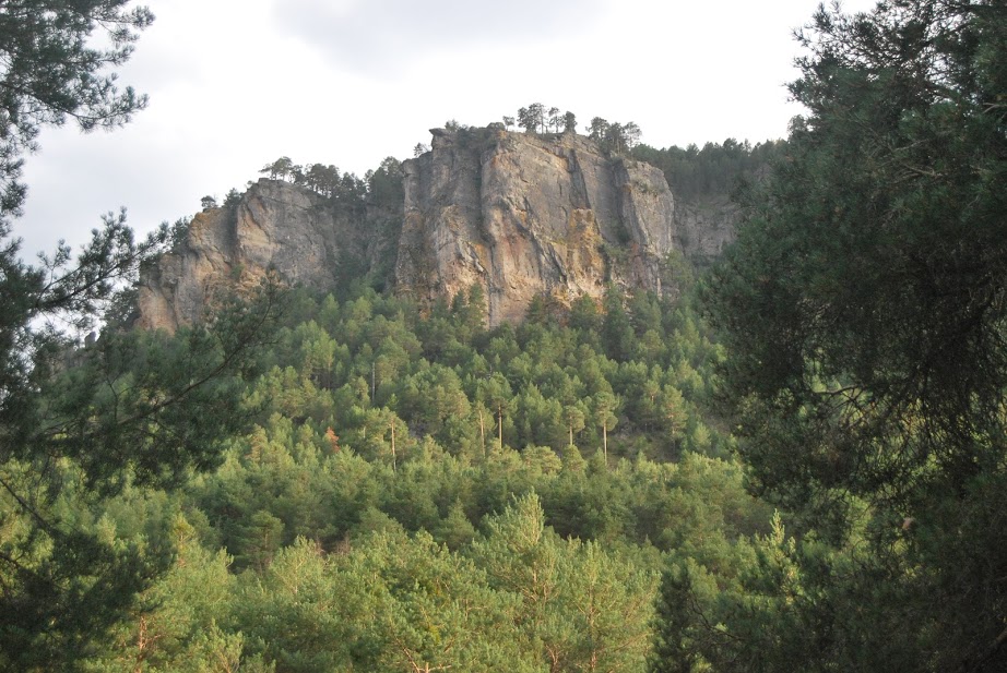
In addition, from the Cuesta del Acebar it is worth highlighting the immutable figure of the El RasónThe calcareous rock that crowns the slope opposite, belonging to the town of Peralejos de las Truchas. With a height of 1658 metres, it is another of those indispensable balconies from which to contemplate the impressive Oceseca canyon. A more than curious and striking river, the intermittent nature of its waters and the spectacular nature of its canyons make it one of the jewels of the Upper Tagus Natural Park.
Finally, we must not forget that this, like so many other corners of the world, is one of the most important places in the Park Natural, they represent the ideal home for a multitude of species that find their homes in these rocky escarpments, being the griffon vulture which will delight visitors with its flights and landings. Next to the viewpoint there is an area where we can watch them take off and land almost next to us. These corners will delight the visitor.
<< How to get there?
Access to this viewpoint is quite complicated as it is very far from any population centre and it is practically impossible to reach with a vehicle. The best way to discover it is to do the stage 3 of the GR-113 that takes us from the hermitage of San Lorenzoin Czechto the village of Peralejos de las Truchas with a distance of approx. 23 kilometres.
If we don't want to make such a long journey, we can get as close to it as we want. from Peralejostaking the road that leads to the mouth of the Hoz Seca with the Tagus, and continuing to the end of it, to park here and cross the river to climb the slope that gives it its name to the facilities of the viewpoint, such as from Czechfollowing the path of the Rambla MalillaWe will reach a signposted crossroads, where we will have to follow a small path to be able to enjoy these views.
The path from here is straight ahead towards the limits of the canyon, until we come to the signpost that marks our destination, once we have started to descend towards the bottom of the canyon.

