RG PNAT 8 Route of Salto de Poveda and Taravilla Lagoon
Short route through the best known landscapes of the Alto Tajo.

Dirección
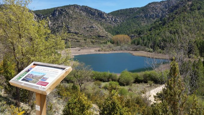
Start and finish at Laguna de Taravilla
GPS
40.6511744, -1.9743916
Circular 5 Km | 5 Km | 5 Km | 5 Km | 5 Km | 5 Km | 5 Km | 5 Km | 5 Km Unevenness 100 m | Duration 2 h | Route On foot
General Route 8: Route of Salto de Poveda-Taravilla Lagoon
Today's itinerary is of the following type circular. The route of the Salto de Poveda is suitable for doing hikinghas a length of 5 km and it will take about 2 hours The project is very easy to complete, as it presents little difficulty.
To start walking, the Salto de Poveda route offers three options:
- the Taravilla Lagoonwhere there is a panel corresponding to the Georuta 7,
- the fishermen's footbridge car park, which you will find shortly after the start of the track, located near the bridge at Poveda de la Sierra,
- or the car park located in the immediate vicinity of the Casas del Salto, already at the end of the road and right next to the viewpoint of the Poveda waterfall.
Whichever of the above-mentioned starting points is chosen to complete this route, we must bear in mind that in summer, these car parks close as soon as they are full, so we advise you to get up early and be prepared early in the morning, as access may be restricted.
We set off on the route from the latter car park, taking the track that starts next to the Poveda Bridge, and followed it until we were close to the Salto, right next to the tourist accommodation. From here we traced a circular route and we found the walk to be perfect.
The section from the Casas del Salto to the pedestrian footbridgeThe walk takes place under a dense and cool shade thanks to the lush vegetation that cools the environment.
As soil moisture increases, we will find, first, a wet zone filled with hazel, lime or mustard treesThe river, as we descend towards the river, will turn into a varied riverside woodland where we can see ash, elm, white willow and poplar trees.
With regard to the fauna that we observe throughout our route, we can say that the main protagonists are the griffon vultures, that hover above our heads as they fly over the canyon.
Nor can we overlook the forest birds as great spotted woodpeckers, blue tit or coal tit, which can be seen or heard throughout our route, as well as some specimens typical of areas with water that may surprise us, such as the dipper and the marsh harrier, although the latter is somewhat scarcer and more difficult to see.
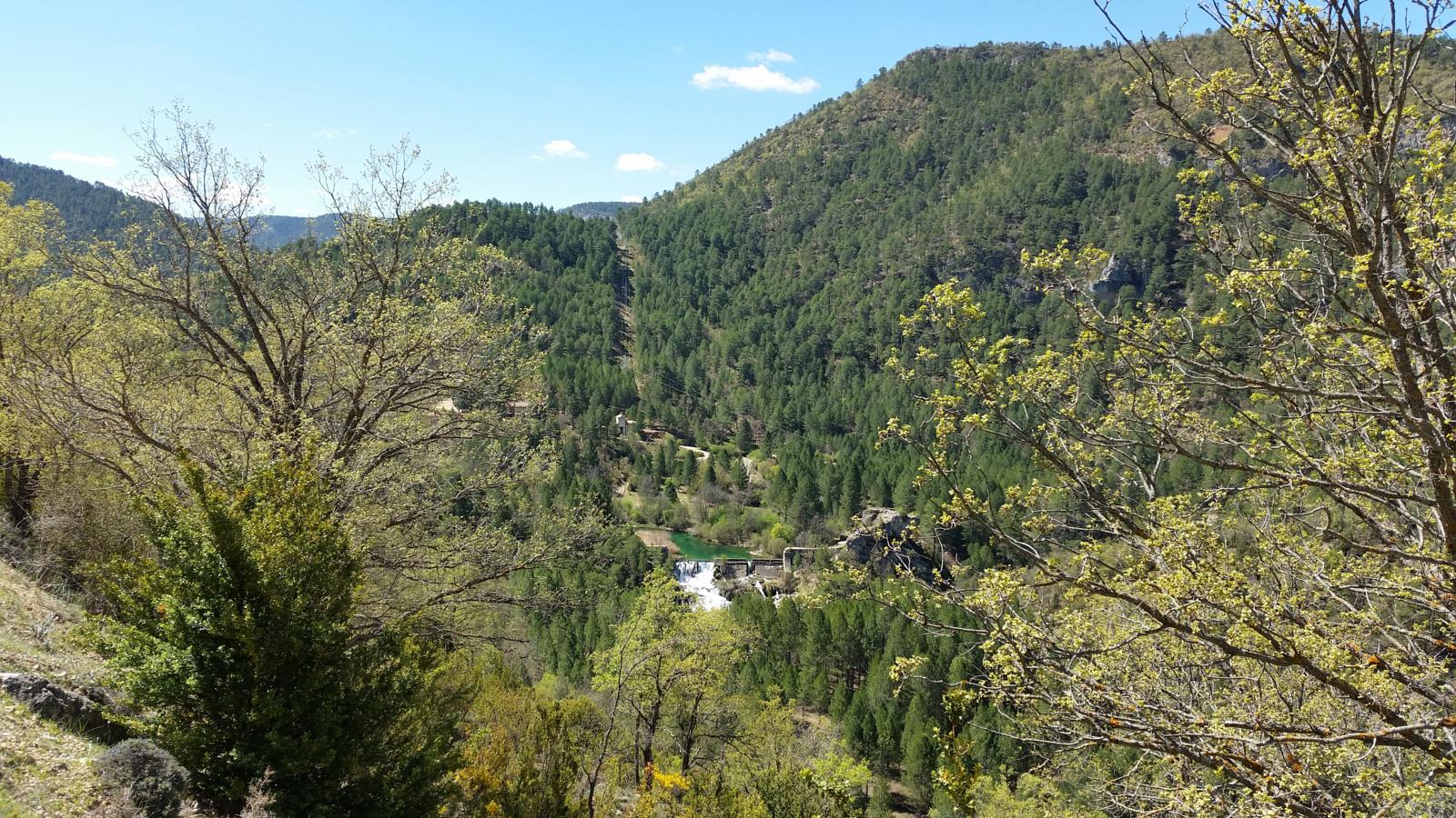
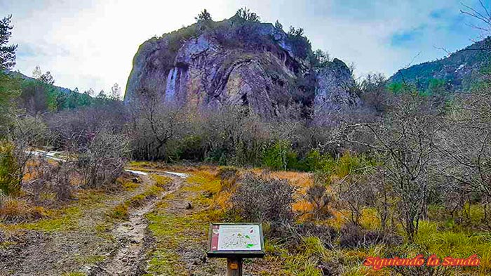
We will see special rock formations, and we will be able to appreciate one of the most beloved and visited landscapes within the Natura Parklon the banks of the Tagus River. We can also highlight the special mycological and faunistic value that with a little care and attention, and at the right times, will give us some surprises.
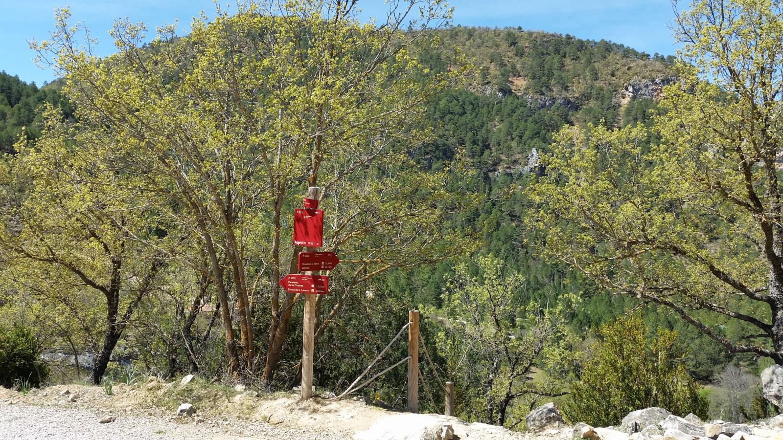
Signposting and Start of the Route
To start the trail from the START PANELIf you are not in the car park, you have to go to the car park of the Taravilla LagoonThere we can park and follow the path in the "official" direction. Once at our destination, we can admire the scenery around the lagoon, and turn around on a path that leaves from the jetty (optional section).
The Route continues along the dirt track ascending in direction to TaravillaA little further on we will see a signpost that looks like a viewpoint, at the back of which we will find a small path that descends until we reach the river.
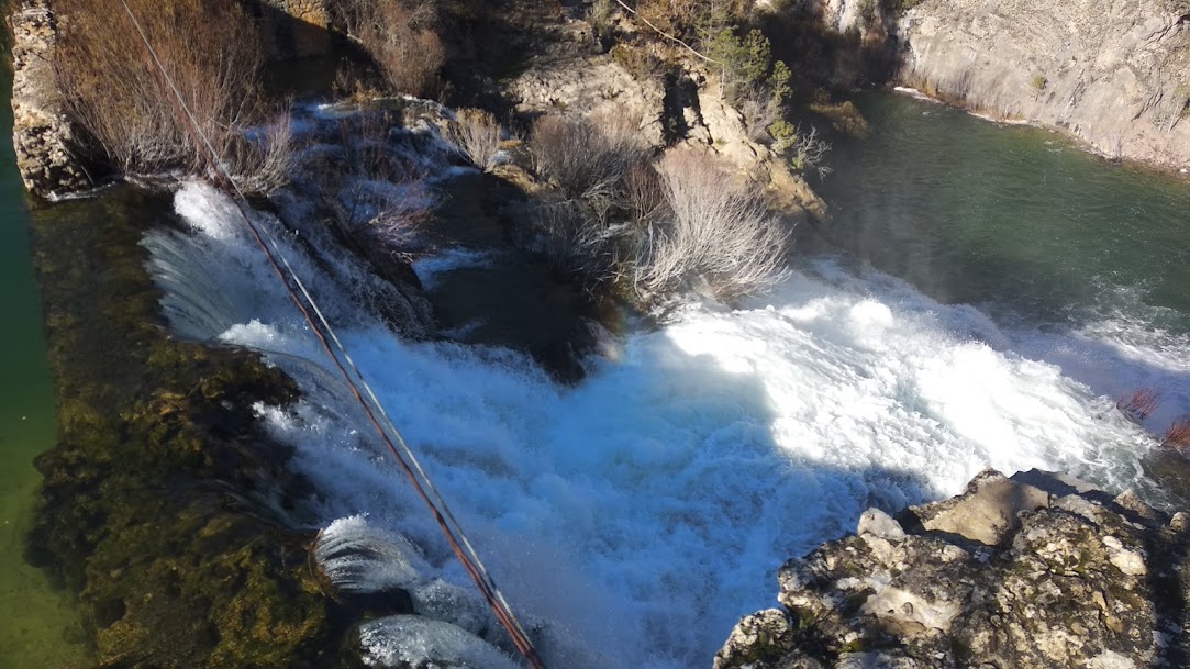
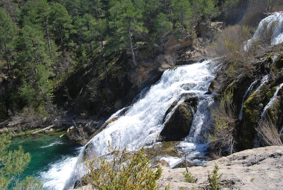
Following the purple markers that guide us on our route, for 10 minutes you will find a plaque located just in front of the Poveda waterfall a perfect vantage point from which to admire its splendour.
This spectacular waterfall originated after the collapse of the wall of an old hydroelectric dam that never actually came into operation.
We follow the markers for approximately 300 metres more until we find, in a meadow, a small plate situated at the foot of a spectacular isolated fold that will keep us watching for a while.
We continue along the path until we reach the level of the river and arrive at a bridge, a small fishermen's footbridge over which we have to cross to join the main track that leads to the waterfall.
After crossing the river, we turn left to reach in 15 minutes through the cool and humid area of the shady side of the river the Casas del Salto. On arrival we will see an access to visit the Poveda waterfall and have another perspective of this waterfall almost naturalised.
Once we have resumed our route and passed the houses of El Salto, we will take the path that goes down to the river and continue along the path of the Tagus Nature Trail (GR-10)It is here where our path is cut off because we cannot take the footbridge, but we can ford it and return to the starting point.
Finally, and due to the various possibilities of starting the path, we advise you to be very clear about the direction and direction you are going to take, and it is advisable to be accompanied by your guide. track of the Salto de Poveda route that you can download here so as not to get disoriented at any time.
Remember that the route described here is the official route of this route, our experience is from the Casas del Salto, and the path is just as easy to follow as it is circular and there are not many places to cross the river, so the direction of the walk is very intuitive.
Finally, this route of the Salto de Poveda is one of the most popular routes in the area. official trails of the Alto Tagus, currently occupying the number 10 in the new listing, although for the time being it retains its previous nomenclature on this website.

