Route 6: Villanueva de Alcorón-Peñalén
A difficult balance

Route 6: Villanueva de Alcorón-Peñalén
Dirección
Home in the Sima de Alcorón
GPS
40.6879098, -2.1781884
Ida 22 Km | Unevenness 40 m | Duration 5 h | Route –
Route 6: Villanueva de Alcorón-Peñalén
The Georuta 6, has a total length of 22 kmThe entire route can be done by car or bicycle, except for the access to stop 2 and stops 4 and 5, which require a comfortable 40-minute walk through a pine forest. The entire route can be done by car or bicycle, except for the access to stop 2 and stops 4 and 5, which require a comfortable 40-minute walk through the pine forest.
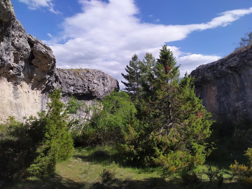
This route is located in the central area of the Park and shows the difficult balance between the use of natural resources and their adequate preservation. You will visit well-preserved natural enclaves such as caves and enchanted cities hidden among the pine trees. But we will also visit places that have been highly transformed by human action, which can help us to better understand some environmental problems and to seek solutions to achieve sustainable development. A difficult balance to achieve that requires the effort of all of us.
The route runs for the most part along the limestone parameresThe area is practically flat, covered by a pine forest of laricio pine and Scots pine with gall oak, juniper and juniper juniper which offer refuge to fauna communities such as forest birds of prey, small birds and mammals such as roe deer and red deer.
Signposting and Start of the Route
<< Stop 1: We will be located in the recreational area of the Sima de Alcorón. Access to the site is via a track that starts at kilometre 5.200 of the road that connects Villanueva de Alcorón y Peñalén. At the turn-off there is a sign indicating the location of the chasm.
<< Stop 2: Inside the chasm, at the end of the first flight of stairs, there is a plaque indicating some details of the cave. From here, carefully descend the stairs to the bottom of the chasm at a depth of 62 metres.
<< Stop 3: Following the road in the direction of Peñalén, half a kilometre before reaching the village and at a sharp bend, there is a track on the left hand side, next to a large stone cross, in a place known as "...".El Portillo de Peñalén". Following this track and the markers, you will reach an esplanade that has been set up as a car park. From there, following the markings on foot, you will arrive in about 15 minutes to the "the enchanted city of Hoya del Espino".where we will find a panel. We are on the Peñalén moorland. Be careful not to get disorientated in this area.
<< Stop 4: Near the previous panel, next to the larger rock, is an old farmyard. Next to it you will find a directional beacon. Look for an easy way up to the large rock, on the top of which is a plaque that shows us this type of landscape from a privileged angle.
<< Stop 5: We get back to the main road and head towards Peñalén. At the exit of the village in the direction of Poveda a plaque is found on the slope of the road. This is in front of the sands of UtrillasThey are so called because they are very abundant in a village in Teruel called Utrillas. They are yellowish-white sands formed by quartz and feldspar with abundant levels of green, red and purple clays, accumulated in a fluvial valley with coastal influence about 100 million years ago.
<< Stop 6: A little further on, in a large abandoned quarry, there is a panel. Here we will learn how, at the beginning of the 20th century, small mining operations met their needs, extracting everything from iron for smelting to pigments for the manufacture of paints.
<< Stop 7: We backtrack to enter the village of Peñalén and take the track that goes down to the river Tajo. It should be noted that the mine is currently being exploited again, so we will have to take extreme precautions and, with no choice, share the path with them.
In the formerly abandoned quarry next to the track is the plaque. From here we can see the serious ecological and landscape impact of mining. Not only the extraction of kaolin and the alteration of the vegetation cover, but also the generation of waste and sterile materials that accumulate and are disposed of in large dumps that are generally washed away by the rains, sieving the river beds and preventing anything living from growing or feeding here.
<< Stop 8: Following the track a little further, you will come to a half-format panel where the route ends. If you wish to continue along this same path, you will come to the track that runs along the bottom of the canyon of the Tagus River, where you can enjoy spectacular scenery.


