RG PNAT 3 The Tagus viewpoints
Long route for bike or 4×4 where you can see 3 of the best viewpoints of the Tagus.

Los Miradores Del Tajo
Dirección
Start in Taravilla or Lebrancón
GPS
40.697562275184, -1.9676193258123
Only Ida 51 Km | Unevenness 219 m | Duration 4 h | Route 4×4 - Bicycle
General Route 3: The Tagus viewpoints
The route of the viewpoints of the Tagus is a quiet and solitary route that can be done in bicycles and all-terrain vehicles. It has a distance of 33 kmif we do it linearIf we also perform the returnwe will have to 18 kilometres, as you don't have to take the branch roads to the viewpoints, being the total of the route 51 kilometres. It runs between the towns of Taravilla y Lebrancon. It will take about 4 hours The time it takes to complete it will depend on how much time we spend enjoying the views of the landscape.
Currently, this general route is included in the list of official routes of the Upper Tagus, occupying the number 2 within the cycle routes (BTT).
It is an easy route along a main track, from which every few kilometres there are detours that take us to some of the best viewpoints along the Tagus River. These viewpoints are:
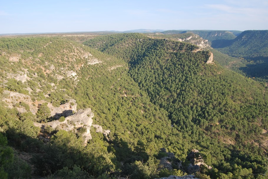
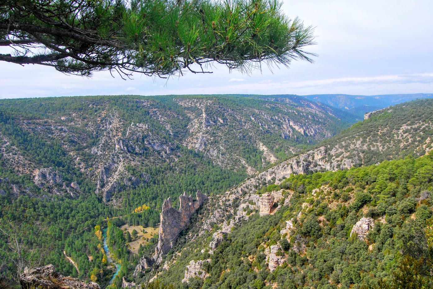
<< February Cave This is one of our favourite viewpoints for sunrises and sunsets. We are at the top of a limestone rock and at our feet we can see that these rocks are full of escarpments and ledges. It is here that at that time of the day the multitude of griffon vultures that fly over our heads gather to ascend or descend as they please.
Multitudes of these birds of prey can be found here, and if you know how to wait for them calmly and quietly I guarantee that this will be one of your favourite vantage points for watching this much-loved scavenger.
We also enjoyed the views of the impressive Muela del Condewhich rises imposingly to our left. Just behind it is the Taravilla LagoonAlthough we can't see it, at our feet the Cabrillas river and completely to our right, we can see almost hanging on a wall the village of Peñalén.
Access to this viewpoint is very easy, the track is in very good condition and the signposting is well preserved. The final stretch, which takes us to the very edge of the canyon, narrows a little but is not difficult, so we can access these views without any problem.
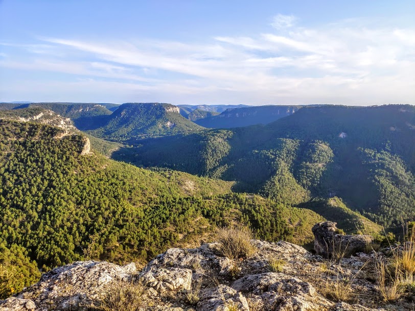
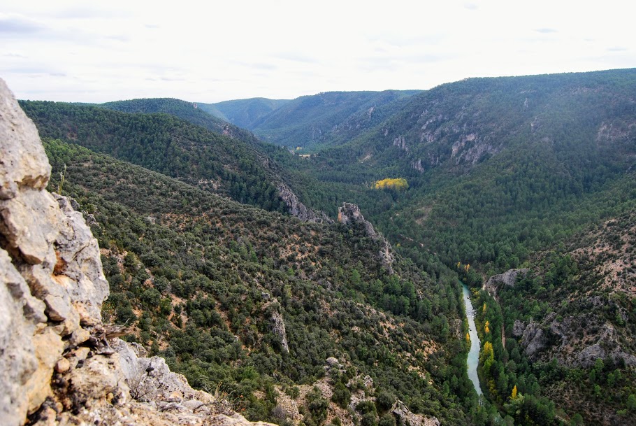
<< Foot and a Half. This balcony offers a spectacular panoramic view of the entire Tagus river in the stretch of the camp. La Teja Fountainwhich we find on the track that runs alongside the river, and the enormous limestone rock known as the "Peña Horadada" or "Peña de la Gitana". accessible only to adventurous climbers, and where we will also find a large chasm right next to our viewpoint, properly marked and signposted.
It is true that everything is properly fenced off, but if we go with pets or the youngest members of the family, we cannot lose sight of them at any time.

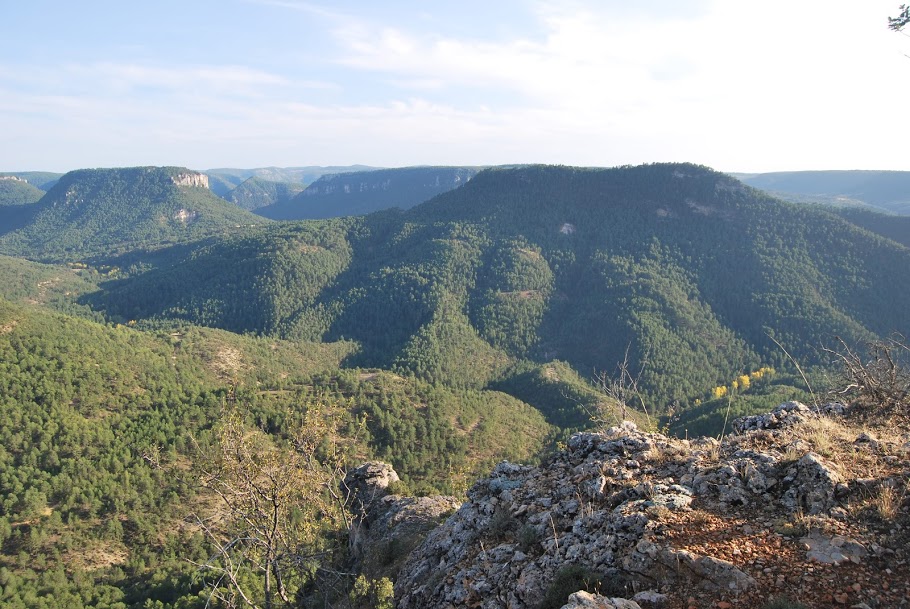
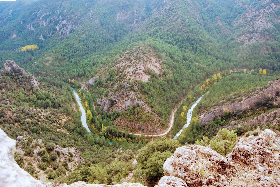
<< Puntal del PanchoFrom here we can see the large limestone rock located just in front of the viewpoint, at the bottom of the Tagus valley, called the "Garabatea Castle". This is an impressive rocky ridge that seems to be split by the river itself, which at this point forms a perfect meander.
This balcony leads us to imagine what life was like for livestock farmers and shepherds who used to feed their herds in these millstones and used the natural cuttings and shelters as shelters. The traces of this can be seen to the right of our viewpoint, where on an almost vertical wall, we can see a series of constructions corresponding to these shelters and corrals built to safeguard the livestock during the night.
With this route of the viewpoints of the Tagus, we will have the opportunity to see, in addition to the unbeatable views of most of the canyons that the river carves out, a multitude of wildlife. During the rutting or barking season, deer and roe deer can be heard at the top of this mountain, accompanying us with their bellowing throughout the night. But, as we have already mentioned, the star of these canyons is, without a doubt, the griffon vulture, at the right time of the day, they will pass over your head looking for the thermals that will make them gain height, it is one of the best viewpoint routes in the whole country. Upper Taj Natural Parkofor the observation of these marvellous birds.

How to get there?
To reach the start of the trail the viewpoints of the Tagus, we must go to the locality of Taravilla. At the very entrance to the village, next to the road, we will find a series of panels and signs, One of them is our path, and from here begins the path that takes us to the first viewpoint.
With regard to the condition of the track, it should be noted that generally in good conditionwith the exception of the section linking the locality of Taravilla with Tagus BathsThis is a very difficult route, although it may not seem so at the beginning of the journey.
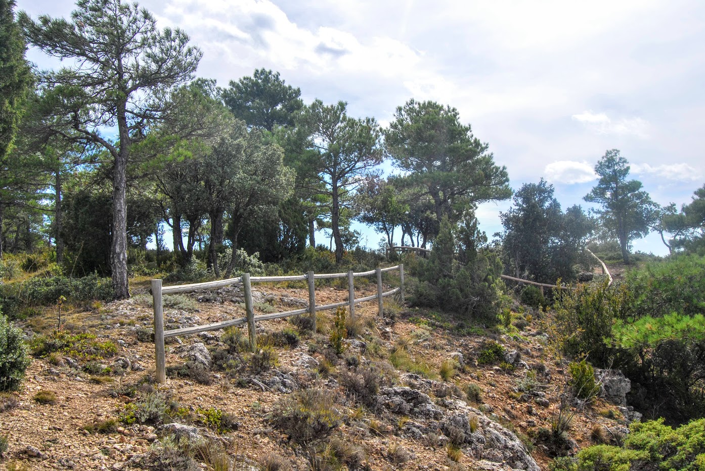
Signposting and Start of the Route
At the beginning of this route there is an information panel with a brief description of the route, which is also marked with paintings of colour orangeHowever, in order to make the route as reliable as possible, we recommend that you download the track on this page by clicking on the button above, although the signposting is quite clear all along the route.