Category: Routes
More than 50 routes on foot and by bike to discover the Upper Tagus on your own

Visit some of the best geosites of the Molina - Alto Tajo Geopark such as the Barranco de la Hoz or the folds of Cuevas Labradas.
Ver más
The Huertapelayo route will allow us to enjoy one of the least humanised landscapes in the entire Upper Tagus Natural Park.
Ver más
We will pass through cities of stone or enchanted cities, chasms, caves, crossing the limestone moorland covered with pines, gall oaks, junipers and junipers.
Ver más
The Las Caleras de Villanueva route brings us a little closer to the traditional uses to which these mountains have been put.
Ver más
We travel through one of the most beautiful and visited areas of the Alto Tajo, discovering wonderful places such as the Salto or the Taravilla Lagoon.
Ver más
El Rodenal, in Corduente, will take us into a magnificent and very well preserved forest until we reach the top of the Barranco de la Hoz ravine.
Ver más
He will reveal incredible secrets hidden in the rocks, from a dropstone, a polje, the aguaspeña and even the remains of a volcano.
Ver más
Georuta through the oldest and hardest rock formations such as in the Rio de Piedras, to the newest ones such as the Aguaspeña tuffs.
Ver más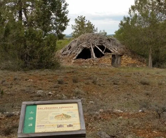
The Puntal de la Cabeza path goes through mixed pine and juniper forests and we will come across constructions such as "chozones sabineros",
Ver más
The route of Salto de Poveda and Laguna Taravilla, runs through these two enclaves, a 5 km circular route with some small slopes.
Ver más
La Georuta 10 is a walk through the past and present of the marvellous enclave represented by the Sierra de Caldereros and its formations.
Ver más
The Barranco del Horcajo ravine route, a beautiful walk through one of the most spectacular canyons of the Upper Tagus. A landscape almost frozen in time
Ver más
A beautiful route along the Cabrillas river that invites us to explore one of the most beautiful spots in Megina. With a comfortable walk of just over 3 hours.
Ver más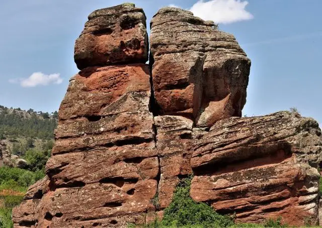
On the route of the red stones we can admire the curious rock formations that surround the town of Chequilla.
Ver más
The route from La Espineda to the Peña Alta viewpoint is a 7.5 km circular path with a gradient of 250 m starting at the Fuente de los Vaqueros.
Ver más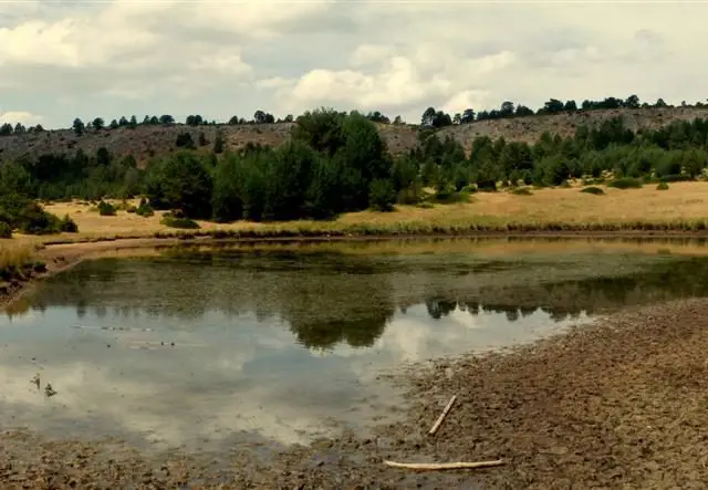
The Laguna de la Salobreja route is a comfortable 14 km trail that takes us to one of the most curious lagoons in the Natural Park.
Ver más
Come and discover the curious landscape of the Arroyo del Enebral and the Río de Piedras area with this route, one of the most complete in the Alto Tajo.
Ver más