
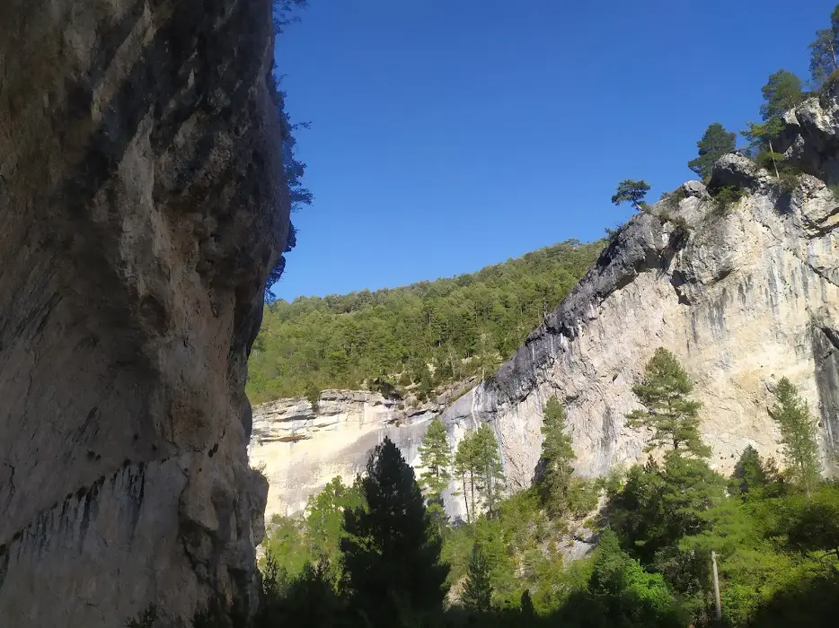
Sometimes it's difficult to choose a walking route to explore the Alto Tajo Natural Park. There's a lot to choose from: its stunning canyon, legendary juniper groves, lush forests, its renowned river or tributaries... That's why we've compiled this Top 10 list of Official Trails to discover Alto Tajo, which can help you explore some of the best and most representative paths in the Park.
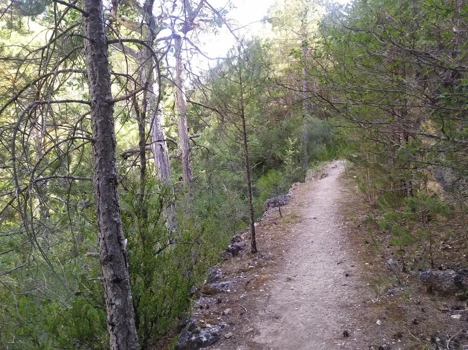
We have chosen a sample of several official trails, marked and properly signposted, specifically, those that for us would be our favourites and of course, those that you should not miss. So on your next adventure, don't forget to include some of these routes, you won't fail.
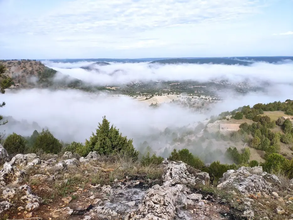
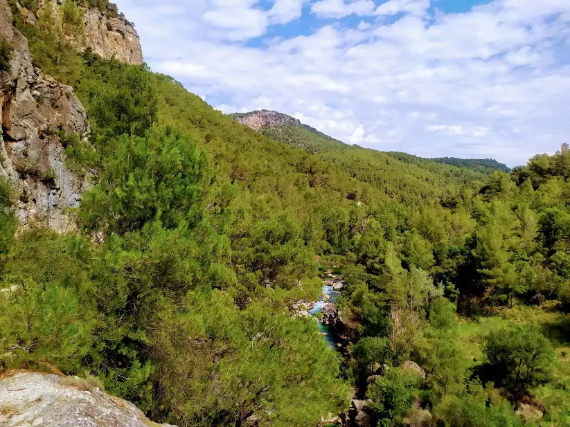
1. Horcajo Ravine Route (Cuenca)
Undoubtedly, one of the routes that must be included in this list is the General Route 9, better known as the Horcajo Ravine Route.
This is an easily accessible trail with a length of 6.6 km, allowing us to walk as we cross part of the ravine. Being a circular route and presenting an ascent of 240 meters in its last 2 km, we recommend it for the whole family. However, please keep in mind that it's a narrow trail that descends and then ascends the ravine, with not many difficulties but still deserving of our full attention.
What stands out the most about this route is its spectacular landscape, especially as we venture deeper into the ravine, where the mesophilic vegetation, which finds its ideal habitat here, closes in along with the steep limestone walls of the canyon. This canyon, which has a privileged location, is home to a multitude of rock-dwelling species.
2. Valle de los Milagros Route


This is another route in the Alto Tajo Natural Park that will not disappoint you, as it takes you through one of those places that manage to make you travel without moving your feet from the ground.
With the Route of the Valley of Miracles, we are guaranteed a morning of adventures and family entertainment. Essentially, the route we follow traces the course of the Linares River, starting right from the recreational area of the Casares Cave, all the way to the base of the two pinnacles, known as the Miracles.
We will walk for about 6 km alongside the river, having to ford it several times over crossings that are not difficult but do benefit from having an extra point of support (bring your walking stick). The only incline we encounter throughout the route is the ascent to the base of the pinnacles, so we can say that it's a comfortable stroll along the riverbank, bringing us closer to discovering one of the most special and striking places in the entire Natural Park.
3. Georoute of the Sunken Armallones (Ocentejo)
The next of the proposed routes explores a section of the Tajo River known as the Sunken Armallones. We start from the town of Ocentejo, where we will find the corresponding signage for Georoute 01, which introduces us to this magical place.
During our journey, we start at the higher part and gradually venture into the spectacular canyon that the river has carved over time, eventually ending up at its water level. If we pay attention to the panels we come across, we can also better appreciate all the hard work and the multitude of factors that have played a role in shaping this beautiful landscape.
It's a linear route, but due to its short distance (8 km), we won't have any issues doing it as a round trip. If we want to extend the route by 5 more kilometers, making it 13 km in total, we can head over to see the ancient Salinas de la Inesperada. And if we do this during a period of abundant rainfall, we might be amazed by the impressive Ojos de la Cárquima.
4. The Rambla del Avellano route (Arbeteta)
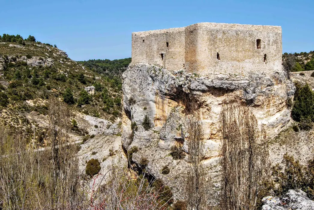
Another of the most beautiful and complete routes in the Natural Park could not be left out of this entry. During its 12 kilometres This is a circular route through a multitude of landscapes. It is a route with a little more distance and height difference (400 metres), even so it is acceptable to do it with children and pets, the important thing is to take it easy and enjoy the surroundings.
We start our tour in the beautiful village of ArbetetaWe walk along old paths and fields, until we enter dense wooded slopes, refuge of many animals, we descend into the wadi, where the rocky landscape gives us beautiful postcards for the memory and we can visit a beautiful castleThe walker will be delighted by one of the most beautiful gorges in the Park, where narrow alleys, crags and the cliffs of a small enchanted town will delight the hiker.
5. La Hoz Ravine Route (Corduente)

This is a very simple route, it traces a circular route of 9 kilometres around the Dehesa de Corduente Interpretation Centre and the more than well-known Barranco de la Hoz.
We will walk almost the entire route on paths and tracks and a small stretch on a very little-travelled road, which will take us into the beautiful valley of the Gallo riverWe can also complement our route with a visit to the Interpretation Centre where we can better understand the reasons why this spectacular landscape has such special characteristics that make it one of the most visited and appreciated of all the Natural Park and the Molina-Alto Tajo Geopark.
The whole family will have a great time, as the section that descends the ravine is an adventure for the little ones and for the not so little ones.
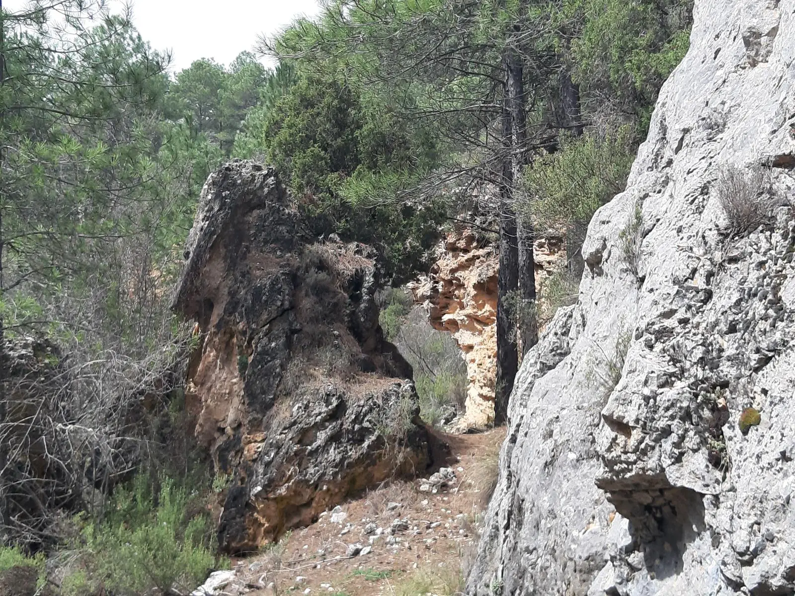
6. Route of the Red Stones (Chequilla)
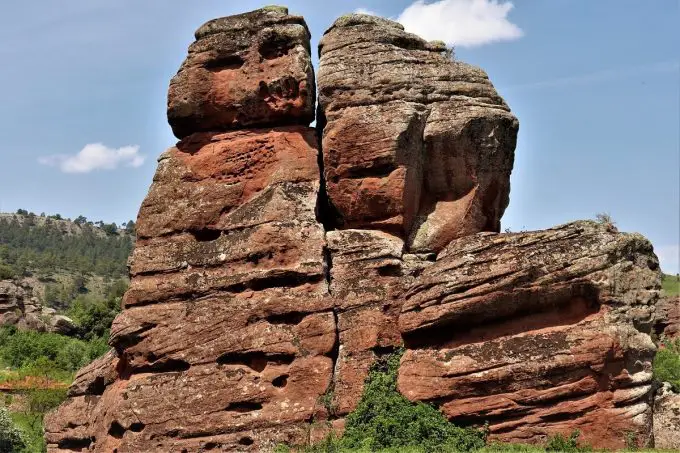
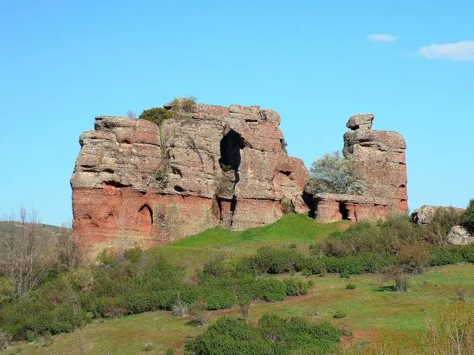
This route deserves to be recommended because in less than a day you can 3 kilometres we will take a comfortable walk in the surroundings of the peculiar locality of ChequillaThis is a fundamental way of getting to know another of the most curious landscapes of the Molina-Alto Tajo Natural Park and Geopark.
In little more than an hour, the Local Trail 10, The route takes us through streams, crop fields, scrubland and pine forests before taking us to enjoy the impressive red organs and towers that populate the surroundings of Chequilla. Some of these red sandstone structures are the ones that form the curious bullringThe city's history, which captivates every visitor, is not to be missed.
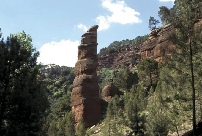
7. Peñas Rubías and Laguna de la Salobreja Route

This trail invites us to get to know one of the most curious and most appreciated wetlands, the Salobreja Lagoonwhich, as its name suggests, has salt water thanks to an impermeable layer of gypsum and clay that gives it its salinity.
It is a path of 14 kilometres circular and signposted that takes us along the path to the lagoon and then down a dry riverbed until we come across the Hoz Seca RiverWe go up the river to reach the starting point of the route.
It is also another of those routes that crosses one of the points of geological value of the Natural Park and Geopark, such as the small enchanted city of the Peñas Rubiaswhere curious monoliths invite us to discover magical corners.
I would just like to add that it is a somewhat long and character moderate as the section that descends through the ravine of Tía Raimunda can be a bit complicated for those who are not used to walking on rough terrain such as the dry riverbed of a mountain stream. So if we prefer or if it suits our needs better, we can make a return trip from the starting point to the lagoon, along a comfortable path which will take us a little more than a few minutes. 8 kilometres in total.
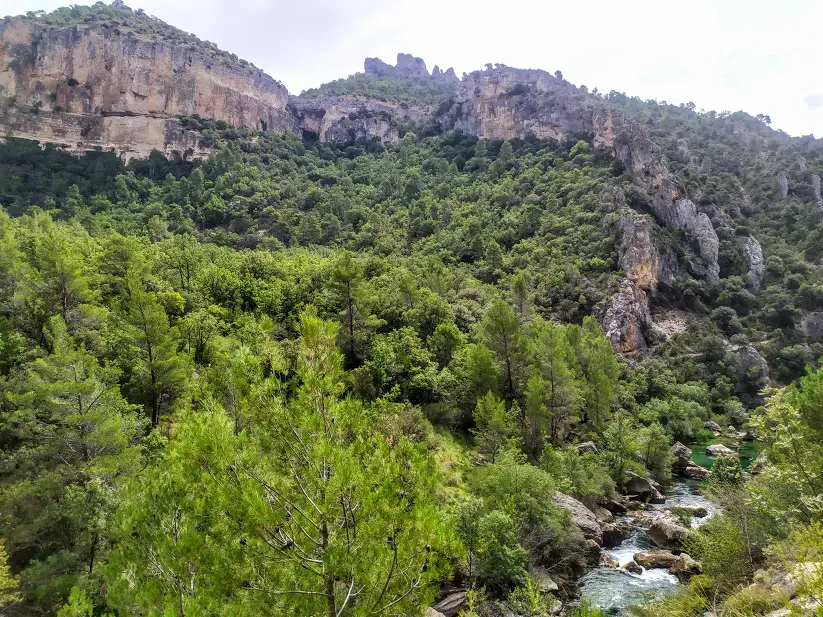
8. Taravilla Lagoon and Poveda Waterfall Route

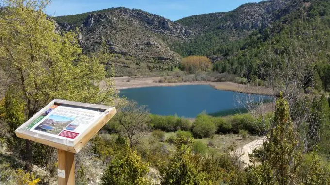
Of course, we could not forget one of the best known and most appreciated routes in the whole Park, which is undoubtedly the route that takes us to two of the giants, the Taravilla Lagoon and the Poveda Falls.
This is a circular itinerary that will take us for about 2 hours parallel to the Tagus River, allowing us to enjoy its spectacular riverside forest and the many secrets hidden along this route, such as a alpine fold impressive isolated or the former abandoned meander through which the river we follow today once flowed.
It is undoubtedly a walk for the whole family, there are some small uphill or downhill stretches that force us to take extreme precautions, but the youngest members of the family will undoubtedly have a great time. Currently the footbridge which crosses the river and connects Salto de Poveda with Laguna de Taravilla, is closed We recommend that if we want to do this route anyway, we recommend some water shoes and wade through the river as in the old days, with our feet soaking in water.
9. Route of Cabrillas (Megina)


The Cabrillas River route is one of those itineraries that we enjoy especially in the warmer months, as a large part of the route runs parallel to a passage of the riverbed, which means that both we and our pets can cool off on numerous occasions.
This is a circular route, which starts on the outskirts of the town of Megina where you will find all the information on the corresponding panel. From here, for about 9 kilometres, we will travel along local paths, we will look out over the spectacular Hoz del río JándulaThe path, with its twists and turns and alleyways, descends steep slopes until it meets the Cabrillas River We will jump from one bank of the river to the other until we find our way back. It's one of those adventures that young and old explorers alike deserve for a perfect day out.
10. Natural Path of the Tagus


And finally for the more adventurous there is the Tagus Nature Trailwhich, with its 170 kilometres within the Natural Park and divided into 9 stages of different distances allows us to see the course of the waters of the Tagus River between the towns of Orea and Oterboth at the ends of the Park.
Each of the stages has a different length, ranging from 10 to 35 kilometres, although they are always linear, so we will have to organise ourselves and think about the return journey if we decide to do individual stages or part of the total route.
This GR-113 In reality it is much more extensive, as there are numerous stages that invite us to travel along its entire course, from its source in the province of Teruel, to the border with neighbouring Portugal, and may even reach its mouth in Lisbon. So we can always continue our adventure by letting ourselves be carried away by the waters of the Father Tagus.
As you can see, these trails take us to a series of unique landscapes where we can appreciate the incalculable beauty of the Alto Tajo Natural Park, with a view, sometimes, only available to the most privileged. Did you know them? Have you done any of them? Tell us about your experience.